×

|
Rate it:
Tags:
Level: Intermediate
Length: 19 mi (30.6 km)
Surface: Singletrack
Configuration: Network
Elevation: +475/ -464 ft
Total: 11 riders
Mountain Biking Wadi Degla
#1 of 6 mountain bike trails in Egypt
Description:
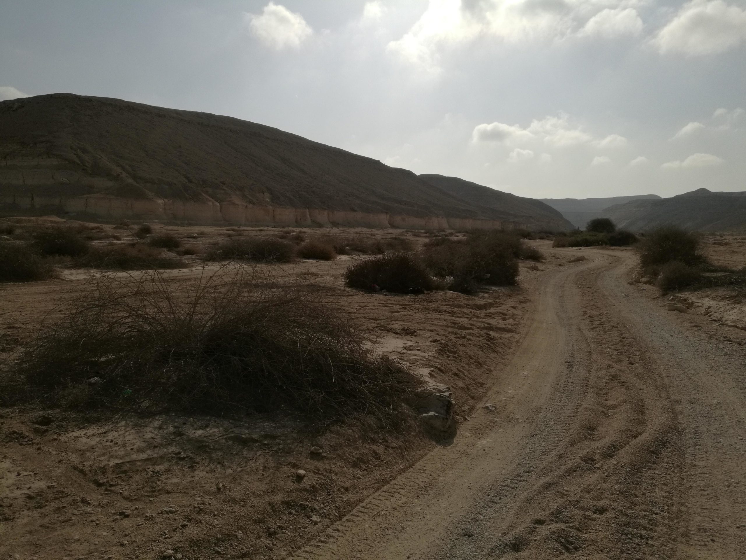
Wadi Degla ("wadi" is Arabic for "valley") lies in the northern part of the Eastern Desert and runs east to west for 30km to drain into the Nile Valley at Maadi, south of the Governorate of Cairo. The area, which encompasses 60 km², was declared a Natural Protectorate in 1999.
The Wadi provides an excellent trail network for all skill levels.
The great thing about Wadi Degla is that it offers a variety of great rides for all skill levels.
Beginners:
The main trail (wadi floor) is fun, easy ride that starts at the wadi gate and extends eastward for about 10.5km. Terrain is mostly light sand and gravel, with the occasional rough sections of scattered rocks or thicker sand, but nothing to trouble the beginner/average rider.
Intermediate/Advanced:
The north and south plateaus of the Wadi provide a vast network of trails that is sure to satisfy advanced riders.
First added by degladude on Sep 30, 2009. Last updated May 7, 2020. → add an update
Before you go
- Drinking water: unknown
- Lift service: unknown
- Night riding: unknown
- Pump track: unknown
- Restrooms: unknown
- Fat bike grooming: unknown
- E-bikes allowed: unknown
- Fee required: unknown
This trail information is user-generated. Help improve this information by suggesting a correction.
General directions (from the Wadi Degla official brochure):
Drive out to the Zahraa el Maadi district to the Water Pumping Station. Then turn right and drive parallel to the USAID building until you turn left at the sign indicating the west gate.
To get to the Visitor Center take the Qatamiya/Ain Sokhna road and in front of the Public Transportation Garage, turn right at the sign and drive for three kilometers. Turn left and keep going until you see the sign for the Visitor Center.
From Nasr City/Heliopolis:
Head west on the ring road and take the Carrefour exit. Head south (Carrefour should now be to your right) until you get to Wadi Degla Sporting Club. Turn left at the club and head east until you see the blue sign marking the short road to the Wadi Entrance.
Getting there on your bike:
If you live in Maadi, its a short 8km ride eastward.
If you live in Nasr City or Heliopolis, it should take you 35-90+ minutes (depending on where you start off exctly) at moderate pace to get to the Wadi on your bike. There is a rather long and steep climb on the road leading to the ring road from Nasr City. The distance between Nasr City (starting at Abbas El Akkad St., for example) and the Wadi entrance is about 21km. Be prepared for a 45-55 km "endurance" ride if you plan to go by bike from and to Nasr City/Heliopolis. Here is a Google Earth KML file that shows the route from nasr City's Abbas El Akkad St to Wadi Degla's entrance (and back)

Since I'm a beginner, this route was difficult to finish. It is not that safe as there were areas were the route becomes narrow and any mistake will cost a big fall off the cliff. It was a challenging route even for pros but in the end it was fun.
| Thank