Trails
Reviews
Tips
Community
Deals
Latest
Support
Trails
Find trails
Best bike trails
Destinations
Add a new trail
Reviews
Mountain bike reviews
Components
Tires
Clothing & shoes
Helmets
Accessories
Product news
Community
MTB Clubs
Races & Events
Bike Shops
Tips
Skills
Fitness & Training
Health & Nutrition
Beginners
Repair
Latest Articles
Podcast
Deals
Support Singletracks
Sign in
Create an account
About us
Newsletter signup
Home
/
Mountain Bike Trails
/
Canada
/
British Columbia
/
Grand Forks
/
Trans Canada Trail – Grand Forks to Christine Lake
Trans Canada Trail - Grand Forks to Christine Lake
See all photos (14)
×
❮
❯
User
Today
| Rate it:
Tags:
×
Share this photo
Forum code
HTML
Get Directions
Add a photo
Title *
Add a photo
Share
Check in
Loading...
×
Check in
Level:
Length:
14 mi (22.5 km)
Surface:
Other
Configuration:
Other
Elevation:
+50/ -51 ft
Total:
1 riders
Mountain Biking Trans Canada Trail - Grand Forks to Christine Lake
Add a review
#308
of 1,381 mountain bike trails in British Columbia
#27,688
in the world
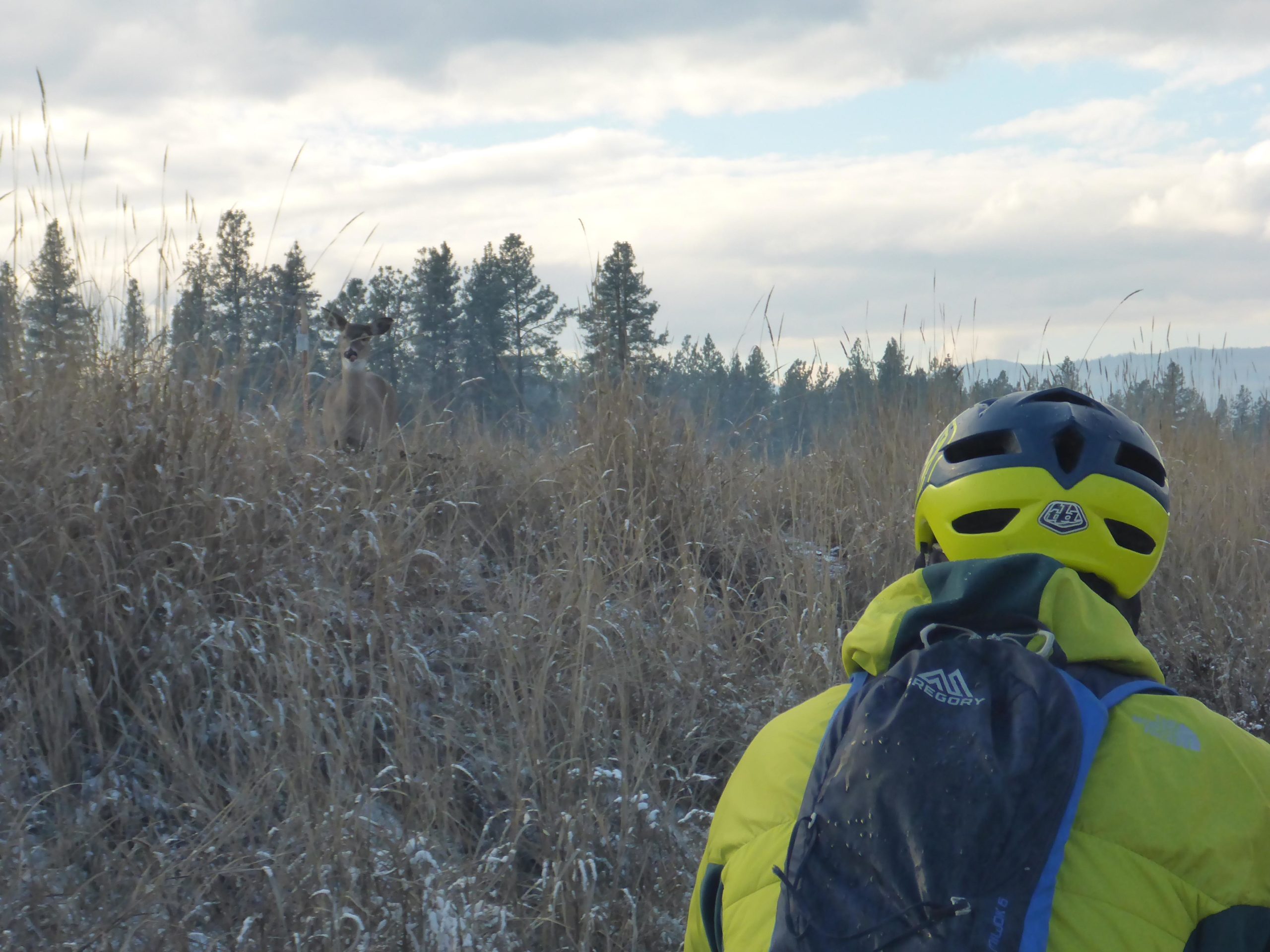
Trailhead beside sign.
First added by
chuckpelley
on Nov 11, 2018. Last updated Apr 17, 2020.
→ add an update
Before you go
Drinking water: unknown
Lift service: unknown
Night riding: unknown
Pump track: unknown
Restrooms: unknown
Fat bike grooming: yes
E-bikes allowed: unknown
Fee required: unknown
This trail information is user-generated.
Help improve this information
by suggesting a correction.
Getting there
Route to Trailhead with Google Maps
Heading East on Highway 3 turn right onto 68 Ave. The trail head is obvious by the parking lot and sign.
×
Save this item
Loading your lists...
+
Create a new list
'
Trans Canada Trail - Grand Forks to Christine Lake Trail map
Add to or improve this map
//
Share this map on your website
Local Info
Club Sponsor
-
Local Bike Shop
Chain Reaction Ride and Slide
Trail checkins
chuckpelley
(Nov 10, 2018)
What's this?
Upcoming Events
None.
Add one
Trail conditions
Good (Nov 10, 2018)
update
login to update
Camping & Lodging
Coming soon!
Trans Canada Trail - Grand Forks to Christine Lake videos
Add a video
We don't have any videos of this trail yet.
Add one here
.
More trail photos
Mountain Bike Trails Near Grand Forks, British Columbia
Add a review
Rating
Difficulty
Review
Reviews
View more
Rider questions
Ask
×
Update trail conditions
×
Update trail conditions
Please
login
or
create an account
.
×
Share this trail
Tweet
×
Add a photo
0%
Write a caption...
Title *
Tag your upload
Tag a trail, bike, and/or a category.
cancel