Trails
Reviews
Tips
Community
Deals
Latest
Support
Trails
Find trails
Best bike trails
Destinations
Add a new trail
Reviews
Mountain bike reviews
Components
Tires
Clothing & shoes
Helmets
Accessories
Product news
Community
MTB Clubs
Races & Events
Bike Shops
Tips
Skills
Fitness & Training
Health & Nutrition
Beginners
Repair
Latest Articles
Podcast
Deals
Support Singletracks
Sign in
Create an account
About us
Newsletter signup
Home
/
Mountain Bike Trails
/
United States
/
Nevada
/
Las Vegas
/
Tin Can Alley
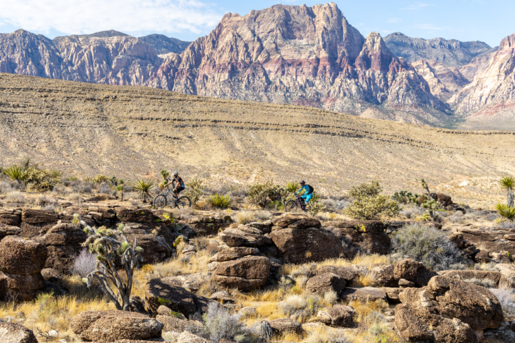
Tin Can Alley
See all photos (7)
×
❮
❯
User
Today
| Rate it:
Tags:
×
Share this photo
Forum code
HTML
Get Directions
Add a photo
Title *
Add a photo
Share
Check in
Loading...
×
Check in
Level:
Beginner
Length:
5 mi (8 km)
Surface:
Singletrack
Configuration:
One-way
Elevation:
+188/ -484 ft
Total:
22 riders
Mountain Biking Tin Can Alley
Add a review
#40
of 126 mountain bike trails in Nevada
#6,165
in the world
This is a DH trail, intermediate difficulty
First added by
702Markk
on Jun 3, 2013. Last updated Oct 28, 2024.
→ add an update
Before you go
Drinking water: unknown
Lift service: unknown
Night riding: unknown
Pump track: unknown
Restrooms: unknown
Fat bike grooming: unknown
E-bikes allowed: unknown
Fee required: unknown
This trail information is user-generated.
Help improve this information
by suggesting a correction.
Getting there
Route to Trailhead with Google Maps
Tin Can Alley starts from hwy 158 at the roadside parking for the Northloop Trail
Featured in
Nevada
Spin the wheel and pray: Does Las Vegas pay out as a mountain bike destination?
They say "the house always wins," but what happens if you leave the casinos behind and explore the epic trails surrounding Las Vegas, NV? Tim dives deep into some lesser-known trails and leaves wanting more.
Oct 31, 2024
7
×
Save this item
Loading your lists...
+
Create a new list
'
Tin Can Alley Trail map
Add to or improve this map
//
Share this map on your website
Local Info
Club Sponsor
Southern Nevada Mountain Bike Association
Local Bike Shop
Las Vegas Cyclery
View more
Trail checkins
Keith Stone
(Aug 28, 2022)
What's this?
Upcoming Events
None.
Add one
Trail conditions
Good (Oct 5, 2019)
update
login to update
Camping & Lodging
Coming soon!
Tin Can Alley videos
Add a video
These videos have been shared by members of the Singletracks community.
Report inappropriate content here
.
More trail photos
Mountain Bike Trails Near Las Vegas, Nevada
Add a review
Rating
Difficulty
Review
Reviews
View more
Rider questions
Ask
×
Update trail conditions
×
Update trail conditions
Please
login
or
create an account
.
×
Share this trail
Tweet
×
Add a photo
0%
Write a caption...
Title *
Tag your upload
Tag a trail, bike, and/or a category.
cancel


 7
7