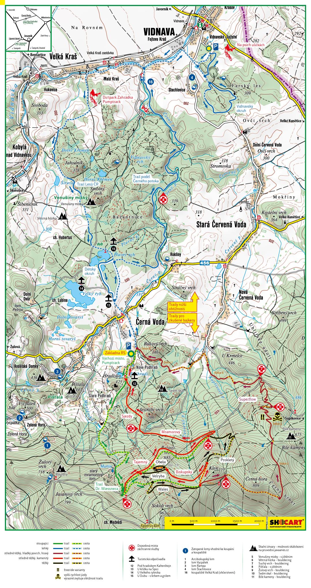
Superflow trail
http://www.rychlebskestezky.cz/en
 | Mramorový | 1.1 mi | |
| Naucná stezka | 1.1 mi | |
| Obelix | 0.2 mi | |
| Prokletý | 0.6 mi | |
| Sjezdy | 0.3 mi | |
| Superflow - sekce 1 | 0.7 mi | |
| Superflow - sekce 2 | 0.9 mi | |
| Superflow - sekce 3 | 1 mi | |
| Superflow - sekce 4 | 1 mi | |
| Superflow - sekce 5 | 0.6 mi | |
| Superflow - sekce 6 | 0.4 mi | |
| Superflow - sekce 7 | 1 mi | |
| Tajemný | 2.2 mi | |
| Velryba | 0.5 mi | |
| Wales | 0.7 mi |

 2
2
Great trail. The ride up is a continuous 45 minute slog, but mostly on well designed singletrail. The ride down was great. Definitely has super flow. It could use some more challenging technical features but you cant jump on Tjemny trail for that. In fact, I found Tjemny to be much more fund. Overall I would highly recommend to anyone to visit here. There is on-site camping, food, beer, bike shop...everything you could want for a weekend shred-fest.
| ThankProbably best trail in Czech Republic
| Thank