Ride north on US 6 and immediately take a left on N. River Road, crossing the bridge. Ramp up the bank around the concrete barriers on your right (north) and ride along the gravel road until you pass under I-70. Watch out for trains as you hop over the tracks and climb the bank to the west.
The singletrack climbs up from the interstate very steeply, requiring some hike a bike until rejoining the original trail, whose trailhead was blocked off by CDOT. Now you'll be on a rocky, shelfy, old mine road until you reach the topof the cliffs. Keep following the singletrack up behind the cliffs until you top out on a saddle, where the trail splits before heading down into the next valley.
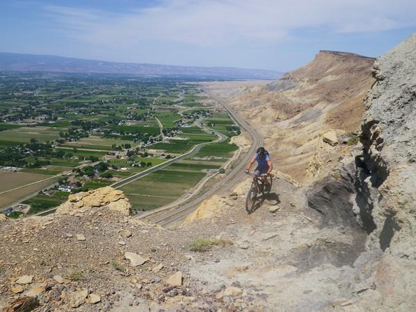
Take the left fork here, descending to the base of a very steep slickrock. Climb the slickrock, traversing as much as needed to keep a rideable grade, and bear left (east). Follow this singletrack along the ridgetop carefully to the flag, and enjoy the great view of the Grand Valley.
From here, keep going east down another slickrock, carefully picking your line. At the base of the slickrock, the singletrack is difficult to follow, but stay near the rim and avoid falling off the cliffs! The singletrack will cross more slickrock, and drop down to rejoin the original trail.


Very steep sections. lots of hike a bike. but the top is awesome view of the grand valley. be prepared for the climb
| ThankGetting started on the trail was a challenge we pretty much had to hike our bikes most of the way up the beginning. There was a stretch of decent trail going up then there were a few steep up hill sections that were too loose for us to ride.
| ThankThere is quite a bit of trail on the bench to the North, as well as along the rim, in this area. Stop by Rapid Creek Cycles in Palisade for information. The
| Thank