This trail description is South-to-North. You will want a shuttle vehicle at the other trailhead off H75 Road. We used Peach Valley Road to drop the shuttle at that end.
The Sidewinder Trail is a relentless, rocky, technical, physical adventure on the bike. There are very few extended climbs or downhills, but my GPS still measured 2500' of climbing and 3000' of total descending by the time we were done.
Mostly it is a constant mind-game of rocky, technical bike-handling tests. There are very few sections of fast cruising. The trail is extremely well-built though so the technical challenges are mostly rideable for a skilled rider. There were 6 of us on our ride and while we were all bucked-off at various places, usually a couple of us would clean most features.
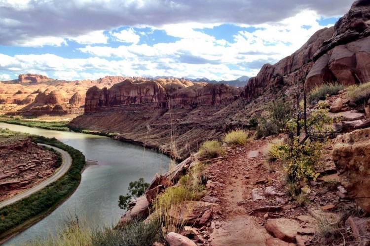
As the name implies, the Sidewinder weaves in and out of many arroyos as you cling to the western edge of the Gunnison Gorge Wilderness Area. You will climb and descend these arroyos enjoying many slickrock drops and ledges along the way, as well as about a thousand other rocky treats.
The Sidewinder is not for beginners. I would imagine they would hate it and probably wind up hurt. For a rider loving a technical, physical workout its one of the best trails I've ever ridden. It took our group 5 hours to ride the whole thing including all our breaks and lunch and all that. If you google "Sidewinder Trail" then you will find a map on the BLM website that shows the route and many other bailout options.
Go ride it... you will not be disappointed.


 19
19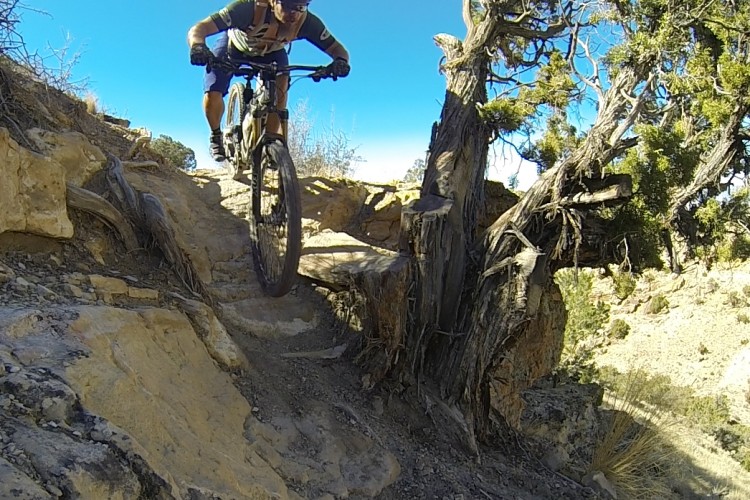

This was a FANTASTIC trail! Long and very challenging--not for the faint of heart. Very technical overall, both up and down, with lots of challenging moves, ledges, switchbacks, etc etc. despite being a 20 mile point to point, this isn't a cruiser trail--it earns its black diamond rating!
As mentioned in some descriptions online, if you're riding this trail as an out-and-back, or as a loop with the dirt road, you definitely need to ride it south-to-north. I rode it this direction, and you definitely get the best overall flow through the descents and techy sections in this direction. Also, you get about an extra thousand feet of descending, and more overall singletrack descending. If you were to ride north-to-south (the WRONG direction) you'd have about 1.3 miles of dirt road descending to end the ride. Now wouldn't you rather descend that portion on Singletrack? Yes, yes you would.
| ThankThis is a great trail! It's a rough and wild ride full of surprises and great views; expect to get bucked off. Not for the beginner. There are many ride options and access points; get a map from BLM. This just might be one of the best trails in the area.
| ThankHere is a link to our GPS profile:
http://connect.garmin.com/activity/132039289
The start on this is from our campsite though and not from the trailhead described above.
| Thank* Review edited 2/6/2012