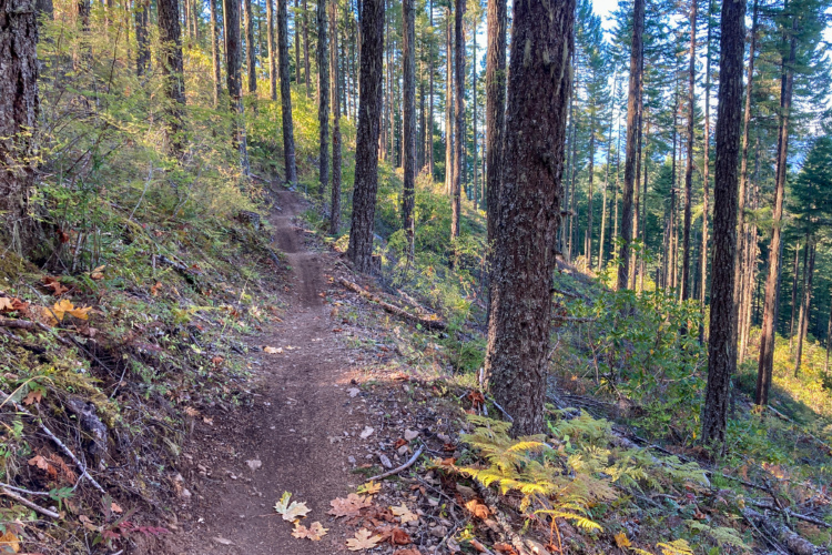
The north trail is a fun roller coaster along 3.5 miles of beautiful Salmon Creek. It is suitible for for beginning riders, but is plenty of fun for intermediate riders as well. The trail is mostly singletrack with a little dirt road here and there. The trail terminates at Salmon Creek Falls C.G. There are few obstacles (usually) and not too much poison oak.
The bridge that once connected the north and south trails was washed away during a winter storm a couple of years ago. What was a 6.5 mile loop is now a 14 mile out-and-back if you do both trails. The ride can be made longer by adding the connector trail from Greenwater Park and the trail(s) across the river from that park.
The trail on the south side of the creek is a much more technically challenging one. It is definitely not for beginning riders. It is mostly narrow singletrack over rocky, rooty, steep-pitched, wet ground. I suggest people avoid riding here during anything but the driest of weather because of the abundance of salamanders that use the trail. This trail, too, is about 3 miles long one-way.


 3
3
Hesitate to post an unfavorable review but this is without a doubt my least favorite Oakridge trail. I never found a fun section.
| ThankAdded section to top was a welcome addition as it is very different from anything in Oakridge. Nice rollers, high banked berms, and all at speed enough to get some air throughout. After that, cross-country style descending continues on less than techy terrain but plenty of blind corners on bench cut hillside trail.
| ThankI rode this trail on Jan. 28. Very first section washed out. Okay from Flat Creek Work Station up--except that it is a little wet due to high water conditions in Salmon Creek. Not suitible for kids except in upper sections near campground and around "Warrior Trail" section.
| ThankI rode the north (easier) trail last summer with my 10-year-old daughter, and we had a blast. It wasn't so tough that she couldn't manage, but it was challenging enough to really give her a great introduction to trail riding. Lots of short up-and-downs, some roots and rocks, and a few shallow water crossings.
| Thank