×

|
Rate it:
Tags:
Level: Intermediate
Length: 10 mi (16.1 km)
Surface: Singletrack
Configuration: Network
Elevation: +113/ -85 ft
Total: 56 riders
Mountain Biking Rayburn Trails
#18 of 223 mountain bike trails in Massachusetts
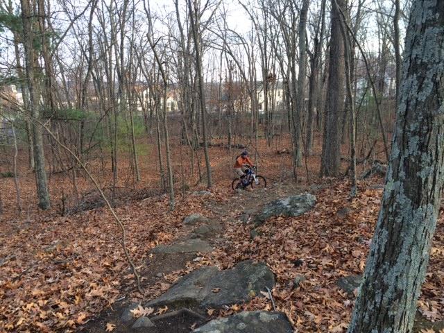
Rayburn Trails is a tightly built network of singletrack floating in, out, and around the power lines. Depending on who you ask, there is up to 10 miles of trails which can take some time to ride based upon the nature of the trails themselves. This is EXTREMELY tight, sharp singletrack. The ground runs the gamut from smooth track to rocks and logs to quick downhills and climbs, wall rides, stone wall crossings, bridges, swamp… there’s honestly something for everyone in this land. Your bike handling skills will be put to the test, but it can be very easily ridden on a hard tail as the terrain isn’t too threatening. Bring plenty of water, though, as it’s easy to become disoriented and the way out is the way you came in. Stellar New England singletrack, though – awesome switchbacks! As NEMBA is now involved with the trail, it's becoming well-marked and easy to find where you're heading.
First added by Fitch on May 26, 2009. Last updated May 10, 2020. → add an update
Before you go
- Drinking water: unknown
- Lift service: unknown
- Night riding: unknown
- Pump track: unknown
- Restrooms: unknown
- Fat bike grooming: unknown
- E-bikes allowed: unknown
- Fee required: unknown
This trail information is user-generated. Help improve this information by suggesting a correction.
Take the Mass Pike to Exit 11. Bear right out of the tolls onto Route 122. About a mile up on your right, just after Wyman-Gordon (left side), is Deermolm Street. This will take you under the Pike, which then turns into Riverlin Street. Stay on Riverlin for just under 2 miles and bear left onto Brightside Street. Buck Brothers on the left is normally okay with parking (just stay out of the way). The trail entrance is at the top of the street – just go straight up the hill and follow the tire marks!


Great area, a lot to explore, descriptions onsite are spot on, nothing too difficult
| Thankone of my favorite places to ride
there are secret trails you find the more you explore
i can easily pick up 20-30 miles of trails to ride between rayburn and martha deering conservation
there's a little bit of everything
| Thanki ride both hard tail and full suspension through these trails depending on my mood.
nothing like a hardtail to keep you honest.
Little bit of everything out here, but all very rideable and enjoyable 100%. I entered Rayburn Drive in Milford on my GPS to find an entry point, and if you park on that road directly underneath the big powerlines you'll find at least "an" entrance to the trail(s). Take the doubletrack under the powerlines heading north, then hook a right into the treeline and there's the singletrack. I took the track that had little stones piled up on either side of the start of it, as s there were a few apparent entrances there, and got almost four miles of track until it finally spit me back out underneath the lines. Nothing too difficult, but not boing either, this place is simply very well designed, and designed for mountain bikes specifically. I'd say it's one of the best I've done in the area.
| ThankGreat condition, tacky surfaces. Bridges were a little rickity, but holding up pretty well.
| ThankIt's sad thinking that most people will never experience leaf-covered, rooty, rocky, New England single track in the fall. This is a time where your rear wheel becomes your sliding enemy, not your solid friend.
| ThankGreat trail twisty and fun
| ThankBeautiful switchback trails
| ThankThere's a new-ish section of ST climbing in if you park at Buck Brothers which is a lot of fun and is way better than just pedaling along power lines. Additionally, due to power line work, there's some impromptu "bridges" laid down which is pretty fun.
| ThankJust rode this today for the first time. It's okay and its close to where I live. It is a VERY tight single track with lots of switch backs. The turns are tight and that really slows things down a lot. I like to go faster, so slow is boring to me and I found myself cutting off some of the switchbacks and going off trail. There are some technical parts to the trails where they cross big rocks or stone walls, but its mostly pretty easy riding. One review states there are 10 miles of trails, but I sure don't know where they are, but I'll keep exploring. Its a good single track for beginners.
| ThankPretty good ride today. Fairly intense. Me and 16 track athlete did it and we are both tired...which is a good sign. Wi do it again
| ThankAwesome tight singletrack, probably the best in Central MA. There are many parking options, the most popular is on Rayburn Dr. under the powerlines. Another good place to park is at Dorothy Pond, its easy to pickup trails by going north on Riverlin St. There are also many more unpopular trails on the west side of Riverlin St. branching off of an abandoned railroad.
| ThankThere's some new trail in there since last summer - always fun riding here and a fantastic use of the local terrain. The BUMS rule.
| ThankLate July - trails are buff and fun, mostly dry as long as the rain hasn't been too bad. It still needs about 2 days to not retain too much water, but the primary trails are in great shape. Riding is always a challenge here and always rewarding -- the power line side closer to Buck Brothers is showing more use and is becoming more defined.
| ThankThat was the tightest singletrack with switchbacks galore that I have ridden up here! Reminded me of some of the Florida trails I rode back in February. Trail is really well maintained, clear - although lack of consistent markings - just some pink/orange ribbons randomly placed to follow. But it was a fun ride for sure. Started out of Buck Bros and went right. That far side of the powerlines was the super tight singletrack with short up hills bursts(batteries were dead in the camera or else I would have some nice pics up today) some wet spots still. Coming back across the powerlines is where the bigger climbs, rollers, and opportunities for stunts are, much more bogs across the trails on this side.
| ThankNice change of pace to have some balance and turning challenges. Not the place for speed, but fun none-the-less!
Left side of the trails has some pretty wet spots, though the turning tight ST is still in good shape. Give it a day or 2 after the rains; otherwise, this place keeps getting more fun.
| ThankGreat tight single track, moderate climbs. Easy to get lost, a lot of circles! Fun for all levels.
| ThankSorry to hear about the below! It's definitely not a flow type of trail, rather something different and technical. The second half of Rayburn, after the bisection of the power lines, opens up to some great large rollers and the occasional stunt area. The trails are becoming buffer and buffer with all the riding, as well.
| ThankKeep in mind I have only been to Rayburn once. I am not trying to sound like any kind of expert - I just thought I would share my thoughts. I found the majority of the single track to be way too tight for my liking. Flow? Is there any? None that I found. Not trying to dis the efforts out there - just not my kind of place. The ATV's running around all over the place detracted from the experience even more - 1 to 4 kids on each ATV, usually without helmets. Dumb. With so many other places to explore, I seriously doubt I will go back.
| ThankBig wheelers may have some trouble here! The trail was designed by a local rider in and out of the woods, capitilizing on the land and giving the track a super-technical feel and flow that really makes you appreciate the bursts of speed you can get. I broke my saddle and had to bail after 4 miles, but this is some of the best central Mass riding I've ever seen.
| Thank