×

|
Rate it:
Tags:
Level: Beginner
Length: 4 mi (6.4 km)
Surface: Singletrack
Configuration: Network
Elevation: +128/ -157 ft
Total: 18 riders
Mountain Biking Pentwater Pathways
#138 of 326 mountain bike trails in Michigan
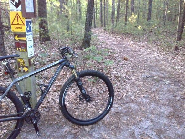
Starting at the State Park is the best way to gain some miles on this ride. Park there, or in town near the Brown Bear or the Antler Bar. Ride south along business 31, turn right on Long Bridge Road, then take the first left after the bridge (might be log road) follow that down for a mile and a half or so, then make a right into a two track marked Pentwater Pathways. Jump into the loop system at the parking area. This way is probably 4 miles from town. Or you can just drive to the parking area. Follow the outer loop, mostly making lefts at all the intersections. Trails are well marked with maps at nearly every intersection and function as ski trails in the winter. If you ride from the beach, and do two loops it's about a 18 mile ride total, mostly flat, the second half of the trail system contains all the hills, nothing major.
First added by andyklevorn on Nov 29, 2008. Last updated Apr 28, 2020. → add an update
Before you go
- Drinking water: unknown
- Lift service: unknown
- Night riding: unknown
- Pump track: unknown
- Restrooms: unknown
- Fat bike grooming: unknown
- E-bikes allowed: unknown
- Fee required: unknown
This trail information is user-generated. Help improve this information by suggesting a correction.
Starting at the State Park is the best way to gain some miles on this ride. Park there, or in town near the Brown Bear or the Antler Bar. Ride south along business 31, turn right on Long Bridge Road, then take the first left after the bridge (might be log road) follow that down for a mile and a half or so, then make a right into a two track marked Pentwater Pathways. Jump into the loop system at the parking area. This way is probably 4 miles from town. Or you can just drive to the parking area. Follow the outer loop, mostly making lefts at all the intersections. Trails are well marked with maps at nearly every intersection and function as ski trails in the winter. If you ride from the beach, and do two loops it's about a 18 mile ride total, mostly flat, the second half of the trail system contains all the hills, nothing major.


Easy scenic ride. Would like to see more singletrack in this area.
| ThankVery good trail for being away from it all. Wonderful Michigan scenery. Loops 1-3 are not overly challenging. All climbs are quite short.
| ThankFast and flowy, probably awesome for single speeders, not much for climbing . A very fun trail. And well marked.
| Thank