×

|
Rate it:
Tags:
Level: Easiest
Length: 4 mi (6.4 km)
Surface: Doubletrack
Configuration: Out & Back
Elevation: +61/ -61 ft
Total: 7 riders
Mountain Biking Petaca Point
#118 of 287 mountain bike trails in New Mexico
The trail runs southwest near the rim of the gorge through desert scrub. It ends at the confluence of Arroyo Petaca and Rio Grande, overlooking Petaca campground.
First added by TrailAPI on Aug 20, 2013. Last updated Apr 28, 2020. → add an update
Before you go
- Drinking water: unknown
- Lift service: unknown
- Night riding: yes
- Pump track: unknown
- Restrooms: unknown
- Fat bike grooming: yes
- E-bikes allowed: unknown
- Fee required: unknown
This trail information is user-generated. Help improve this information by suggesting a correction.
From Taos, follow NM 68 sixteen miles southwest to Pilar, NM and turn northwest on NM 570. Cross the Taos Junction Bridge and climb out of the gorge to the trailhead on the rim.

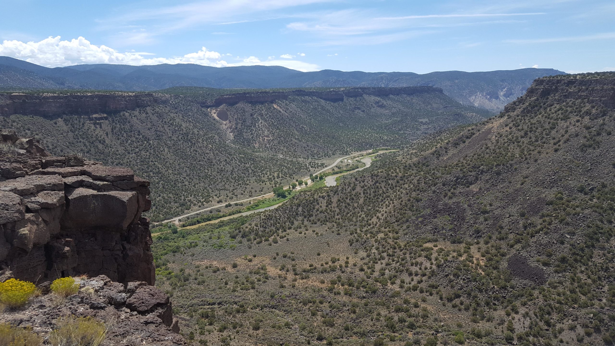

Petaca Point Trail is an easy doubletrack route extending four miles to an overlook at the junction of the Rio Grande and Arroyo Petaca gorges. The vista is worth the trip but the trail is uninspiring.
| Thank