×

|
Rate it:
Tags:
Level: Intermediate
Length: 6 mi (9.7 km)
Surface: Singletrack
Configuration: Lariat
Elevation: +229/ -214 ft
Total: 23 riders
Mountain Biking Opossum Hollow
#31 of 170 mountain bike trails in Missouri
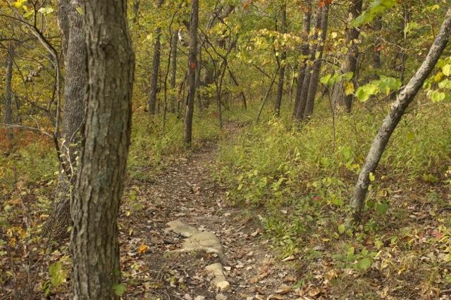
A short length of trail will bring you to the loop. The loop is clearly marked with numerous red squares and the occasional trail map on small, trailside stands. It winds back and forth along hillsides in this wooded area and is bisected by a white connector trail. I hope that someone more familiar with the trail can provide a better description.
First added by CFM on Jan 2, 2012. Last updated Apr 28, 2020. → add an update
Before you go
- Drinking water: unknown
- Lift service: unknown
- Night riding: unknown
- Pump track: unknown
- Restrooms: unknown
- Fat bike grooming: unknown
- E-bikes allowed: unknown
- Fee required: unknown
This trail information is user-generated. Help improve this information by suggesting a correction.
From US Highway 50 in Johnson County take State Highway 23 south to Knob Noster State Park. Follow the signs to Clear Fork Lake Area that will have you turning right (west) onto County Road DD which bisects the park. After a short distance turn right (north) into the Clear Fork Lake Area and follow the road straight to its end at the trailhead parking lot. Bathroom and picnic facilities are available.


This is a great beginner trail with short portions that allow more advance riders to push harder for a bit more fun. If it has rained within the last 2-3 days the trail will be closed to MTB and open for hiking.
| ThankThis trail is awesome! As beginners, my boyfriend and I, found it challenging as well as a huge adrenaline rush. SO thrilling that we barely had time to look at nature but did come across 3 baby raccoons and a turtle. Be careful for the sharp rocks. Highly recommend this trail and the Knob Noster campground. They have great showers and laundry facilities.
| ThankWe just finished this run and enjoyed it. The trail starts out with great flow and rock gardens then hits a portion of steep climbs and fast, slightly technical downhill runs. The trail is black dirt so I could see it being closed after rains. We rode counterclockwise and really enjoyed the fast flow of the last three miles or so. Stop at the park ranger station and grab a map. The trails are pretty well marked. I would go back if in the area, but would not make this a destination.
| ThankFun loop that was easy to follow because of great signage. It has great flow and just technical enough to be a blast to ride
| ThankThis is a great little trail! Mostly smooth rolling with a few rocky stretches. Also some fun rock gardens to pick your way through. My only complaint was it was not well marked at intersections. There were no trail maps at the trailhead and the mounted maps at intersections were missing except for one. And this one showed only two directions but there were clearly 3 trails intersecting. The main trail does have red blazes so pick a direction and watch for them. We were riding clockwise so just stayed to the left and made our way back without issue. Definitely check this trail out if you are in the area.
Also, they will close the trail if there has been much rain. So you might call if you are driving any distance.
| ThankWalked this trail friday. It was my first time there. Was pleased with the trail features. Nice singletrack with several bridges, rock gardens, and skills lines built in. im from northwest georgia...so the elevation changes are here are minimal. i would recommend this trail to beginners and advanced riders (can get alot of speed) alike...trails are in good condition they have maps(says 7miles) at the visitors center and on the trails at roughly every two miles or so. trails are very well marked. there are also permanent bathrooms at the trail head. enjoy!!!
| ThankOne of my favorite trails. Challenging at times due to the up hills. Takes about an hour and a 1/2 to do the whole loop with a few "breather/water" breaks. Try this trail - it's worth it. :)
| ThankThe more I ride other trails, the more I realize Opossum Hollow is a great trail.
| ThankGreat trail for beginners trying to up their game. Mostly fast trail with a few rocky areas. Well designed with good use of the terrain. No rutts....yet, the trail is about 4 years old.
| ThankI rode this trail on New Year's Day with my wife and a friend. We all agreed that this is a fun trail and worth a trip to check out despite the fact that it is listed as only 5.5 miles. The loop can be ridden in either direction (don't know if there is a preferred one with the locals) and there is a marked connector through the middle that can be used to create shorter routes. This trail is only opened to hikers (runners) and bikers eliminating some conflicts that occurred when there was only one trail shared with equestrians.
The track runs through forested, hilly terrain with occasional rock features to maintain interest. The builders have kept most of the trail running along contour and in line with good trail building practices. There are a couple of climbs, however, that exceed 10% grade as advertised on the trail brochure available at the park office. Although these are absolutely doable by the majority of riders I fear that over time they will become unsustainable and may need to be adjusted or rerouted. Time will tell.
The trail flows very well within wide, open corridor as it swoops through the many drainages in the area. Some are bridged and others have interestingly been armored with cinderblock but most are just bare crossings. There is good use of the rock available as features and some of the largest bare rock drainage crossings I have ever experienced. There is even one area where rock and cedar logs have been laid down to create some interesting armored tread to negotiate. Sadly most of the users have been bypassing these in favor of the smoother dirt surface. Come on folks! It shouldn't always be "all about speed."
Overall this is an excellent trail entirely within the abilities of all but rote beginners. But don't let that scare you away if you are a seasoned rider. You, too, will thoroughly enjoy your time here. The biggest drawback is the low mileage. Hopefully more is planned in the near future. And the incorporation of a few more technical features may draw more riders.
| Thank