×

|
Rate it:
Tags:
Level: Beginner
Length: 14 mi (22.5 km)
Surface: Singletrack
Configuration: Network
Elevation: +310/ -303 ft
Total: 16 riders
Mountain Biking Ogemaw Hills Pathway
#82 of 326 mountain bike trails in Michigan
Mostly single track nontechnicalwith some fast downhills and lengthy climbs. Very fun trail.
First added by j35u5fr34k on Aug 13, 2013. Last updated May 11, 2020. → add an update
Before you go
- Drinking water: unknown
- Lift service: unknown
- Night riding: unknown
- Pump track: unknown
- Restrooms: unknown
- Fat bike grooming: unknown
- E-bikes allowed: unknown
- Fee required: unknown
This trail information is user-generated. Help improve this information by suggesting a correction.
5 miles north of M-55 on Fairview Rd., just past DNR station


The trail was a lot of fun but not well maintained. I was there on 7/18/22 - there were several downed trees on the trail and part of the trail was overgrown with weeds; sections looked like a game trail. There was a section on the lower loop that caused confusion regarding the direction due to lack of markings and a number of felled trees. That said, I'd go back knowing what I know and still have a blast.
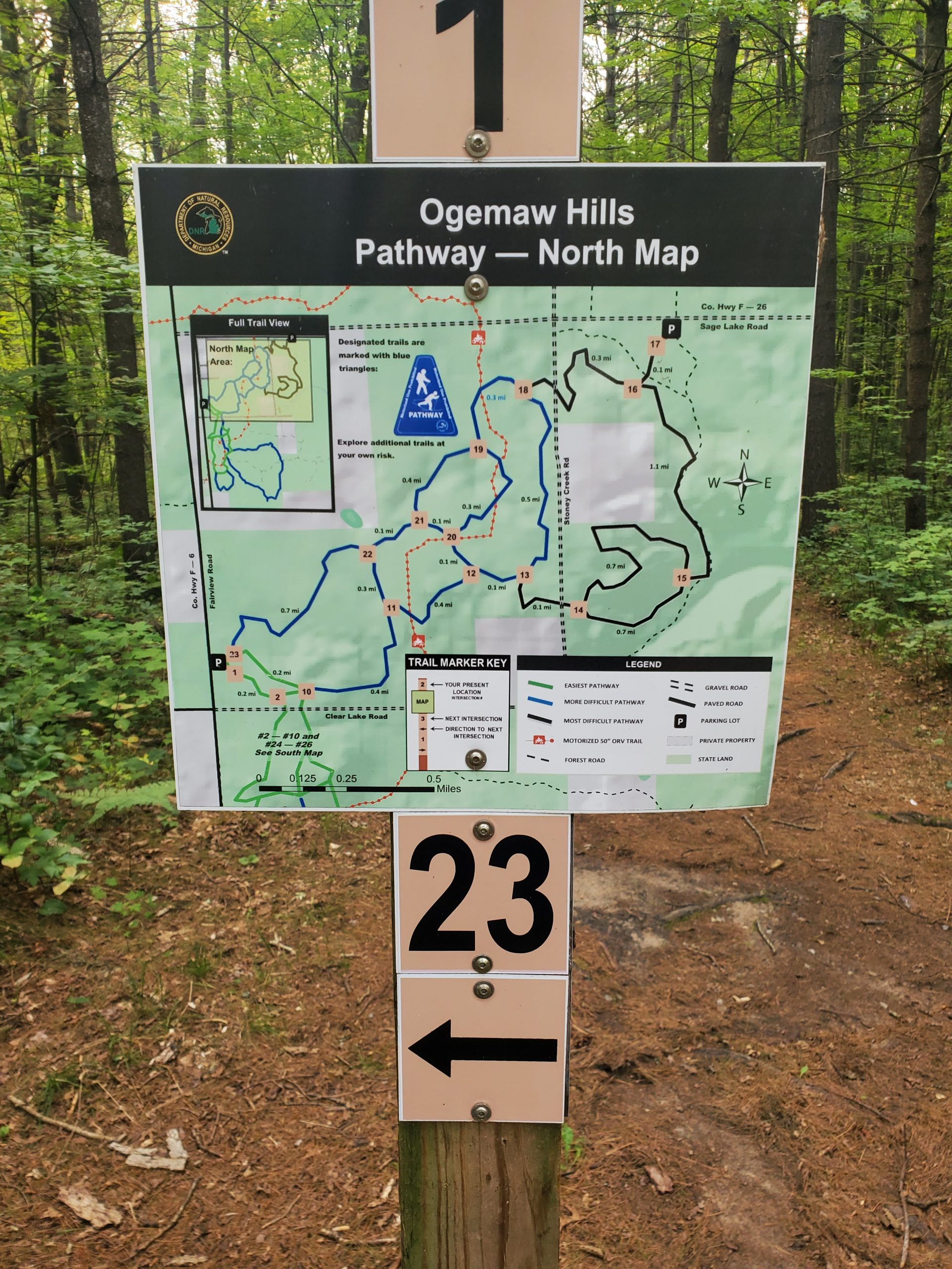
| ThankGood fun with maps and markers at each intersection. Some nice downhills. Limited technical features, but good forest riding.
| ThankGood course. Lots of variations. Be careful with online maps the numbering of trail points seem to be quite different from current.
| ThankThis was some of the most fun I've had on a bicycle. It is multi-use pathway and appears to be originally set up for cross country skiing. There are some long straight climbs and some extremely fun exhilarating straight downhill sections. The topography and vegetation varies. This is a great place.
| ThankEasy trail with some fun downhills and fairly lengthy downhills. At one point there is a down hill that lasts several minutes and I got up to around 30 MPH.
| ThankA little longer climbs and downhills compared to what you usually find in Michigan. This course has good natural pauses if your pushing it and wonderful change of landscapes. Some sections are misleading as to what direction you should go (back side, points 14-18...ish) but not bad. If you find yourself on a logging road (which are fun themselves) backtrack, or head north or west and you'll get out. My wife loves this course, not so technical, just fun!
| ThankI only got to ride half of the trail and it was definitely easy but still fun. The trail is marked OK but I found that certain areas were a bit under kept and overgrown which made things confusing. Its pretty remote when you get out there and cell coverage is spotty so you may want to take a buddy with you.
| Thanknothing technical - lotsa singletrack with some climbs and okay downhills. good workout if you do all the trails. Map postings & blazes are good.
Here's a link to some video: (copy & paste into your browser)
https://plus.google.com/photos/113638271273313852038/albums/5764377150549659857?authkey=CL31yYCjp4OiCw
| Thank