This trail first starts by climbing its way up Mount Taylor's flanks to the summit of the mountain. Here it is a little loose at first, but then mellows out into some nice, slightly rooted singletrack through the forest. Although you will encounter some dirt roads, stay straight on the singletrack.
Once you are on top be sure to take a few pictures before the descent. Note that from the summit it seems as if the route goes directly southeast towards the rest of the trail on the ridge below; however, take the trail going east as it switchbacks around.
You'll enjoy the trail as it drops down the mountain, but be warned because it is very loose. After two switchbacks you'll get some nice open trail before you go below the trees. There you will eventually meet a road. Take a right on the road and then a left onto the singletrack at the junction a few hundred yards away. After that the trail deals out some awesome, techy climbs and rock gardens. You'll eventually reach a forest service road where you should hang right and take it until you see a small roadside campsite and a CDT marker.
Continue onto the CDT and don't fear if it's overgrown at first as it quickly becomes well worn. Lucky for you, navigation on this part of the ride is a breeze. If you follow the CDT markers and the cairns, you'll be fine. this section has some awesome Porcupine Rim-style views and is a gentle, rolling descent until the last couple miles. There you are thrown into a tight and loose descent all the way off the mesa and to the CDT trail head. Enjoy!


 1
1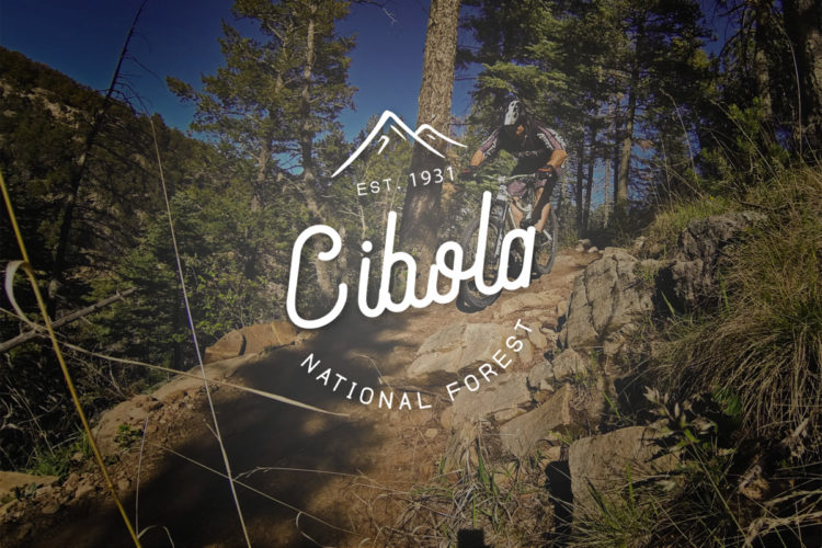


Awesome Trail! Everything one could want in scenery from high alpine environments to desert environments. In addition, trail surfaces hugely vary from buff to tight and loose to pumice-filled technical sections! Make sure to bring plenty of water and food because it can get pretty hot in summer. If you can bear the heat in late June get down there to watch a variety of different cacti bloom on the trail! Enjoy!
| Thank