×

|
Rate it:
Tags:
Level: Beginner
Length: 3 mi (4.8 km)
Surface: Other
Configuration: Loop
Elevation: +370/ -369 ft
Total: 66 riders
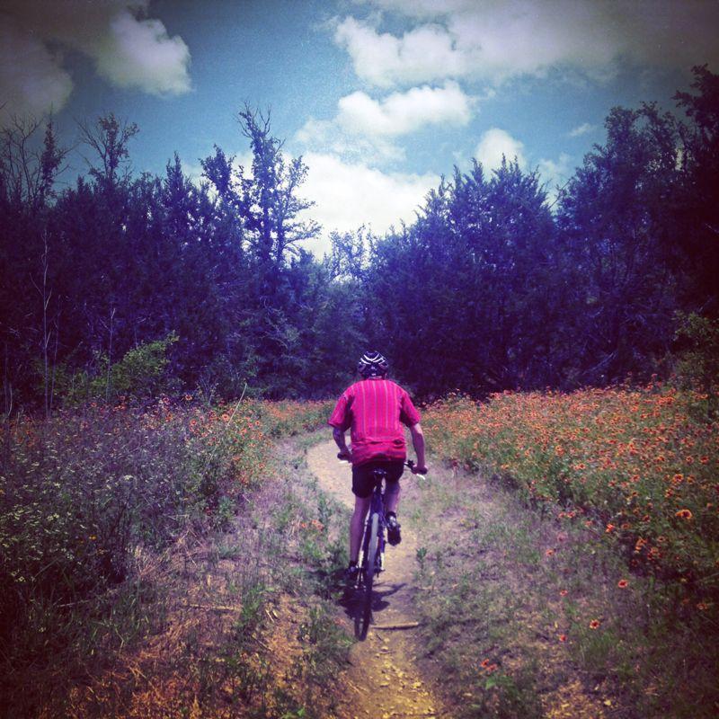
Mountain Biking Mckinney Falls State Park
#84 of 279 mountain bike trails in Texas
Nice cruise through the woods, mixture of single track and jeep trail. One loop probably will not be enough to wear you out. The ride accross the top of the falls is pretty cool.
First added by TrailAPI on Apr 5, 2013. Last updated May 7, 2020. → add an update
Before you go
- Drinking water: unknown
- Lift service: unknown
- Night riding: unknown
- Pump track: unknown
- Restrooms: yes
- Fat bike grooming: unknown
- E-bikes allowed: unknown
- Fee required: unknown
This trail information is user-generated. Help improve this information by suggesting a correction.
From IH35 in Austin take 7th street east, follow the signs to 183 south towards lockhart. Take 183S to Scenic Loop Road which you will stay on til it dead ends at McKinney Falls Pkwy


the main trail is just a paved sidewalk - okay for your children but not much of a mountain biking trail.
Getting across the river was too risky - maybe during a drought other trails may be make this worth a stop
| ThankSmall park entrance fee
| ThankWell maintained, very fast and flowy. Adding the Flint Rock Loop adds 2.25 miles. The occasional gravely, steepish climb, but only enough to get your heart rate up for a few minutes. Most of the track is flat. Trail is very well marked, but getting past the falls if the river is high could be troublesome as there are limestone washouts and algae--plus you have to hunt and peck your way across the riverbed.
The trail is great for beginning riders looking to gain confidence, or intermediate riders looking to shake the rust off. Regardless, the ride is fun, if short, but if you're looking for hair-raising drops or technical work, this trail isn't going to do it for you.
On the plus side, I went on a day the park was really busy and saw only two other riders, and a couple of hikers This isn't anywhere near as over-ridden as Walnut Creek.
| ThankDon't miss this trail! I enjoyed it despite the muddy/mucky conditions that kept clogging me up. Probably best to wait until trails are dry before using, but I have only a short time in Austin and had to go with what it was. On the plus side, I encountered very few people. You will have to cross the river. Signs for the preferred crossing point would have helped. The river was up, so I waded and pushed the bike. Once across, the trail is mostly well marked. I rode counter clockwise and upon returning to the old homestead place, I missed my turnoff and followed a service road up to a gate. Not bad if you want to climb. The descent cleaned the mud out of my tires. Also recommend the Flint trail. It was fun and would be better when dry. Back at the river, I laid the rental bike over and washed the mud off. Overall, I thought this was a great place to ride. Some challenging places, but mostly just good riding.
| ThankMake sure to ride flint rock loop as well (it's open to bikes as well) there is also a open access trail that connects the upper and lower falls...fun and barely used, pay $6 and have the trails to yourself most days
| ThankGreat cyclocross ride especially if you add the Flint Rock Loop...perfect for cyclocross bikes, a little underwhelming on a legit mountain bike
| ThankVery hot during the summer months. This is a good trail on windy or cold days.
| ThankNice and easy trails for beginners. Take it easy when you cross the creek for the Homestead trail though. I made it across no problem on my way to the trail, but took a nice spill on slippery rocks on my way back. It was a nice cool off though. The Homestead trail is really pretty flat but has a few minor climbs and easy going downhill cruises. Nothing I wouldn't allow my 6y/o to try. The other trail is Onion Creek bike and hike trail, and its Paved, need I say more? Ride easy enough just like when you were a kid having your parents taking you someplace safe. * Review edited 5/20/2009
| ThankWife and I did both trails yesterday, (first time riders) and actually got in a maintenance road as well. Homestead is nice, with a cool downhill. The paved was ok as well. Going over the falls is way bumpy but fun.
| Thankbeginner level trail. three miles and very flat but still enjoyable. Great place to take in some scenery or just see how fast you can bomb through an easy loop.
| ThankI'm also a novice rider, and I haven't ridden this one yet, although I have camped here before, and I have to say it's very beautiful there. I hiked around for a bit and hardly broke a sweat. Would be a breeze on a bike. Also, if anyone is willing to offer advice to a beginner, I'm totally open to it. Thanks* Review edited 10/14/2008
| ThankGreat for introduction and for brining your girlfriend or wife along for her first ride. Wide trail with only one nice decent that a beginner can walk down. The creek and falls are beautiful and great for gazing, fishing or swimming a bit up from the trail.
| ThankHomestead Trail is literally a hop, skip, and a jump away once you arrive at McKinney Falls State Park. After crossing the lower falls you will come to a sign that points to the Gristmill and the Homestead, head for the Homestead as this will start you off in the direction the trail is designed to be traveled. On your first ride there are a few spots that may confuse you as to which way to go or where the trail picks back up, just don’t do like I did the first time and inadvertently take one of the maintenance roads – they aren’t that fun to ride. Over-all, this trail is well-laid, the climbs aren’t too difficult, and it even has a section that makes for some nice speed downhill if ya’ let it. This trail is perfect for the new rider. There are a couple spots that border on technical, but little that a beginner shouldn’t be able to handle. For the more advanced rider, don’t think that this trail isn’t worth the time. It is. The singletrack is smooth, winding, and a great place to ooze along enjoying nature or seeing just how fast you can complete 3 miles (just watch for hikers and other riders).
As far as the other review referring to paved trails, that must be the trail around the Upper Falls, though I haven't been up there yet to say for sure.* Review edited 11/20/2007
| ThankThis was my first trail that I tried on Singletracks. I am a beginning rider. There were some very fun downhill sections. This trail is paved and probably a little boring to experienced riders.
| Thank