×

|
Rate it:
Tags:
Level: Intermediate
Length: 14 mi (22.5 km)
Surface: Fire Road
Configuration: Out & Back
Elevation: +914/ -940 ft
Total: 42 riders
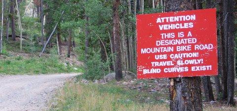
Mountain Biking Keystone Gulch
#391 of 1,429 mountain bike trails in Colorado
This ride is along a dirt service road that starts of with a gentle grade and follows a creek to your right with some beaver dams. After about three miles you'll pass a couple ski lifts and the grade picks up a bit. at just over four miles you'll pass the Outback Express lift to your right and the road will veer left. At about six miles, you'll come to a fork. Continuing on for about a mile, on a bit rougher terrain, will take you to North Peak.
First added by telemarkdude on Aug 18, 2005. Last updated Apr 30, 2020. → add an update
Before you go
- Drinking water: unknown
- Lift service: unknown
- Night riding: unknown
- Pump track: unknown
- Restrooms: unknown
- Fat bike grooming: unknown
- E-bikes allowed: unknown
- Fee required: unknown
This trail information is user-generated. Help improve this information by suggesting a correction.
From I-70, take Highway 6 to Keystone. At the first stoplight make a right then immediate left at the T. Turn right on Soda Ridge Road then left on Keystone Gulch Road (dirt). Parking area is on left and obvious.

This is a great scenic ride. This can be ridden as a loop with Soda Creek, or connect to other trails and head towards Breckenridge, or ride all the way up to Georgia Pass. Be prepared for some serious climbing, with some technical climbs thrown in if you decide to head down Galena Gulch.
| ThankThis is a great starting point to head up to some other trails. Like the West Ridge, Colorado Trail, and Red's Trail. Not nice scenery coming up this trail too. If you're staying at Keystone it's a nice alternative to the lift serviced trails. Keep in mind though that this is a service road for the ski resort so It is really wide and made for trucks.
| Thank