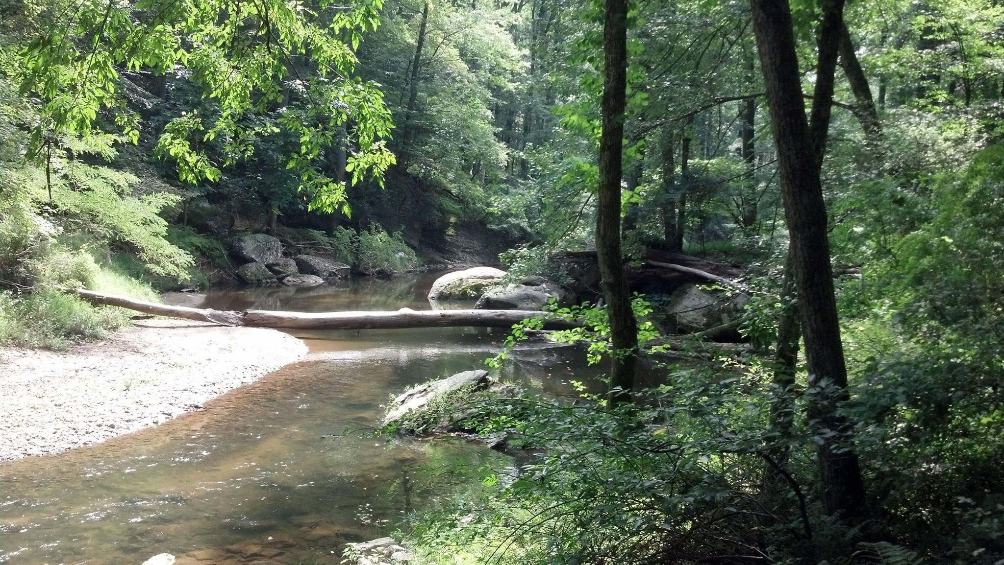
This entire trail runs from Jerusalem Road to Pleasantville Road (and beyond! Although I've never ridden that section). This write up covers the section of the trail which runs from Harford Road to Pleasantville Road and is approximately 10 miles out and back. From the parking lot on the Baltimore County (south) side of the Little Gunpowder, enter the trail. Trail head is right in the middle of the lot. Follow the trail along the Little Gunpowder. There are four stream crossings and some nice rock gardens along the trail to Bottom road. When the trail exits onto Bottom Road, go right across the bridge over the Little Gunpowder River. Continue on Bottom Road until you pass Laurel Brook Road on your right. Just past Laurel Brook Road, enter the trail again on the left. The entry is a nice steep uphill climb to a flat trail. This section of the trail is an old railroad bed, so it's pretty flat for about .75 miles. At several points you can see the Little Gunpowder on your left down in the valley. Continue on the old rail trail until it abruptly ends, then turn left. There is a nice little 2 ft. drop around the first turn. The trail continues towards Pleasantville Road, with a couple of nice uphill sections and some rooty, technical downhill sections. Once you've reached Pleasantville Road, take a left on Pleasantville and ride across the bridge over the Little Gunpowder. Be careful here! The cars headed northbound on Pleasantville have a sharp, almost blind turn to get onto the bridge. Just over the bridge, lift your bike over the guard rail and onto the trail again. You're now in the Balto county again. The first section of trail has a nice, technical downhill section to a small stream crossing. The trail on this side of the L'il Gunpowder has some swooping up and downhill sections with stream crossings at the terminus of each downhill. Some fun technical sections, too. Continue along this trail until it dumps you out onto Bottom Road again. Come out of the woods and go left on Bottom, back down towards the L'il Gunpowder. Enter the woods on the right before you cross the bridge and backtrack along the little Gunpowder towards Hardord Road. At two of the stream crossings on this leg there are side loops that follow the streams uphill, cross the stream, the follow it back downhill. One of them has a nice, small waterfall at the top. This is a multi-use trail, and during the summer sections of it can be overgrown. Sticker bushes, the unofficial MD state flower.
 | Jerusalem Mill trail | 6 mi |


The trails I rode included New Jesse, T-Bone Climb, Overlook Trail, and Cat & Mouse. Some challenging rocky climbs made for a good workout. The view at the top of Overlook Trail is very picturesque. Really enjoyed these trails but with all the leaf cover I just couldn't take advantage of the downhills as much as I would have liked.
| ThankThis was my first time on these trails. They are about an hour away from my house. While there are a lot of trails here, and they are decent trails I found them to be about the same as the trails I already ride nearer my home. The scenery was beautiful as many of the trails dip down near the river. There's plenty of climbing including technical climbs so you can have a great time here.
| ThankThis review is of the Sweet Air Trail system within the park. (NB: There are six different areas, i.e. trail systems within this park. As a result it's impossible to compare reviews from different people if you don't know which trails they rode). The Sweet Air trails include some nice singletrack and some doubletrack with some short challenging climbs (not dissimilar to Patapsco's Avalon section albeit not as long or as challenging or fun). To/from the parking lot you need to ride a decent distance through some fields to get to the singletrack. There's little in the way of rocks and some trails have decent flow but not for any meaningful distance. If you are looking to get in 5-10 miles with some decent cardio this trail system is fine. It's a shame because there is some really strong potential in this system given the elevation change on both side of the river. But IMO it's just not designed with MTB in mind.
| ThankPretty easy but still fun
| Thanktake the left side of Harford Road, the right side ends at Belair road and has some narrower rocky passes that require getting off for beginner riders. Advanced should be fine though
| ThankI've been riding loch raven for years and only recently discovered gunpowder and it is pretty good. I don't know that I'd call it beginner, however, because of all the rocky sections. Aside from that, it's fairly tame and most of it is along the river so it's pretty flat. It's fun and I'm hoping that there is more that I haven't discovered on the opposite side of the river to make it a longer ride.
| ThankHad a great time today even after 4 days of on and off rain. Nice and muddy, some good single tracks and the river crossings were interesting with the water level up. Small and large climbs, good steep decents and switchbacks. Did 11 miles started out on the white trial off the parking lot on Harford Rd, ran into a road about 6 miles in and hit the yellow trail which took us back around. Trails were well marked and maintained.
| ThankIt has something for everyone it is hills it has technical parts it has a small skills section too
| ThankNice trail not far north of Baltimore. I worked at the Harford rd parking area and initially rode the orange trail which is about a two mile loop that keeps you on the north side of the river. I then crossed to the south side and took the white trail to Jerusalem Village. It's an out and back and with a few turn arounds managed 9.6 miles. The trails can get muddy in some areas but are very fun. There is some elevation, most notably a large climb/ decent past the Belair rd crossing. There are a lot of hikers as well as horses so watch your speed.
| ThankThis is my go to trail, close to home. I've ridden probably a hundred miles here and I am still having fun, by myself or with others this trail is great.
The section between harford Rd and bel air rd has some very nice climbs, which means some very nice declines, but they are all off the main trail. So look and explore.
My favorite section is harford to bottom Ed. Fairly fast and lots of fun. Lots of stream crossings. Lots of little climbs.
Highly recommend this trail to anyone with a bike.
| ThankThis was a FUN ride! The only issue was I totaled my crankset on a log and had to get repairs. The trials were just right for a beginer with just enough tech and climbing.
| Thank***EDIT***
As of 2014 I'm editing my post and changing my review of this trail as a whole. There are many ways to enter and ride Gunpowder Falls State Park and the section that most reviews on this page describe is Harford Rd entrance. I have uploaded GPS for the Harford rd trail and describe how to get to both the Harford Rd trail and the Rt 1 Trail below.
Gunpowder Falls State Park - Harford Rd Entrance - My Rating : ****
From 152 travel south on Harford Rd. to the Baltimore County line. Just before the Bmore county line you'll see a parking lot on the left and if you continue over the small bridge into Bmore county you'll see another parking lot on the right. You can park at either lot. The lot on the left, the northern lot, contains a small loop and a bridge with a nice downhill. The park on the right will take you down to Pleasantville rd taking a break at bottom road (when you come off the trail you'll stay left on bottom road, go up the hill in the road (and follow the trail markers) and you'll see a new entrance to the trail on the right).
In general this trail is pretty fun but nothing crazy. There are a few overlogs, some rock sections, some hills, some log rides, and some easy downhills. There are also some "add on" sections that offer some climbing challenges, views of some waterfalls, and some fun downhills. Everything north of Bottom Rd is much more challenging as it is full of the rolling hills that Harford County is so famous for. This is the place to ride in Harford County.
Gunpowder Falls State Park - Rt 1/Bel Air Rd Entrance - My Rating: **
| ThankFrom 152 travel south on Rt 1/Bel Air Rd and you'll see the parking lot on the left eventually. This trail is OK but nothing to be amazed at. The only trail you are technically allowed to ride is the Lost Pond Trail which is only 3.1 miles ... signs strictly prohibit bikes in other areas but you know how MTBers do. The majority of the trails here are completely flat with no obstacles except large mud puddles even if rain hasn't been around in days. There are some cool stream crossings and some very technical rock gardens (most if not all of which are traversable but not all are traversable the first time by any means). There are some trails that go up with some nice rewarding downhills and maybe a small drop or two but nothing fantastic. The majority of the trail is wide (virtually no MTB experience necessary) and right by the river which is very accessible for a swim during the hot summer months (probably one of the coolest features of this trail). The trail where the dog walkers/hikers do not often go can get really overrun with brush ... I'd avoid anything getting to tight as it will only get worse since it's not very well maintained and is lovingly lined with sticker bushes.
First time here, I ran in to two locals, Bob and Jerry, they took me on the grand tour. I think we did 12.3 miles. Awesome trail. Loch Raven doesn't have anything on this trail. It can be as easy or as hard as you want. GREAT RIDE!!!
| ThankJust rode this trail today. It was a nice ride along the river. Nothing technical, no steep climbs, but you can get going pretty fast. There are a few river crossings that make you feel like a bad ass. Definitely a beginner type trail, but I would go back.
| ThankEdit: I should also mention that it is well-kept.
Quick ride. Awesome for some fast speed some intermediate obstacles. They really cleaned it up over the past year and made it a nice place to ride.
| Thank