The 7.9-mile one-way Fort Circle Trail is the only singletrack trail in the District on which mountain biking is permitted. There are quite a few street crossings, including some busy ones, but you probably wonít mind the brief rest once you see how many hills this trail has in store. Its main drawback is how overgrown with vegetation it can get. The center section of the trail from Ridge Road south to Good Hope Road is very nicely wooded and hilly singletrack. South of Good Hope Road, the trail becomes extremely overgrown with plants by the time it enters Fort Stanton Park. North of Ridge Road it is overgrown in some places (though still rideable) and very urban in others.
From the parking lot, take the asphalt path downhill (away from Fort Dupont Drive) and take the first right to continue on asphalt across an open grassy area. The trail soon enters the woods and becomes gravel. It will turn to asphalt again shortly before it comes to a T with another path. Turn right at the T to arrive at the intersection of Ridge Rd and Fort Davis Drive. Cross Fort Davis Drive at the intersection, because you pick up the dirt singletrack Fort Circle Trail at the corner, where it enters the woods. Ride through the hills of Fort Dupont Park until you come to a T. Turn right and you will come immediately to another trail junction. You can go either way here. If you go right you will ride along the bottom of a hill. If you go straight, you will go up this very tough hill to a grass clearing, then turn right to re-enter the woods and bomb down the other side of the hill (makes it worth the effort!) to link up with the main trail again. Continue to follow the trail south through the woods with street crossings at Massachusetts Avenue, Fort Davis Drive, Pennsylvania Avenue, and Branch Avenue. After crossing Branch Avenue, ride up Park Drive a short way to where the trail re-enters the woods on the right. This next section is very hilly. When you reach 28th Street, cross and go left a short way until the trail again enters the woods. There are two more street crossings, at Naylor Road and Good Hope Road. Across Good Hope Road the trail crosses several small bridges and a muddy area on its way to Fort Stanton Park. It will likely become too overgrown to continue somewhere in this area, where you must turn around and return all the way to the intersection of Ridge Road and Fort Davis Drive. Cross this intersection to the trail entrance diagonally opposite you and follow the trail until you hit C Street. Cross and continue to a trail junction where you go right and eventually cross East Capitol Street. After crossing, go up a grassy hill, ride the trail down to Flint Place, and continue a short way to Benning Road. Cross and take the concrete path to the left a short way, then right up a hill and follow the loop around through the park until you return to Benning Road. Return a second time to the intersection of Ridge Road and Fort Davis Drive, this time going back down the paved trail to the right through Fort Dupont Park and to the parking lot where you started.


Nearby place to practice some skills.
| ThankAs the person who rides here the most, normally twice a week, I do adore these trails. They are perfectly located for me on my ride home from work.
Are they great trails full of typical MTB obstacles? No. But they can be a fun escape from the h*ll of Wash DC. Many fear they are unsafe due to the "element" that live near by, that is just fear mongering BS. Ridden here for years and never had a problem beyond kids smoking pot.
Great little punchy climbs are good for training. Loose gravel covered in leaves and nuts can realy catch you off guard. Lots of falls to practive dismounts.
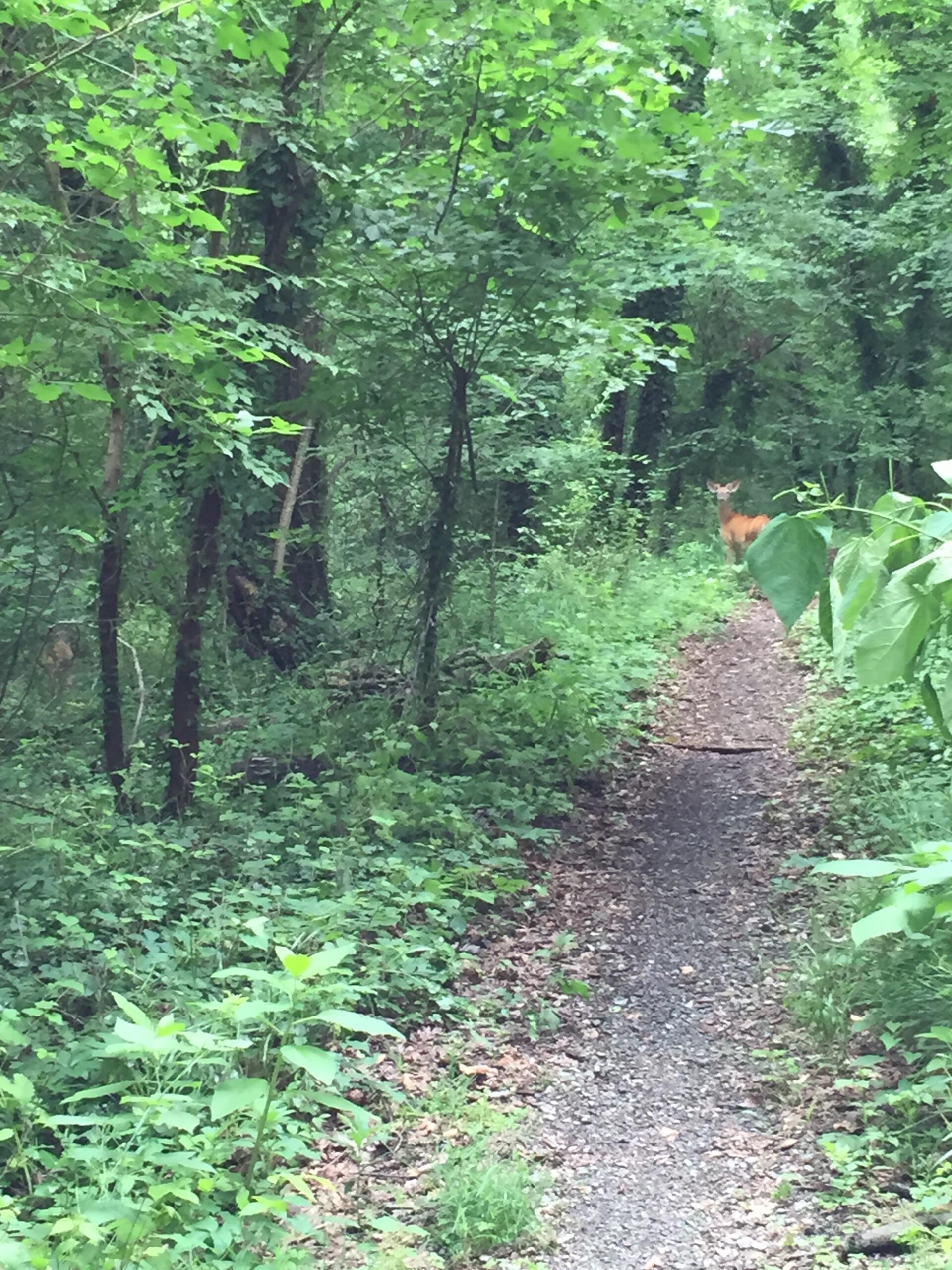
| ThankFor being in the heart of DC this is a pretty good trail. I parked at the Benning Rec Center and rode the whole trail. Only challenging part was some of the climbs with erosion bars. Saw more deer than people. Would recommend if it is close for a quick ride.
| ThankA pretty easy trail, there are only a couple climbs that are difficult and you might have to get off your bike. You cross lots of busy roads but the trail across the street is fairly easy to find. The trail has maps posted at most intersections so it's easy to follow.
Dries out pretty quickly you can easily ride a day or so after the rain.
| ThankLots of loose gravel so it can get tricky on turns and the short but steep climbs and descents. The trail is pretty short and broken up by streets but easily accessible from DC without a car. You're more likely to see deer than people, which is pretty cool for being within city limits.
| ThankThis is the Only true mtn bike trail in the city of dc. Don't be scared off, by heading south of the river there is still some great riding down there. Most of the trail falls on the "Forts of DC" trail. With a small portion of it that actually weaves through ft DuPont park. The bulk of the trail is wide and gravel packed to an extent to prevent erosion. So it is not the most technical trail, but there is still a fair amount of elevation change in the short amount of trail. I find the trail most enjoy able to ride from east to west, which still works well because it dumps you out in the city either way. The last 1/4 mile of the trail gets overgrown during the late spring/summer. Down trees air maintains by NPS as long as they are notified. I will usually use this trail for a leg opener the day before a race just to get on the bike. The singletrack is Cross bikeable. Things to be careful of: Road crossings, you cross multiple inner sections to get to portions of the single track, some busy roads most not expecting a mtn biker to pop out of the woods. Broken glass, there is some small portions of it on the trail. Be aware of your surroundings, I rarely have ever even seen anyone out on the trail and never have run into any issues, but remember you are still not in the best neighborhood so keep a keen eye for what is happening around you. But most of all have fun, because it is still remarkable to have this section of trail in the city.
| ThankI live only a few blocks from this trail and can vouch for the fun and challenging section from Branch Ave to Ridge Rd.
| ThankPortions of the ride were full of vegetation, but the section between Branch Road and Good Hope was both clear and challenging. Don't bother going past Good Hope, though - it quickly become completely overgrown. I didn't see any other riders, but I'll be back on the other portions, though, since it is riding distance from my place in SW (although the ride there is through some really sketchy neighborhoods).
| Thank