We went down to Durango for the day and it just so happened that the Iron Horse Classic was in
town. We watched a couple of criterium races then headed for the nearest singletrack just
outside town at Dry Fork. There were a couple of horse trailers in the trailhead parking lot, never
a good sign for bikers. Fortunately, one group of horseback riders was coming off the trail as we
geared up and we never saw the other group. The signs at the trailhead warn riders to avoid the
trail when things are wet but we quickly realized by looking at the trail conditions that this
warning is rarely heeded. The tread is hard and bumpy with hoof prints and solidified tire tracks,
relics of muddier times. The climb wasn't too difficult, though we probably went around the loop
in the wrong direction based on the number of riders we saw coming the other way (in our
defense we decided on the counter-clockwise route after viewing the trailhead map and elevation
profile which seemed to indicate that this was the way to go). The scenery was great, lots of wild
flowers and a few nice aspen groves near the top. The return down was great, a little bumpy
with rocks and roots at times. Check it out if you're in the area, the singletrack doesn't
disappoint.

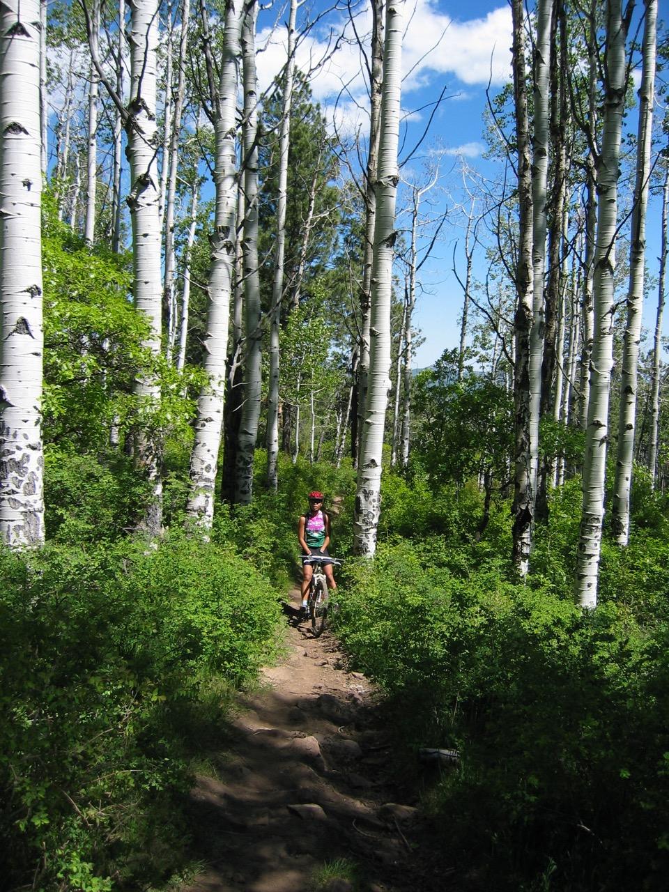


Great loop to get a little taste of the Colorado trail. Some massive aspen trees about halfway around the loop that are photo-op worthy.
| ThankEpic climbs, epic downhill, long rock garden trail further back, and Gudy's Rest!
| ThankA great addition to the Durango trail system. I like to ride out 25th st, which becomes Junction Creek Rd and take it to the Colorado Trail Start/end Trailhead. Ride this about 2 1/2 miles with a gradual climb and cross Junction Creek. The next 2 miles or so are pretty steep switchbacks leading to Gudy's Rest. A great bench and overlook to take a break. From there continue up and you can either take Hoffeins Connection down to Dry Fork, or continue up another couple miles and get to the tp fo Dry Fork. Ride this down all the way to Lightner Creek Rd. I do a loop from town, out Lightner Creek and back Hwy 160 east to down. Pushing it you can finish in under 2 hours, about 16-18 miles total
* Review edited 10/8/2011
| ThankWhat a great ride. We rode in a clock wise rotation with a good climb and no technical stuff just some loose rock on mostly single track. The Downhill was more tree roots and rocks with small drops (less than a foot) so a counter clock wise would be a bit more technical but still not bad. The trail was mostly shaded for us (we were done by about 10:30) and with the thick forest it may be for most of the day. Our ride took us about an hour and a half to two hours (I slowed down my son, so it could have been done much faster). My GPS had a problem so I did not get the mileage of the ride but would guess the 9 miles is about right.
| Thanknice trail through aspen and oak groves. lots of shade. lush and a bit overgrown on some parts. i'm used to dry sunny open space in abq, nm. great workout up if you're not used to the altitude. good bomb down as a reward. lots of bikers, so go the usual clockwise route.
| ThankBeing from AZ this trail was a treat for me. I am used to lower altitude desert single track and the altitude for this trail was a challenge for me. I think I topped out at just over 9000 feet. The 4.5 mile climb was tough but not technical. There are some rocks and roots but nothing major. I rode this trail clockwise and it seemed to be the direction MTB riders were going. I met several hikers near the intersection of the Dry Fork and CO trails going counter clockwise. The climb is worth the DH! The CO trail and Hofheins trail make up the 4 or so miles of downhill back to the trail head parking. The DH single track is great with vegitation growing dense on both sides of the trail that will open up and let you see the next section of DH. Watch for cows on the Hoffheins trail! I came face to face with a cow right in the middle of a fast section of DH. Keep you eyes pealed here. I was very pleased with the workout and awsome views.
* Review edited 7/3/2009
| ThankA very rewarding ride. I rode up Dry fork to the CO trail and down Hoffheins for a very nice ride. The climb up dry fork is slow and steady with a few flat spots tossed in to keep you motivated. The CO trail is a blast, fast ST that has plenty of hidden rocks and roots to keep you on your toes. At the CO and hoffheins intersection you NEED to continue on the CO trail for .2 miles to an amazing overlook, I think is is called Gudy's Rest. A nice place to air dry and drink that last of your H2O because the descent on Hoffheins will not let up and you will have too big a smile to partake in the camelback. Watch out for horses and cows, I narrowly missed a holstein about 150 yards before the finish. A must do if you ask me.
| ThankThis is not even close to the closest single track in Durango. Durango has multiple singletrack trails right in town that are way above and beyond what dryfork is. The Telegraph hill trail system and the Test Tracks start in town and have way better singletrack without the fear of meeting a horse or two.
| Thank