From the tee where you parked, head SE on the 4x4 road a couple miles until the intersection with Rd 311--turn East on 311. Bypass Motorized trail 1414 on the right and road 311E on the left. Go through the cattleguard and proceed another mlle and look for road 311D on your left. These 4X4 roads are often sandy and have some short but very steep climbs. Take 311 D which will soon deadend at a parking area and the start of the singletrack. 5 miles of singletrack will then drop you back at another parking lot at the end of 373A which will deposit you back at your vehicle. The singletrack starts as a gradual climb on narrow, often overgrown tread, then makes a sharp, rocky,,switchback climb before a series of ups and downs and a drop to an old homestead by a boggy area. Cross the bog, make the final climb to the top of the ridge, then enjoy a seriously rocky drop back to the road. Again, this is all crystal clear with the map.


 1
1

Great backcountry ride. Since it is relatively short, I recommend riding it as an out and back to stay off the roads. It's a good ride in both directions, but quite different. If you start from the west side trailhead, you face a big climb from the beginning with extended hike-a-bike sections, but it's worth it as you get familiar with this portion of the trail for the descent in the end on the way back. That familiarity could be the difference between a very cool rowdy descent and an ugly crash. The descents in both directions are fun but totally different. Descending the west side is hot -- steep, chunky, narrow lines, loose. Ride smart. Heading east from the summit, the downhill is 3 plus miles and relatively gradual in most places. Fast and fun. Coming from the east trailhead, this 3 plus mile descent becomes is a long steady climb to the summit, but not overly taxing. Overall, the trail is currently not overgrown as mentioned below and the sand really doesn't slow you down much on the descents. It only alters the ride in a few spots. Currently, there is only one log on the trail that required a dismount. Most of the trail is intermediate, but the west side descent is certainly black diamond.
| ThankFantastic trail that feels WAY out there, and runs through some areas with really cool history. If you're feeling adventurous, this is the trail for you!
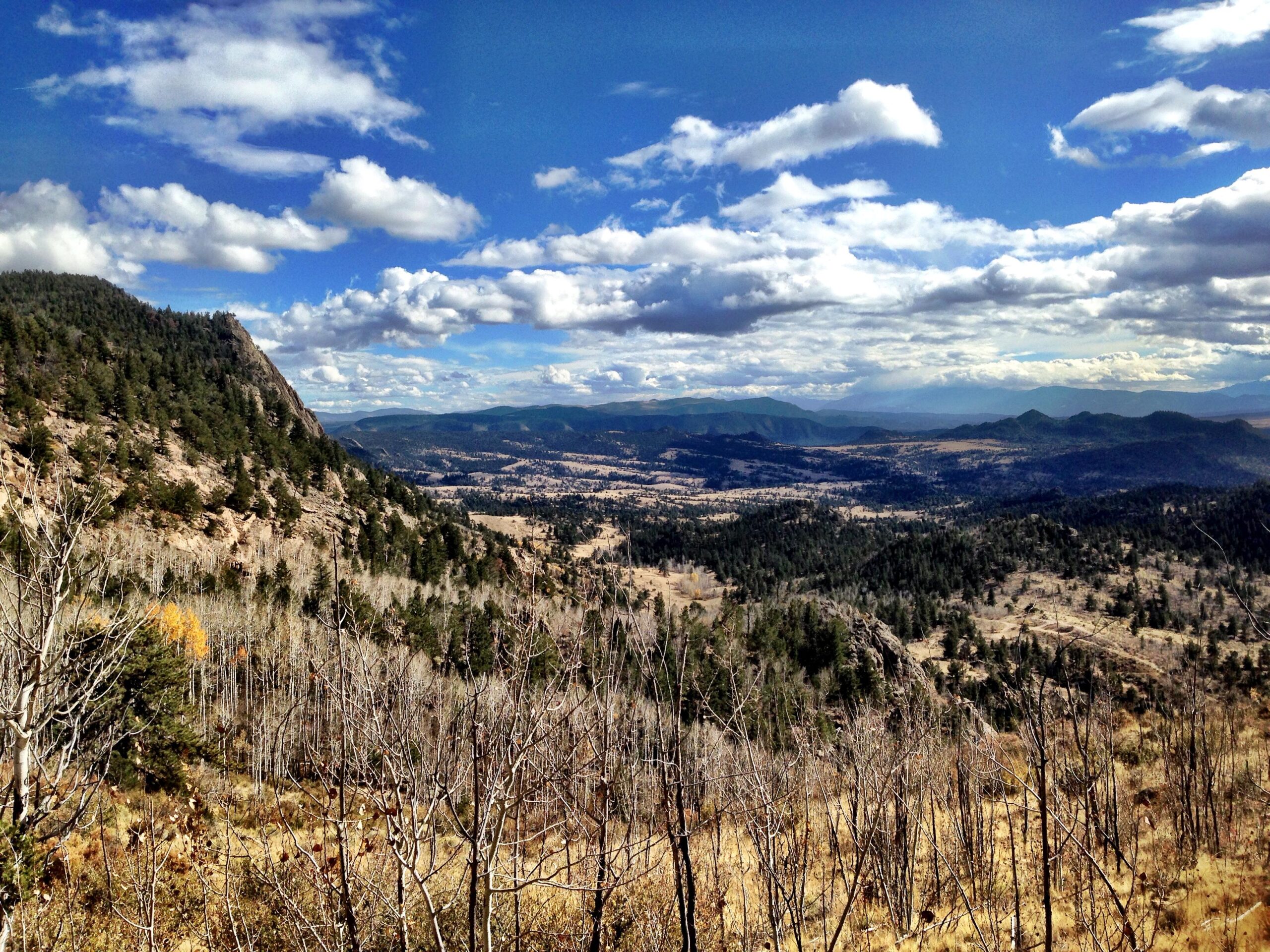
| ThankWhen I saw this route on the map, I wondered why I'd never heard of it before. Now, I know. Getting there is a bit of a chore and requires either a 4X4 or a lot of brutal climbing on fire roads. Then, to do the ride as a loop requires about 5 miles of tiring 4X4 road, even if you drove all the way in. Lastly, the singletrack is very narrow and much of it overgrown or sandy. Having said all that, don't let this scare you away if you are an adventurous rider looking for something new. There are lots of technical goodies along the way including an excellent final descent (including at least one rock "staircase" that will invite most to dismount) and the scenery in the area is fantastic. You will pass through deserty shrubland, riparian wetlands, ponderosa and aspen forests and even spruce and pine forests higher up. You will see the remains of an old homestead and all the while, you will be surrounded by magnificient granite rock formations with occasional views of the Collegiate Range and all it's 14ers. This one is fairly high on the adventure scale and ya' gotta work a bit for it, but if you're okay with that, it's worth a stop.
| Thank