×

|
Rate it:
Tags:
Level: Intermediate
Length: 4 mi (6.4 km)
Surface: Singletrack
Configuration: Loop
Elevation: +754/ -806 ft
Total: 157 riders
Mountain Biking Cypresswood Trails
#34 of 279 mountain bike trails in Texas
A good single track trail which contains a bowl area and some technical atributes. Majority of the trail is moderate and is the best trail around. Only one route really besides a flat walking path of which the trail crosses many times. If you come to a creek, just follow the path to Cypresswood, cross the bridge, and follow the path on either side south leading you to more trail. If you come to a bridge(T.C. Jester) crossing a creek where the trail seems to end, follow the tire marks under the bridge for the trail continues on along the creek. This is known to be the best trail by many experienced riders all over the area.
First added by lilmike1493 on Apr 13, 2009. Last updated May 11, 2020. → add an update
Before you go
- Drinking water: unknown
- Lift service: unknown
- Night riding: unknown
- Pump track: unknown
- Restrooms: unknown
- Fat bike grooming: unknown
- E-bikes allowed: unknown
- Fee required: unknown
This trail information is user-generated. Help improve this information by suggesting a correction.
From I-45 take the Cypresswood exit. Travel west on Cypresswood passing Kuykendahl road. Continue heading west on Cypresswood untill you intersect T.C. Jester (about 2 miles). On the right there is a gated in park with volleyball courts, ect. and there is a parking lot on the west side of the road leading into the neighbor hood. You can park there. The trail head is on the south east side of where Cypresswood crosses the creek (which is further west on Cypresswood about 1/4th mile). Also there is a trailhead at Collins/Cypresswood park which is further west on Cypresswood on the left. It is behind the police station and a public library. The trail head is to the left on the asphalt walking path along the creek about 200 yards from the skate park. If you cross Stuebner Airline, you have gone to far.

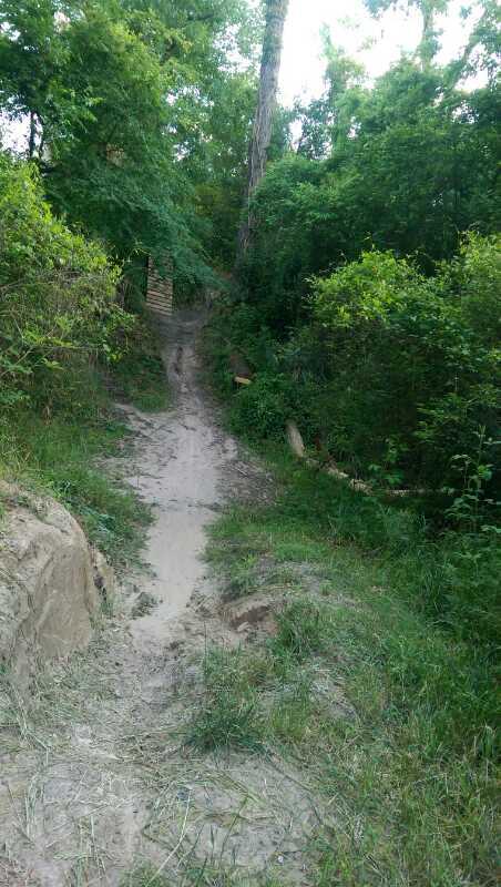


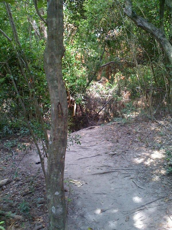


The trails are in good shape, even after Harvey. Nice riding surface with the exception of a few sandy sections, but all trails seem well maintained. The most notable thing about Cypresswood is that the trails on the west side of the park (which is where you park and start) are all two way, and that section is filled with blind corners. On a busy day, this will definitely force riders to slow down a bit for the blind corners. If you're interested in really hauling, continue east past the greenbelt and hit the one-way trails section. Overall this is a great place to ride, and I would recommend it for any skill level. Excellent trail system!
| ThankTrails were in good shape today. More beginner than intermediate in my opinion. Will definitely go back.
| ThankGreat trails & fun to ride...the absence of defibrillators at the rest areas was reassuring. Thanx to all the volunteers who keep these trails in great shape & always adding new to the mix. :-)
| ThankGood beginner trail. Little bit of everything but hard to keep a consistent pace because the trails don't have much rhythm. Lots of super soft loamy sand which also affects your pace. The trail is mostly trimmed of branches and debris and seems well maintained.
| ThankIt's a great place to go ride and take inexperienced people. There's really nothing too technical on the trail, and most things that may seem challenging to the new rider have a bypass.
It's a popular spot in a heavily populated place. Traffic is high and the trails converge on each other a number of times, but easy to find your way around.
| ThankSome fun riding. Well maintained trails well marked. Good flow. Met some very nice riders that showed me the trails.
| ThankFun trail, a few technical spots but nothing to tough. It's closer to 6 miles than 4 and you can add another mile if you start at Meyer park and go down along the creek
| ThankRode Cypresswood today and it was it great shape give that we've had rain earlier in the week. Obviously there were still a few wet spots but none avoidable. A lot of the usually sandy areas are still holding enough moisture to be packed. Trail should be excellent tomorrow.
| ThankThis trail is always enjoyable, and is my go to trail in the area. There can be a lot of sand in some places, but overall, it is a fast moving trail. The trail is always well maintained, and there are markers for most of the trails with names.
| ThankPretty fun trail with some flow considering there is no elevation change. Couple of little tech spots. Could have been marked better. There were some markers but they weren't consistent and I ended up re-riding some of the sections. Going to try to ride again tomorrow and hopefully get a better feel for it and report back.
| ThankI ride here 3 days a week it is large enough with several trails to keek it from being boring. My wife can make 70% of the technical parts so we have a great time. Not busy during the week at all. I love this place.
| Thankperfect trail is not too difficult but it has many twists and options
| ThankI have been to this park several times. There are a number of good parks in Houston, but I found this one to be the best overall. It has a good flow and a couple of interesting land features. You might see some wildlife also. I went 6/17/2012 and there must have been a bad storm recently. There were many downed trees and a lot of clean up that needs to be done.* Review edited 6/18/2012
| ThankExcellent singletrack. There's not a whole lot of elevation change, but the trails are flowy and have some technical sections. Very similar to Memorial Park in Houston but without so many roots.
| ThankPretty good single track. Easy enough to bring my girlfriend on, yet there are still a few more difficult options and some man-made obstacles to keep me entertained. It is a single track though... so beware riders coming from the opposite direction. There's not alot of room to let oncoming riders by you.
| Thanksuper fun and well cared for a must stop in houston area
| Thank