×

|
Rate it:
Tags:
Level: Intermediate
Length: 6 mi (9.7 km)
Surface: Singletrack
Configuration: Loop
Elevation: +152/ -143 ft
Total: 11 riders
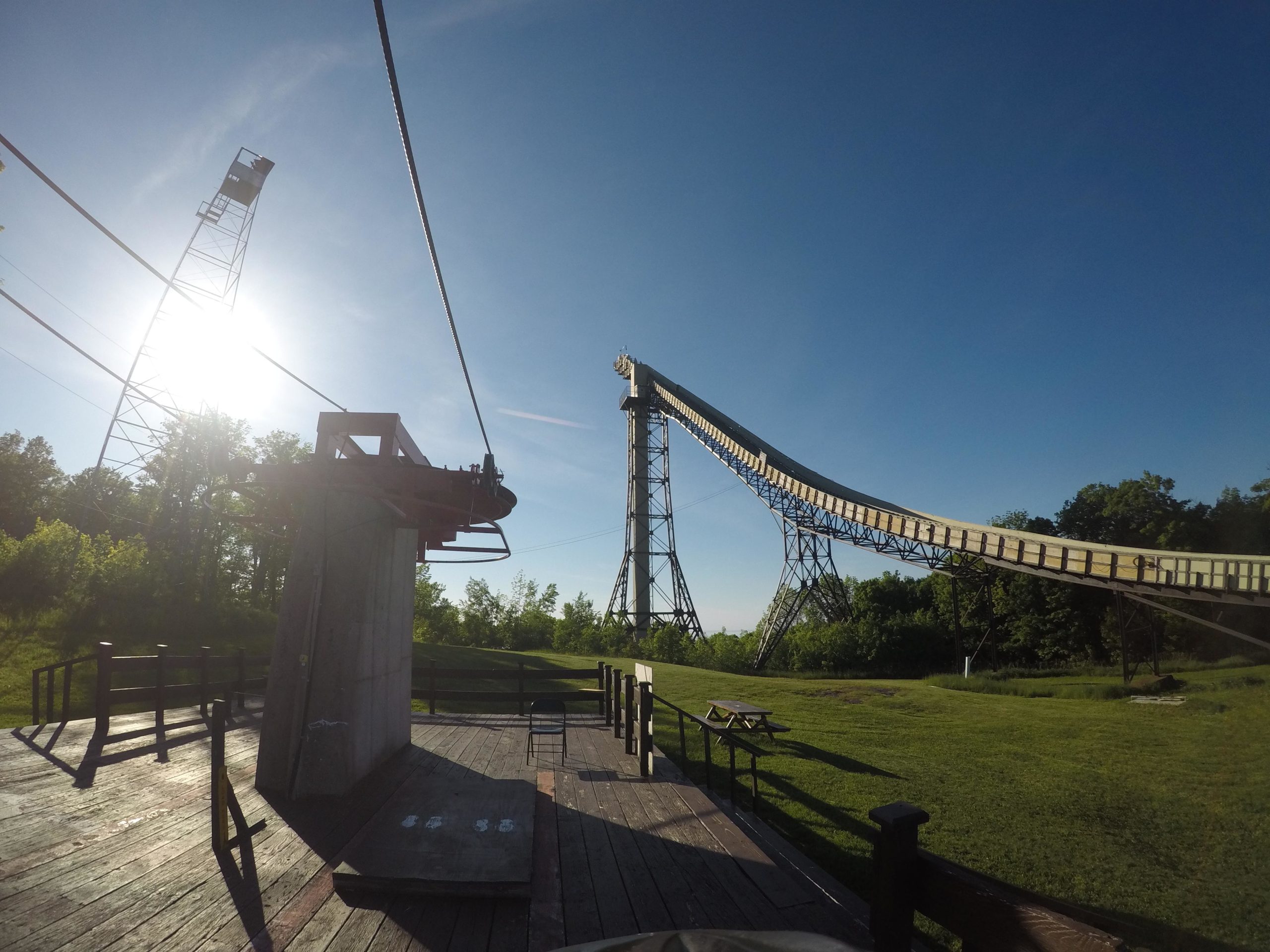
Mountain Biking Copper Peak
#105 of 326 mountain bike trails in Michigan
Great view from the top of ski jump.
First added by Alex Hoelke on Sep 23, 2016. Last updated Apr 22, 2020. → add an update
Before you go
- Drinking water: unknown
- Lift service: unknown
- Night riding: yes
- Pump track: unknown
- Restrooms: unknown
- Fat bike grooming: unknown
- E-bikes allowed: unknown
- Fee required: unknown
This trail information is user-generated. Help improve this information by suggesting a correction.
Copper Peak is located at N13870 Copper Peak Rd just off of County Road 513 in north Ironwood. From US 2, turn north onto Powderhorn Road. Follow the guided signs to bring you to County Road 513 and follow that for approximately 10 miles to the entrance of Copper Peak.


Fun flow. Intermediate climbs with long fun down hill.
| Thank