×

|
Rate it:
Tags:
Level: Easiest
Length: 22 mi (35.4 km)
Surface: Doubletrack
Configuration: Loop
Elevation: +438/ -431 ft
Total: 5 riders
Mountain Biking Citico Creek
#76 of 205 mountain bike trails in Tennessee
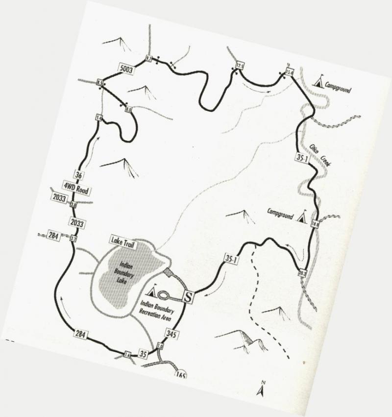
Route Climbs High into the mountains then returns along Citico Creek.
Indian Boundry trail circles the lake for beginners.
First added by Rockinr on Oct 16, 2007. Last updated May 7, 2020. → add an update
Before you go
- Drinking water: unknown
- Lift service: unknown
- Night riding: unknown
- Pump track: unknown
- Restrooms: unknown
- Fat bike grooming: unknown
- E-bikes allowed: unknown
- Fee required: unknown
This trail information is user-generated. Help improve this information by suggesting a correction.
From Tellico Plains, Tn. Take 165 east about 16 miles to Indian Boundry Recreation Aera. Turn left on 345 park near the camp ground.
Awesome camping with camp store.


It is awesome
| Thank