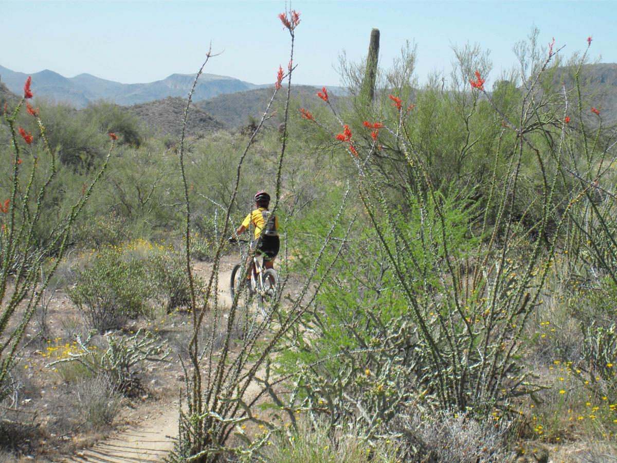
The Black Canyon National Recreation Trail will be a 79-mile hiking,
mountain biking and equestrian trail stretching from the Sonoran Desert
lowlands in Phoenix to the high grasslands of Prescott Valley. Although the
trail is not yet complete, the care given to engineering the trail for a great
mountain bike singletrack experience is already obvious.
This 24-mile “Little Pan Loop” has emerged as one of the favorite segments
of the portion of the trail that has been completed. It may take you longer
than you think: bring lots of water!
The Ride: Leave from the Black Canyon City TH following the singletrack
southwest.
At mile .85 the trail forks. The right fork is the trail heading towards
Prescott. If you follow it for 1.4 miles to the edge of the Agua Fria River
you’ll get some great views of the river bottom and will get to try your skills
on some tight switchbacks. However, take the left fork for this “Little Pan
Loop” lollipop ride.
Keep your speed down until you are familiar with the trail. There are a
couple tight corners you don’t want to overshoot or you will launch out into
space.
Before you know it you will make the first of four crossings of the Agua Fri
River and will start realizing it’s great to be on a trail designed for mountain
bikes. There are no steep or technical ascents or descents. It’s basically a
middle-chain-ring kind of ride.
At mile 8.7 you begin the loop portion of the lollipop. These directions
assume a clockwise approach to this loop. Turn left out to the gravel road
and be alert and follow the signs for the “Black Canyon Trail.” Keep your
sense of humor when you get close to the river. The trail winds around old
motorized trails through the sandy river bottom and you’ll feel like you are
on a treasure hunt for awhile. The trail eventually climbs out of the river
bottom and is, once again, a great singletrack that’s easy to follow.
At mile 11.93 you intersect (“tee” junction) the main Black Canyon Trail
singletrack. Turning left will take you in the direction of Phoenix. You will
want to turn right and head for your third river crossing. If you leave the
river following signs with an American flag on them, backtrack. You’re
following the wrong trail. Keep looking for signs indicating you are on the
“Black Canyon Trail.”
At mile 15.25 you will complete the lollipop loop and begin retracing your
route back to the TH.
At mile 23.95 you arrive back at the TH – tired and happy.


My recommendation: Skip the little pan loop and just ride BCT as an out and back. The little pan loop portion was not that great and very grown in, I took many cactus to the arms and fist. I would wear a long sleeve also, too many branches sticking out to wack you. Also bring extra water if you're even going to attempt this. I ran out of water at mile 17 with my 3L camelbak. Lots of up and downhill to even get to the little pan loop segment as well as having to walk a good distance in sand across the river.
| ThankVery beautiful and fun loop! If you're not from the area, definitely a scenic track and AZ must do. If you're not familiar with desert (March) riding, be sure to have some rattlesnake knowledge as I rode over one and was nearly bit.
| ThankAwesome trail. Has a good dose of climbing, downhill, ruggedness and good views! Definitely grab a slice of pie from the rock springs general store on your way out.
| ThankWow is all I can say!
| ThankThe best trail I have ridden in this desert so far
We parked at the north trailhead on the west side of the rock springs exit.
Bring lots of h20 and food. Ran out of both and got a little lostish.. 26 miles of fun and excitement! The trail is not marked well at all!! So be warned luckily I was w a buddy that had been there before and we were able to pick up the trail again. Highly recommended trail to get out and experience some single track (as in the entire trail!!)
I take exit 236 - Table Mesa - to the TH (FYI - Get the singletracks phone app. It links all TH's to your phone's GPS. Hard to find without it). From there head N. At the fork about 1.4 miles you can either take the standard trail (go right) or head down to the little pan loop at the agua fria river (left). If you head to the river make sure you head immediately right once it comes out of the mountain onto the sandy double track or else you end up on Jeep trail 9980. Follow the rock bridge across to the other side and head due N again. You will pick uo the trail again there. The trail curves in many directions after that but don't worry. Head North and in approx 3 miles you will come to a large out cropping and a dirt road, Turn RIGHT on the dirt road and right after the the big left turn you will see on your right the BCT TH which will take you back to the original fork in the road and back to Table Mesa TH. It is easier to do this in reverse order the first time CCW (take the right at the fork - at the road turn left and get on little pan on your left and ride that down to the river) but i prefer it CW. IT really is an awesome trail. Plenty of H2O, T/R tubes & some CO2 cartridges. It's a long walk. Do not ride this trail from Jun-Sep.
| ThankI don't give out a lot of 5-star reviews but this trail deserves every one of them. The trail is not overly technical but there are some steady climbs and there is some exposure. Other than that, this is just a perfectly engineered trail in a beautiful location.
| ThankTrail build quality is superb here, beautiful work on a trail that will stand the test of time.
| ThankWithin 1.3 miles of the trail head you cross a river, usually about 1' deep, a rarity in this very dry region. Access is close to I-17 but you'll only notice it for a few minutes. Plenty of climbing here, pristine Sonoran desert.
Gotta love riding a trail designed and built for mountain bikes!
| Thank