Desperate to escape grinding poverty and strike it rich, mass migrations of the hopeful in the 1800s rushed to the latest gold discoveries to stake their claims all over the globe in places as far flung as Mariposa, Kalgoorlie and Bannockburn.
Alluvial gold was discovered in thick layers of consolidated gravel in 1862 in Bannockburn - an arid, isolated place, but miners came in their thousands as more and more gold was discovered around Central Otago from Lawrence to Arrowtown.
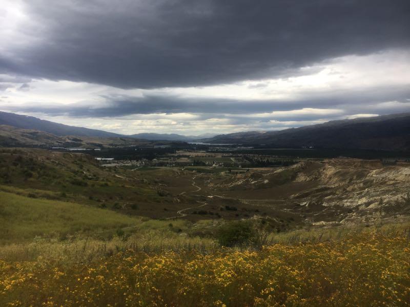
A 4km walker-biker track now loops around the Bannockburn Sluicings Historic Reserve where a unworldly landscape of schist boulders, vertical bluffs and ruins is all that remains of the monumental earthworks of the miners who used picks, shovels and sluices - high pressure water blasters...
This is a great little outing for riders interested in history, heritage, gold and geology. It's not an easy trail but with a bit of pushing here and there it's suitable for intermediate riders. There are lots of information boards and photo opportunities. For a longer more challenging ride on the same theme try the Carricktown Loop.
The Bannockburn miners were generally disappointed as the gold was limited and soon ran out. Nowadays viticulturists are mining this gravel-soil and Bannockburn pinot noir is superb.


Good track on a good day. With a range of incline and decline you pedal through a historic area of Cromwell and the gold rush. Just note there is minimal shelter if you are riding in the sunshine and the track could get muddy after a rainfall. A good track to do if you have a free hour or two.
| ThankThe landforms are awesome and the ride is very pleasant - a great place for heritage enthusiasts.
| Thank