×

|
Rate it:
Tags:
Level: Intermediate
Length: 58 mi (93.3 km)
Surface: 4x4 Trail
Configuration: Loop
Elevation: +2,354/ -2,251 ft
Total: 10 riders
Mountain Biking Alpine Loop
#498 of 1,429 mountain bike trails in Colorado
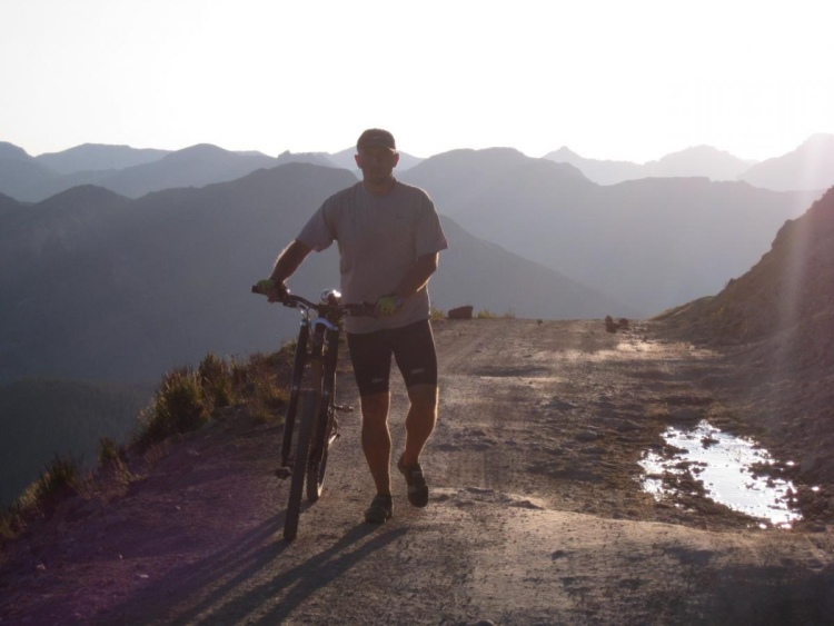
The Alpine Loop Back Country Byway in the northern San Juan Mountains of
Colorado is a spectacular tour of some of North America's most magnificent
scenery. The largely 4WD trail boasts two 12,000+ foot passes, Cinnamon Pass
(12,613ft) and Engineer Pass (12,800ft) and is an epic high country mountain
bike adventure with 7,000ft + of climbing. The route is mainly on well maintained
4WD roads that are well signed. Take plenty of water, food and rain gear since it's
very exposed on top. The Loop itself has rustic facilities including three
campgrounds, a picnic area, and 10 restrooms along the way. The Alpine Loop
was one of BLM's first Scenic Byways. Outside magazine listed the Alpine Loop as
one of the 10 best rides in the country. The loop can be accessed from Ouray,
Silverton or Lake City. The route described starts at Eureka (there is car parking
at the trailhead) which is reached by heading NE out of Silverton about 7 miles on
Co Rd 2. Lake City is also a popular starting point and you can do the loop and
avoid the out and back from Eureka to Animas Forks.
First added by jeremyg998 on Jul 30, 2012. Last updated Apr 28, 2020. → add an update
Before you go
- Drinking water: unknown
- Lift service: unknown
- Night riding: yes
- Pump track: unknown
- Restrooms: unknown
- Fat bike grooming: unknown
- E-bikes allowed: unknown
- Fee required: unknown
This trail information is user-generated. Help improve this information by suggesting a correction.
The trail is well marked and signposted. From the car park at the trailhead
(+10,000ft) at Eureka head up the trail to Animas Forks. This about a 3.5 mile
steady climb on a decent 4WD trail that takes you up to about +11,000 ft. About
0.5 miles past Animas Forks you take a right turn following the signs for Cinnamon
Pass. From here the trail climbs more steeply over the next 3 miles to the pass
(+12,630ft) with a few difficult rock sections. Once at the the pass, enjoy the
view as you are surrounded by 14,000+ ft peak!!!. From the pass, the trail
descends steeply at first with some rocky sections. After about 2.5 miles the trail
splits (CR 12), stay left. From here you ride another easy 7.5 miles or so downhill
until you reach Co Rd 30. There are a few turn-offs on the right on the way but
just stay left. Turn left on Co Rd 30. Ride about 8 miles on a decent dirt road
where the 30 forks left around Lake San Cristabal. Ride around the west side of
the lake until you reach the 149 turn left and head into Lake City. You've just
completed about 24 miles of downhill with a drop of elevation to around 8,730ft -
get ready for the uphill!! At 1st St turn left, after a few hundred yards, fork left
onto Co Rd 20. There is now about 20 miles of climbing to get the Engineer Pass
(+12,800ft). The road starts off easy so enjoy the first 10 miles as you climb
easily (after about 6 miles you pass the turn off to Co Rd 23 on the right). After
about 10 miles you reach a junction (Co Rd 24), here you need to take a left turn
and continue on Co Rd 20. From here the road starts to climb more steeply with
rocky and heavily rutted sections. After about 5 more miles you will reach another
junction, stay right on Co Rd 20 and right again after about another mile. Now
the real climb begins about 4 miles from Engineer Pass. You grind it out to the
pass with a few sections that you may have to hike your bike. At the pass, the
road turns to the left and continues to climb (ouch) looping around the side of
Engineer Mountain. Enjoy the view, it's SPECTACULAR. Continue to climb
another 0.5 mile (+150 ft) and then start to descend. There is a short uphill
(downhill all the way after this) and after a mile you come to a junction. Take a
right and follow some switchbacks down another mile where you will pass a trail on
the right. Go straight on for about 0.5 mile to another junction where you turn
left. Carry on for another 2 miles to Animas Forks (passing to trail up to Cinnamon
Pass you took earlier after about 1.5 miles). From Animas Forks, take to trail
downhill another 3.5 miles to the trailhead and car park.


We bikepacked out of silverton as far as we could get back in July. It was a great ride to share with my 4 year old. Most of the land in the beginning is private. I wasn't excepting that.
| ThankVery scenic ride with a lot of climbing. Haven't done the whole loop, but will recommend to everyone who wants to try high alpine riding. Nothing too difficult there.
| ThankThe only reason it gets 3 stars is it's a jeep road. So you'll pass jeeps. But as one lady expressed to me, they'll be shocked to see you out "risking your life". My plan for the day was to hike one of the 14ers along the Cinnamon Pass rd. So I hired a shuttle to take me up to the American Basin Trailhead with my bike. I hiked my 14er and biked down to Lake City from American Basin. I guess it's about 20 miles, with pretty much no climbing, lots of downhill. It's doubletrack, but there's about a mile stretch with a serious cliff and no guardrail - it's a jeep road after all. The road has some good rocks in it so you bump around pretty good. The view is amazing, even if you don't hike one of the 3 14ers with trailheads along the route. In the winter and spring there's great backcountry skiing in American Basin - maybe if you have a fat tire bike? It's mostly a view thing though, not a single track experience. If you want singletrack in the area, check out the Camp Trail up the Continental Divide and the Continental Divide Trail itself.
| Thank