
Legal eMTB trail access continues to spread across the USA. In the last few weeks, two of the biggest mountain bike destinations in the Western US have announced that previously proposed changes to e-bike trail access in their nearby national forests have subsequently been adopted.
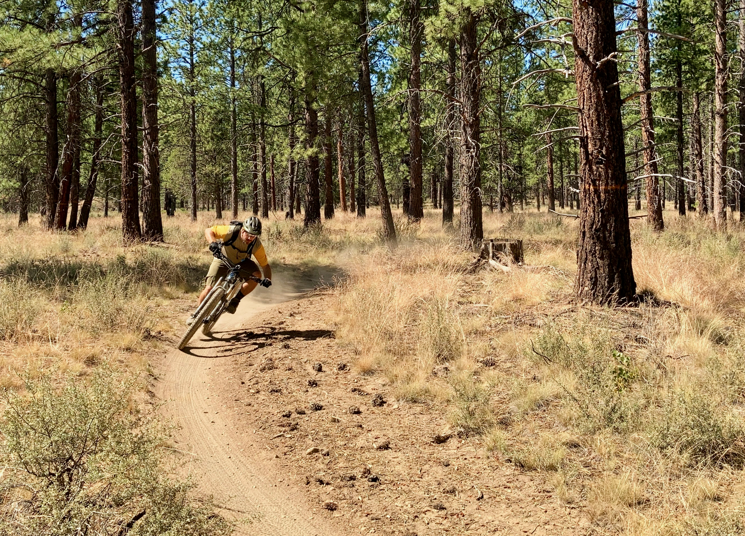
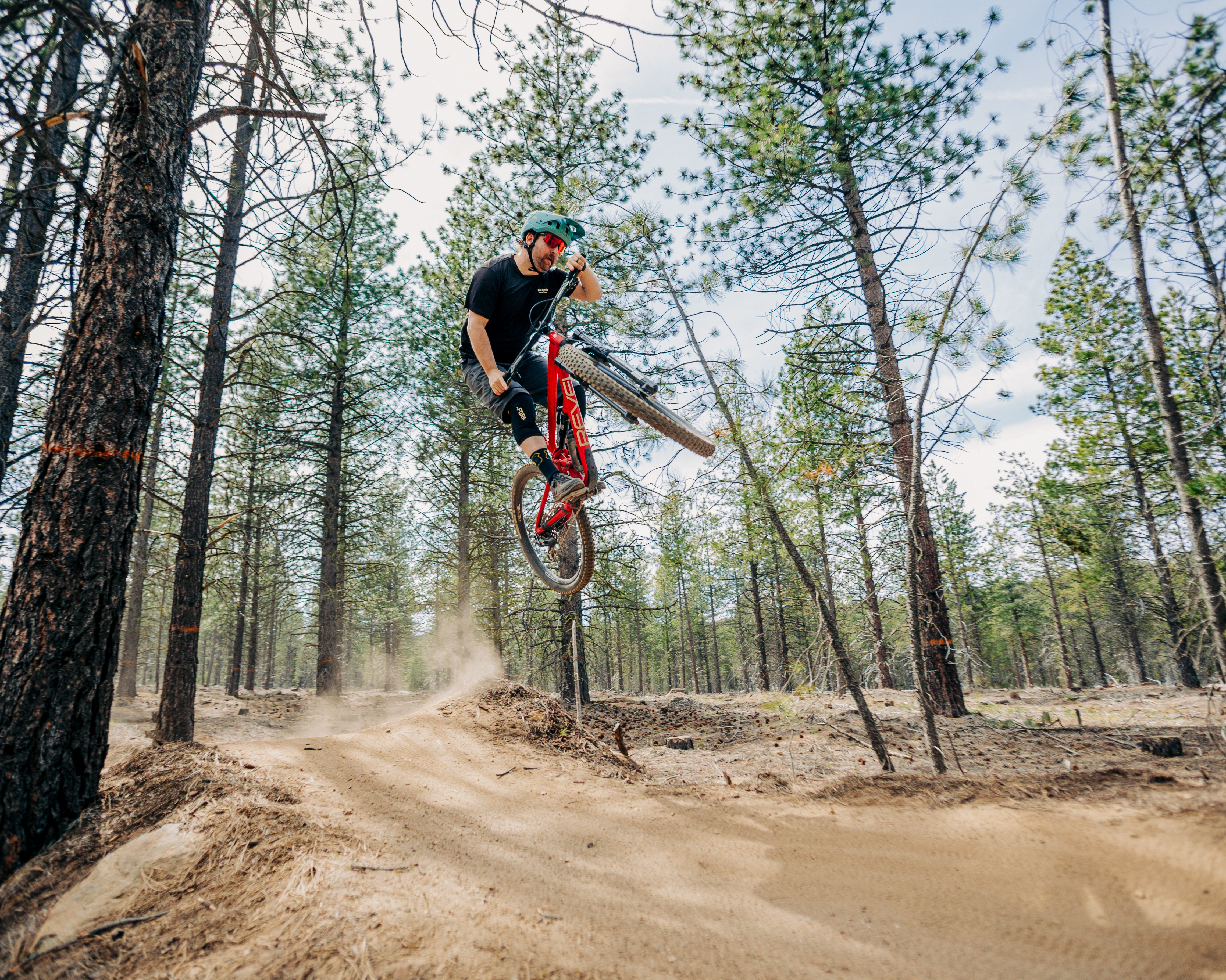
161 miles of trail open to eMTBs in Bend, Oregon
The Deschutes National Forest near Bend, Oregon, is home to about 261 miles of mountain bike trails. Of those available bike-legal miles, 161.4 miles will officially be opened to Class 1 e-bikes as of April 1, 2026.
After completing a comprehensive environmental assessment (EA) and gathering over 1,300 public comments, the Forest Service signed off on opening 67 trails across five distinct networks: Peterson Ridge (28.7 miles), Phil’s Trail Complex (62.5 miles), Wanoga (52.9 miles), Sunriver (8.8 miles), and paved paths (8.5 miles). The trails span beginner through advanced difficulty levels and include everything from paved paths to purpose-built technical features.
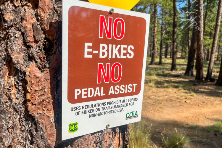
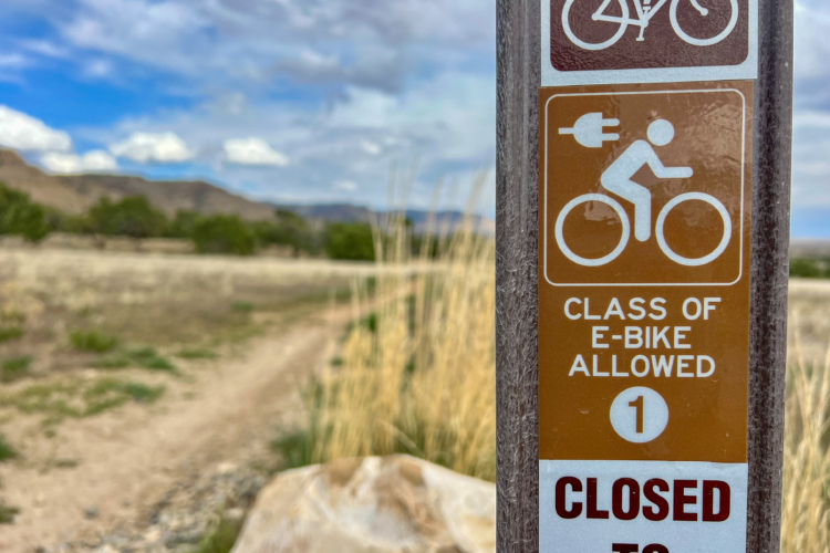
However, there are a few caveats. Most obviously, only Class 1 e-bikes are allowed — the other classes remain banned. Second, e-bikes are banned from the trails from December 1 through March 31 each year to protect critical deer and elk winter habitat, as part of the existing Tumalo Winter Range Seasonal Closure. But here’s what’s a bit unusual: non-motorized bikes are still allowed on the trails during this time. The existing seasonal closure only applies to motor vehicles, according to the Final Environmental Assessment and Forest Plan Amendment document, and that includes e-bikes.
Many riders might not be aware that the Forest Service now classifies e-bikes as motor vehicles under the 2022 policy updates. To allow Class 1 e-bikes on these bicycle-designated singletrack trails, the Forest Service must update the Motor Vehicle Use Map to authorize their use, while still restricting access to Class 1 e-bikes only. Essentially, 161 miles of trails have been converted from nonmotorized to motorized, but all other motorized vehicles (such as dirt bikes and ATVS) remain banned.
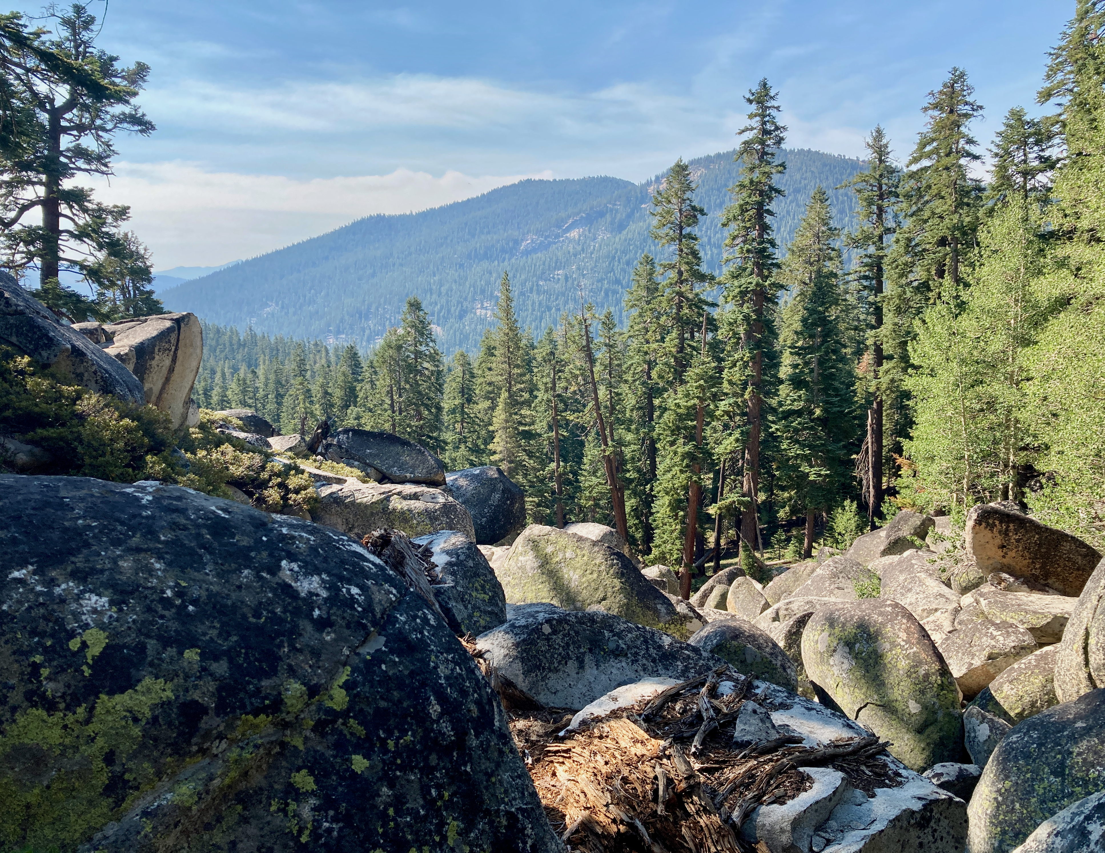
112 miles of trail open near Lake Tahoe in California and Nevada, and over 40 new miles of trail will be built
E-bike trail access near Lake Tahoe has long been controversial, but after a years-long environmental review process that included 496 scoping comments and 576 additional public comments on the draft plan, Forest Supervisor Erick Walker inked the final decision on January 9, 2026, to allow e-bikes on 112 miles of trails in the Lake Tahoe Basin Management Unit (LTBMU).
Big wins for e-bikers include the Flume Trail, Incline Flume, Pope-Baldwin National Recreation Trail, the entire Angora Ridge and Gunmount systems on the south shore, Meeks Creek drainage and Blackwood Canyon on the west shore, plus the full Kingsbury Stinger network and Stateline Lookout area on the east side.
The Tahoe Rim Trail, Pacific Crest Trail, and wilderness areas remain completely off-limits to e-bikes, and the decision notably excludes Trail S59 (the controversial neighborhood-to-Angora Ridge connector) after objections revealed it would’ve dumped e-bike traffic directly into sensitive areas.
As in most destinations, e-bikes will be limited to Class 1 only. E-bikes are also restricted by a seasonal closure on these trails from November 15 to April 1. Similar to the seasonal closure in Bend, this closure applies solely to motor vehicles, so non-motorized bikes are still allowed during this timeframe, where permitted.
26.1 miles of new e-bike-legal singletrack
In addition to opening existing trails to e-bikes, the LTBMU final decision calls for the construction of 26.1 miles of new e-bike-legal singletrack, plus an additional 14.7 miles of nonmotorized trails.
The west shore gets the most substantial new e-bike infrastructure with the 4.45-mile Emerald Trail running north from Emerald Bay, creating a critical backbone connector along the west side. Multiple Quail Ridge neighborhood connectors totaling about two miles link west shore communities directly into the trail system, while the 2.22-mile Blackwood Trail provides separated trail access through Blackwood Canyon away from vehicle traffic. Additional unnamed connectors add roughly seven more miles of neighborhood-to-trail links throughout the west shore communities.
The south shore sees the 4.87-mile Cal Base to Powerline to Perimeter connector as the major new artery, with shorter spurs totaling about a mile linking the Powerline Trail system to Ski Run neighborhoods, plus the Railroad Connector tying Railroad Grade to Incense Cedar Trail near Tahoe City. The 0.68-mile Rock Garden Extension was added in Alternative 1 to connect the Rock Garden trail to Angora Ridge.
The east shore gets the 2.33-mile Zephyr Connector linking Kingsbury Stinger to Zephyr Cove, plus a 1.4-mile paved bike path connecting Incline Village to Stateline along existing road corridors, with about six miles of new e-bike construction also going toward trail reroutes replacing unsustainable existing alignments.
14.7 miles of new nonmotorized singletrack coming to Tahoe
Muscle-powered mountain bikers will also be stoked to learn about the 14.7 miles of completely non-motorized trail the Forest Service is building to offset e-bike designations and provide quiet recreation opportunities.
The crown jewel is the 3.73-mile Perimeter South connector from Heavenly’s gondola mid-station to High Meadows, creating a sustained downhill run that avoids the e-bike-approved Perimeter Trail. The 3.44-mile Cookhouse Drop descends from Cookhouse Meadow to Warr Trail, paired with a short Portal Trail connector, while the 1.75-mile Grass Lake Tie links the Grass Lake area to the Humboldt-Toiyabe National Forest boundary near the Tahoe Rim Trail.
The 2.1-mile Incline Loop East provides a dedicated uphill climbing route for traditional mountain bikers from the Incline Flume Trail to the Tyrolean Downhill, separating non-motorized uphill traffic from the e-bike-approved Incline Flume descent. The 1.4-mile Baldwin Pedestrian Path runs parallel to the Pope-Baldwin National Recreation Trail, creating a separated non-motorized corridor where the original trail will allow e-bikes.
Two short connectors near the Pacific Crest Trail improve mountain bike connectivity while keeping riders off the PCT itself, while a regional connectivity trail and the formalization of the Meiss-Schneider connector as non-motorized round out the package.
The haphazard district-by-district e-bike approval process across the USA continues to cause headaches for e-bikers traveling to ride their bikes, as it’s difficult to know which regulatory changes have been implemented. But one thing’s clear: the trend of opening mountain bike trails to Class 1 e-bikes continues to accelerate across the country.
Updated on January 15, 2025, to reflect that the Angora-Gunmount Tie will not be constructed.


6 Comments
Jan 14, 2026
We've already had years of ebike non-compliance on the trails and we knew this change would come, but similar to other comments here I'm both skeptical of the need and concerned about safety and etiquette.
Jan 16, 2026
Jan 16, 2026
Jan 15, 2026
Jan 14, 2026
Jan 21, 2026
At the very least regulating them as 'motorized vehicles' is a good thing as the fallacy of them being 'human powered' has always been the problem.