If you don't have a shuttle, start on the Fire Road at the Seneca Creek Trailhead, ride up the fire road to the top of Spruce Knob, 6 miles. Follow Huckleberry till you come to the first intersection, stay left on Huckleberry, then in a short distance you will go left again. Follow the trail till you come to Lumberjack trail and then across Lumberjack on a trail marked "to Seneca Creek" In a short distance, Judy Springs trail will take off on your left. Make sure your brakes are adjusted here because it is a couple miles of steep, offcamber downhill with some tough little dips with lots of rocks in them. Watch your speed because they come up fast. You will know when you are about there, because you will come into a nasty rockgarden on the side of a step hill. It can be ridden, just go for it. Stay to the right near the bottom due to a drop off before the creek. After a short climb and another short downhill you will come out a Judy Springs remote campsites, cross the wooden walk bridge and take a left on Seneca Creek Trail. This portion is a gradual climb for about 3 miles back to your vehicle.
If you have a shuttle, you can leave one vehicle at Seneca Creek Trailhead and drive to the top of Spruce Knob, however you will miss some awesome scenery.
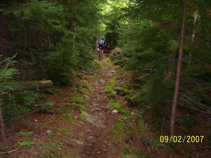
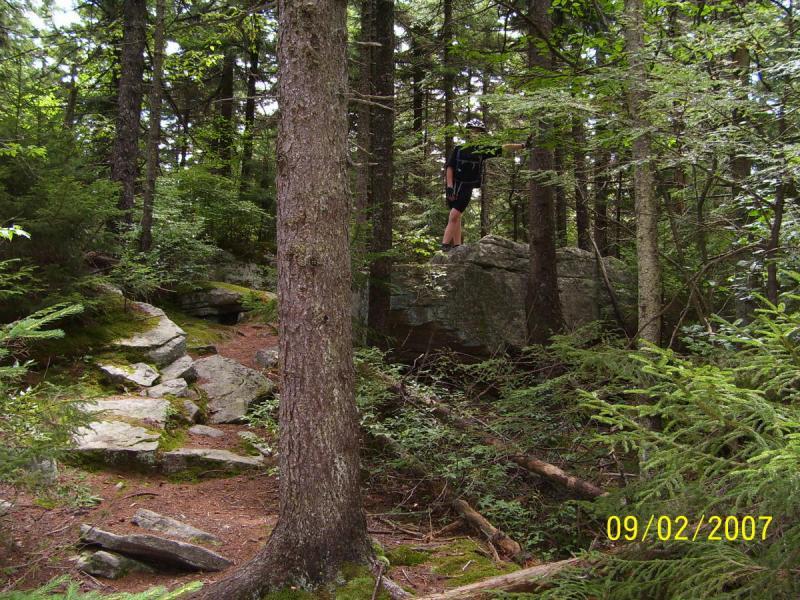
Check the pictures posted.


 4
4
Best to have shuttle to top then park at Walk In Campground. Nice, technical downhill with challenging terrain and drop offs. Count on a few hours even without shuttle. Epic without shuttle, and the road is dusty, dirty. Watch for cow-pies near the campground, they are slippery.
| ThankHey just got my newest issue of IMBA Trail News and they have listed this loop as an IMBA Epic. Pretty Awesome as it's one of my favorite rides. They are calling it the Spruce Knob Loop. I have asked the webmaster to change it to that name to avoid duplications. This is a must ride if you are in the area.
| ThankJust rode this loop in September with a group of 16 other riders. The trails are drier than I even seen them and the ride was awesome. Everyone had a great time and believe it or not, no mechanicals ! None ! Couldn't believe it. Only one bad looking crash on Judy Springs Trail but the guy rode out.
| Thankstarting at the highest point in the state (spruce knob) This is a must ride for the passionate mountain biker. epic scenery/views, and epic terrain. theres even a little dirt on those rocks in places :) in one section i almost had to drop to granny while DESCENDING parts of Huckleberry! there are many other trails up there in the seneca creek backcountry area to make other loops and longer rides too. just make damn sure Huckleberry and Judy Springs are part of the loop/ride! * Review edited 8/25/2008
| ThankJust rode this trail again on August 23, 2008 and it's still awesome. Almost seemed like more rock than I remember, but awesome anyway. Oldnoob joined my son and I for the ride and we did the same loop as last year using Seneca Creek Trailhead as the starting point. I'll post some newer pics in a couple days. If you like rock gardens, root gardens, some loose rock downhills and one nasty boulder field near the bottom you'll love this loop.
| ThankJust wanted to rate this as difficult. Hope to ride this again real soon and will give a better update.
| Thank