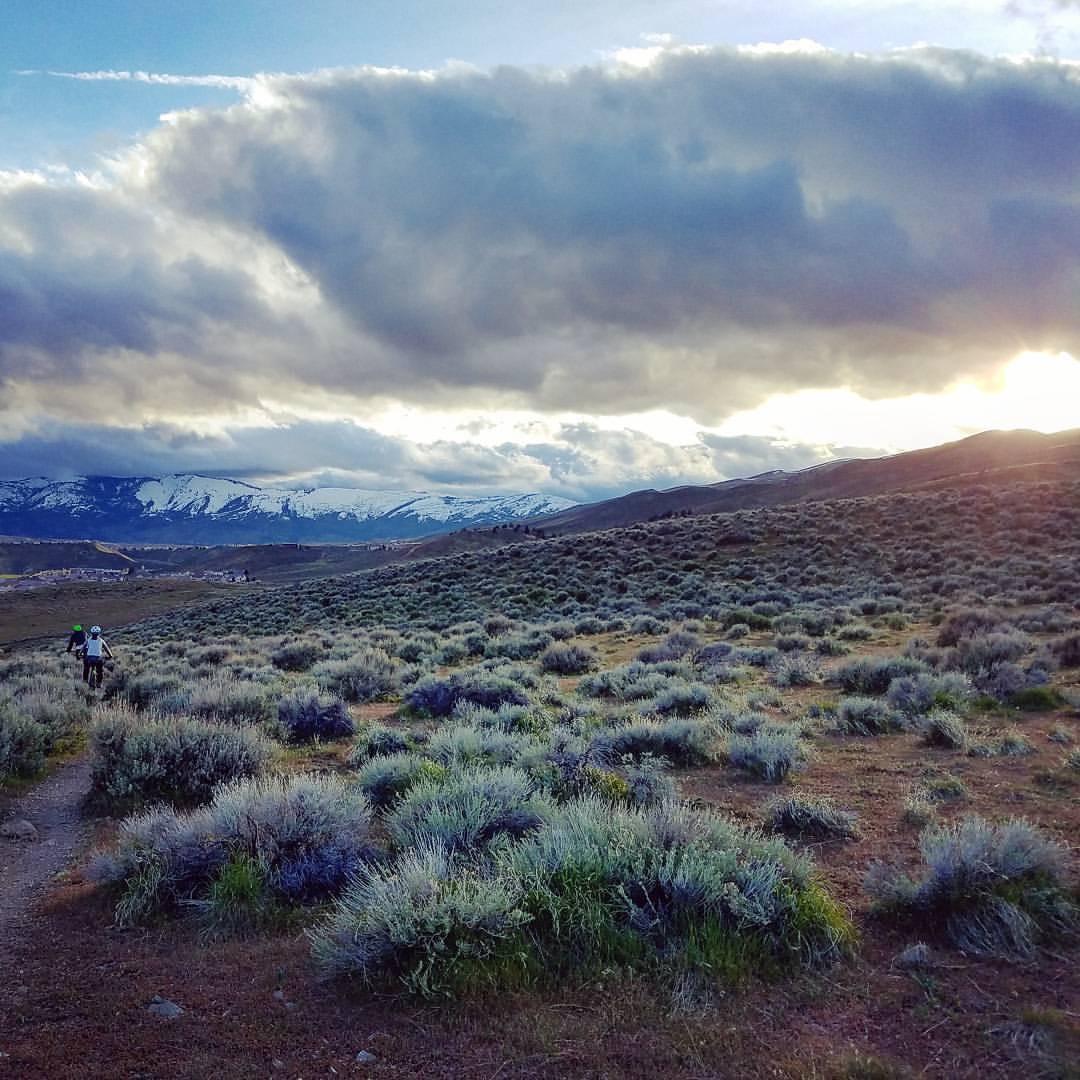
Peavine Mountain is Reno’s go-to backyard trail system, but it’s so much more than just a quick after-work hit. Peavine has been developed by the Biggest Little Trail Stewardship (BLTS), Inc., over the past 18 years, and it now boasts over 55 miles of trails for all skill levels, from beginner to expert. “All the trails have spectacular views of the Reno community and the surrounding Sierra Nevada Mountains,” said Curtis Johnson, President of BLTS. In addition, the connected Sierra Vista Park offers an additional five miles of MTB-specific trails.
Over the last year and a half, BLTS has built three new trails totaling almost five miles of singletrack: Reno Vista, Hopper, and Golden Fleece. These new lines “offer world class flow trail and technical features,” according to Johnson. “We are in the process of building 12.9 miles of new trails that will expand the trail system to two more Reno neighborhoods on the north side of the mountain.”
 | Golden Fleece | 3 mi |


 3
3
I got dropped at Hoge parking and road Poedunk to Halo, riding Snow Terrace to Kings Row, ending at Keystone Canyon parking. Definitely fun, desert singletrack. Nothing very technical, fairly intermediate, and no ball-buster climbs. It was hot!
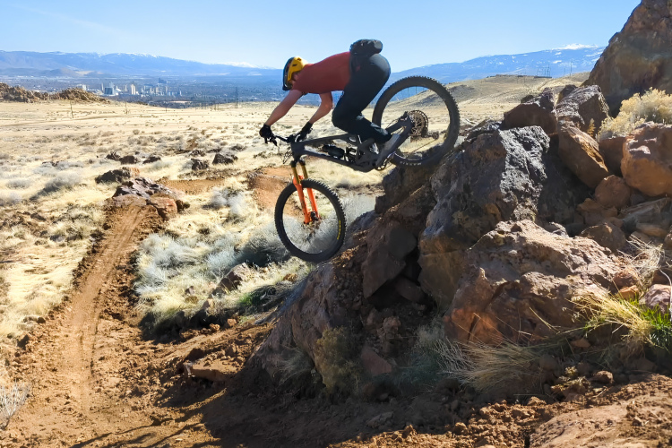
| ThankLots of good stuff. Plenty for intermediate and beginner riders, not really much that is advanced except the N trail which has some nice rocky features. Fun to explore. Mahogany and Bacon strip are highlights. Definitely don't ride when wet, the clay holds tracks forever. Have fun!
| ThankGood stuff. Lots of climbing! Descend for days! Ride it any way you like and you're guaranteed great XC with some sweet downhill built for the full squish bike. Go enjoy!
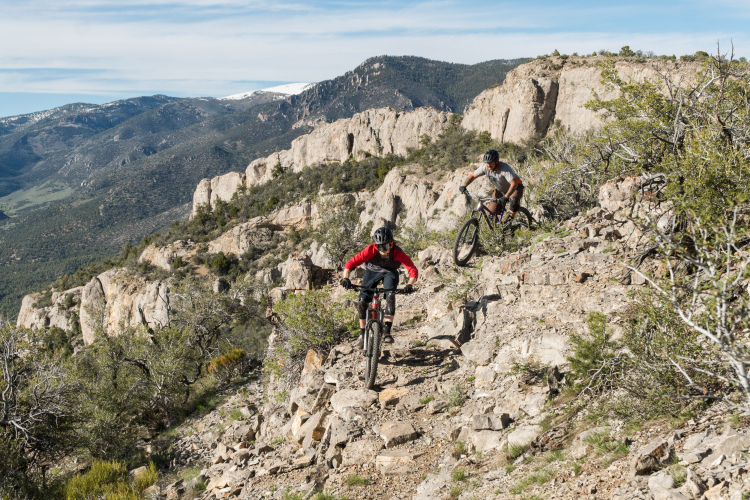
| ThankPea vine mountain has many hundred miles of trails which at times can be rocky but also allow for after work rides due to their close proximity to Reno. Also great for when Tahoe is snowed in. I rode peavine just about year round last year. Best trails include the luge,
| ThankGreat climbs with lots of options. Great long routes to get to upper elevation. Lots of opportunity for great downhills and fast flowing single track. If your in the area its a great ride!!
| ThankThis is a network that can be worked into any number of different loops and/or lollipop loops. It can be easy or even difficult. You can even make it technical (there are several single tracks made in sand or kitty litter) or downhill fun (several steep slopes). Great for before or after work, but there are so many miles of web that you can use it on weekends too! Lots of fun!
| Thank