

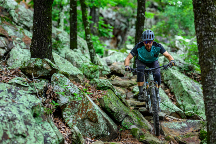
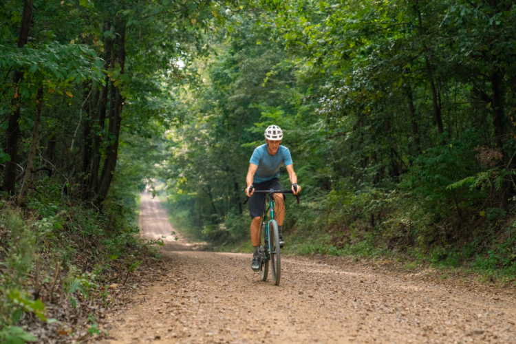
With so many high-quality mountain bike trails and trail systems located in Northwest Arkansas, it’s tempting to ride all day long, for days on end. So what happens when a group of riders decides to give into temptation and do just that? As it turns out, it’s a pretty magical trip, and one that almost anyone can enjoy. Whether you’re an experienced bikepacker or you just want to maximize your time on the bike during a visit to Northwest Arkansas, you’ll have a blast connecting — and riding — the best trails in the area by mountain bike.
A three-day, frontcountry singletrack bikepacking experience
Our objective for this route was simple: connect as many mountain bike trail systems as possible — from Back 40 to Mount Kessler — while minimizing time spent riding on the road, and with a preference for gravel over pavement. With that in mind, we mapped and rode a flexible three-day route — roughly 50 miles per day — that can be adjusted in length and ridden self-supported.
- A three-day, frontcountry singletrack bikepacking experience
- Day 1: Back 40, Little Sugar, and Coler Mountain Bike Preserve
- Night 1: Camping at Coler, or lodging in town
- Day 2: Fayetteville Traverse, Centennial Park, and Mount Kessler
- Night 2: Where to stay in Fayetteville
- Day 3: Lake Fayetteville trails, Hand Cut Hollow, Slaughter Pen, Lake Bella Vista, and Blowing Springs
- Route information
- Equipment recommendations

Day 1: Back 40, Little Sugar, and Coler Mountain Bike Preserve
- Start: Blowing Springs Park, Bella Vista
- End: Coler Mountain Bike Preserve, Bentonville
- Total: ~48 miles
- Singletrack: ~90%
- Elevation gain/loss: 4,400/4,300ft
- Don’t miss: Grindstone Coffee, Staggerwing Session Zone
- Optional: Bonus loop at Coler
The best place to begin this epic singletrack adventure is at Blowing Springs Park, in Bella Vista, AR, located at the northern end of the loop. The Blowing Springs RV Park serves as an excellent base camp, with primitive campsites, tiny cabins, and RV sites available for rent.


Our group of four riders from Atlanta — Nick, Katie, Aaron, and I — stayed in the tiny cabins, which offer cozy accommodations located directly along the route. Most of the cabins feature a private bathroom plus a kitchenette with a coffee maker, mini-refrigerator, and microwave. There’s also a tiny bunkhouse you can rent that sleeps four, with access to a central restroom and shower facility nearby. A shared covered picnic area with a bike rack and bike tools located between the cabins is the perfect spot for route planning and last-minute bike setup.
Even if you don’t stay at the Blowing Springs RV park, you can take advantage of the food trucks and beer garden located at the northern end of the park. On the day we started our ride, a brand-new coffee truck, Grindstone Coffee, had just opened, and we were among the first customers. The coffee and bagels were delicious, and sharing our plans with other riders before we set out was the perfect send-off!

Back 40 trails
Highlights along this section include an optional black-diamond trail, the Ledges, “trail magic” spots, and Pinion Creek falls at mile 19.
Starting at the Back 40 trail system, you’re immediately immersed in the forest, with glimpses of dark limestone outcroppings and shallow hillside caves. The Back 40 trails are generally well graded, with few if any steep climbs or descents. As you make your way along the trail, numerous road crossings remind you that you’re never far from civilization, even if it feels like you’re deep in the backcountry at times.
Riders can generally get away with carrying just a couple of water bottles, as there are countless water fountains and spigots located within the trail system. Note, however, that some of these sources are seasonal and are only available in warmer months. We brought water filters and purification tablets just in case, as there are numerous natural water sources along the trail. There are also several “trail magic” spots located along the Back 40 trail where locals place coolers filled with water and drinks for anyone to enjoy.


There’s a grocery store at about the 18-mile mark where we chose to stock up on sports drinks in preparation for the second half of the day. A bike shop, Phat Tire, is located almost dead center within the day one route, which came in handy for Nick after he damaged a tire early in our ride.
Little Sugar
In the Little Sugar trail system, you’ll find slightly steeper climbs and descents, LED-lined tunnels, and a fast and flowy finish.
Don’t let the name fool you: Little Sugar is a BIG trail system that’s A LOT of fun to ride. After crossing under US Highway 71 from the Back 40 trail, a large, steel bridge takes riders across Little Sugar Creek and onto the Sugar Bridge trail, which leads to Tunnel Vision. Aaron and I had ridden this section before, yet we failed to follow our route — which hooks north to go under the bridge before ultimately heading south — correctly this time. Instead, we “accidentally” ended up on Aaron’s favorite trail in all of Northwest Arkansas: Danger Will Robinson.
“The beauty is a ten out of ten,” Aaron said. “There’s all kinds of rock things you have to get up and over and little turns. And you’re going under a big overhang. You duck a little, which you probably don’t need to, but you want to anyway. It’s just super technical and fun.”

To be clear, you don’t have to ride the expert-rated Danger Will Robinson trail as a part of the route; just follow the Sugar Bridge Trail as shown below. For those who do choose to ride it, the trail, though short, is a real treat, and features chunky rocks, overhanging ledges, and tight squeezes. It parallels the Sugar Bridge trail, so before we knew it, we were back on route again.

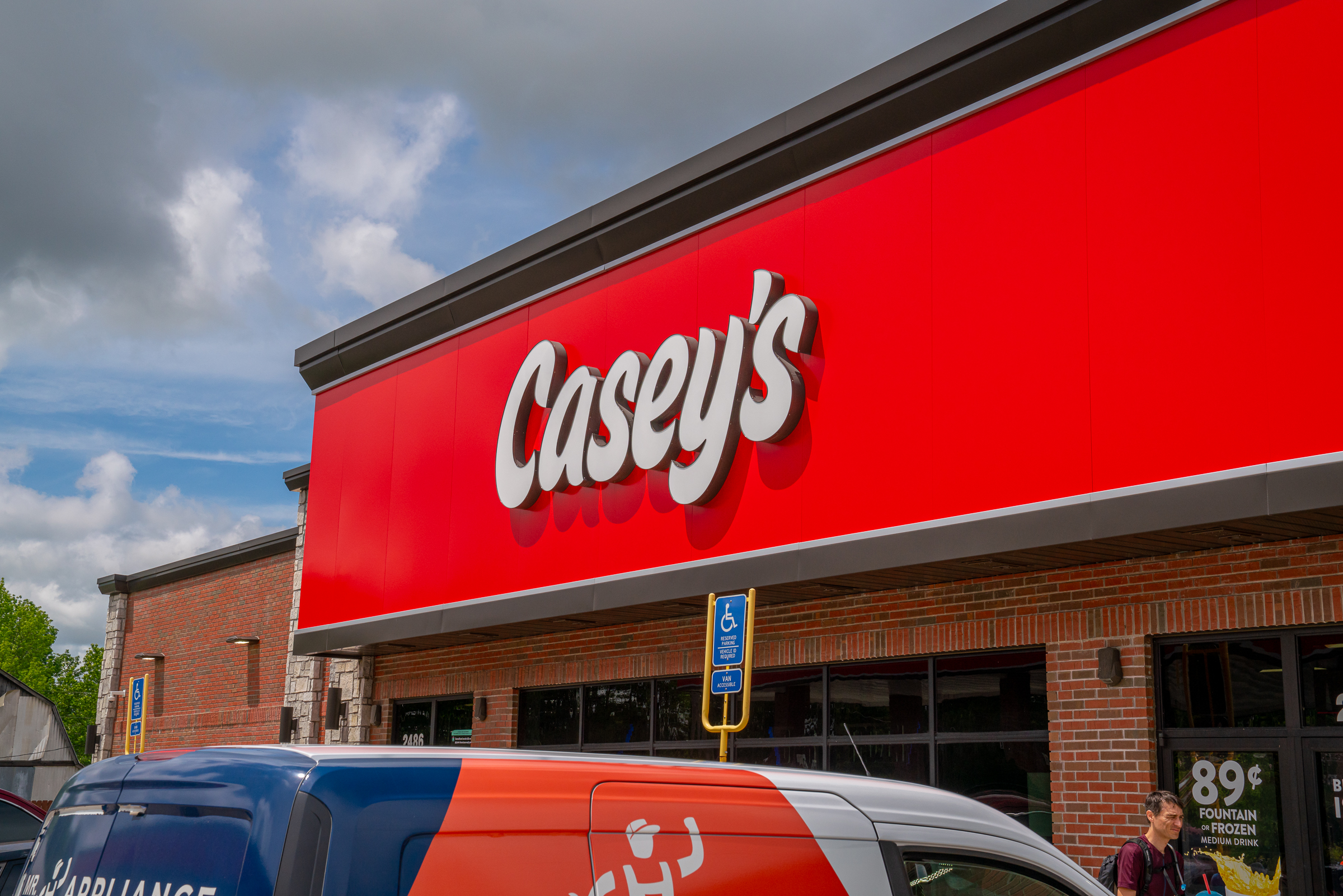
The Little Sugar portion of the route makes use of the Tunnel Trail, which essentially takes riders around the outer edge of the trail network. The trail features multiple stream crossings and rainbow LED-lighted tunnels as it snakes its way through the hills of far Northwest Arkansas. The climbs on this side of the loop are longer and steeper than on the Back 40 side, and by the afternoon, we were feeling the burn. Thankfully, we found a Casey’s General Store at mile 35, where I cooled off in an ice box as a bemused store employee looked on during her smoke break.


In addition to the tunnels and shallow stream crossings, Little Sugar highlights include the Staggerwing Session Zone (not recommended for bikepacking bikes) and a finish on the flowy Down Under Trail, which features a chip-seal singletrack surface with grippy rollers, switchbacks, and berms. This short section was the highlight of the day for me because it was fast and fun, even on a fully loaded bike!
Coler Mountain Bike Preserve
Whether you choose to ride the easy trails or the more difficult tech trails through Coler, it’s worth pedaling up to see the main hub located on the east side of the preserve.
Coler is a well-known Bentonville mountain bike attraction thanks to its mix of extensive singletrack, jump lines, and technical trails. You’ll ride about two miles of quiet, paved road to get between the Little Sugar exit and the start of the Coler singletrack. As far as roads go, this section is pretty great, surrounded by bucolic scenery.
“Day one, we did a 50-mile day, and it was a little bit of a grind at the end. It was hard,” Nick said. His suggestion: don’t go into day one expecting to ride hard and finish quickly; take your time, have fun, and enjoy it.

Night 1: Camping at Coler, or lodging in town
- Camp: Coler campsites start at $25.38/night. Impressive amenities, but sites fill up fast. Food and coffee are available nearby in the park.
- Motel: The Bike Inn, rates from about $60 – $225/night. Community space with fire pit and hot tub.
We booked a couple of campsites at Coler for the night, which meant our ride ended shortly after entering the park. You could ditch your gear and explore the trails in the park, but we were all exhausted from our ride and wanted to get our tents set up before dark.


The campground at Coler is nothing short of spectacular. Opened in 2017, the campground features 16 elevated platform sites and five camper van sites that can be reserved online. Separate men’s and women’s restroom buildings feature soaring ceilings, clean stalls, and hot, private showers. There’s also e-bike charging available on site. The campground routinely fills up, especially on weekends, so be sure to plan ahead.


Alternatively, you could ride Coler, then keep biking for a few more miles on a mix of bike paths and roads to a hotel close to the route. The Bike Inn is a popular choice and is located in an area with several big-box hotels to choose from. I really like the Bike Inn because of the shared outdoor space complete with a fire pit, hot tub, and picnic tables where guests routinely mingle each night and talk about the day’s adventures. The Bike Inn also features laundry facilities and a mini, self-service bike shop stocked with various supplies and snacks. You can choose from a standard room in the motel, a tiny cabin, or a parking spot for a camper van.
Dinner options
- Las Palmas: Traditional Mexican fare and delicious margaritas
- Thai Basil: Delicious Pad Thai
- Airship at Coler: Nachos and tacos, but note they close at 7pm
- Pedaler’s Pub: Great pizza and a popular choice for adults and kids alike
There are several excellent restaurants located about a mile or two east of Coler along South Walton Boulevard. We ate classic Mexican food and drank margaritas at Las Palmas, and if you’re staying farther down the road at the Bike Inn, I can recommend the Pad Thai at Thai Basil Bentonville. Airship Coffee at Coler is just a few hundred yards from the campground, where they serve nachos and tacos until 7pm. Since the campground is close to town, you could also order DoorDash from pretty much any of the local restaurants in town.

Day 2: Fayetteville Traverse, Centennial Park, and Mount Kessler
- Start: Coler Mountain Bike Preserve, Bentonville
- End: Razorback Greenway / Fayetteville Traverse, Fayetteville
- Total: ~59 miles
- Singletrack: ~30%
- Elevation gain/loss: 3,200/3,100ft
- Don’t miss: Gravel farm roads, Doomsday breakfast tacos, Kessler singletrack
- Optional: Explore more of the trails at Centennial Park
An early morning thunderstorm knocked out the power to Airship Coffee at Coler on day two; luckily, we didn’t have to go far to find another coffee shop, 7 Brew, just a block off route. You could also take a slightly longer detour off route — about a mile — to Joyhouse Coffee Company in Cave Springs, which features an inviting space full of comfortable seating.


The day two route requires significant road mileage, and the upshot is that most of it is scenic and fast-going, with a good amount of gravel to keep your knobbies dirty. There aren’t any good resupply options along a 30-mile stretch here, so be sure to stock up before you head out.
In our experience, the drivers in this part of the state are generally very courteous to bikers. “We’re stopping, and they’re just waving us on,” Aaron said. “Like, ‘Come on. Go ahead.'”
While munching spicy chicken sandwiches outside a gas station just east of Fayetteville, we got a tip from a local rider who suggested the singletrack at Kessler and Millsap might be muddy given the morning rain. Though the weather had been sunny and hot for hours, he noted that the trails around Fayetteville don’t drain as well as those in the Bentonville area.

Fayetteville Traverse
Highlights include high-quality trail sections that weave between buildings on the University of Arkansas campus.
The route takes riders onto the University of Arkansas campus and follows the Fayetteville Traverse trail, which connects popular trail systems around town. We were blown away by the quality of the trails on campus and how seamlessly the Fayetteville Traverse transitions into forest sections that feel wild and remote.
This bikepacking route passes by the new Stonebreaker Hotel, where we would be staying for the night, which provided a great opportunity to drop some bags so we could enjoy the singletrack to come.

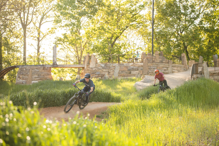
Centennial Park at Millsap Mountain
Here you’ll find flowy, fast-rolling singletrack that’s punctuated by stacked rock features to keep things interesting.
Centennial Park features a variety of high-quality singletrack trails in addition to boasting a competition-level cyclocross venue. There are also some bigger jumps and drops to challenge more advanced riders, though this bikepacking route mostly sticks to the singletrack as it skirts the eastern and southern edges of the park.
You could easily add on as much singletrack as you like here, though, due to conditions, we opted to skip some of the singletrack and rode a section of greenway instead.


Mount Kessler
Ride Kessler for the natural singletrack trails, big climbs (and descents!), and a backwoods feel that’s close to town.
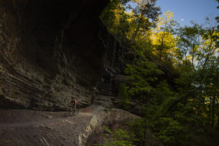
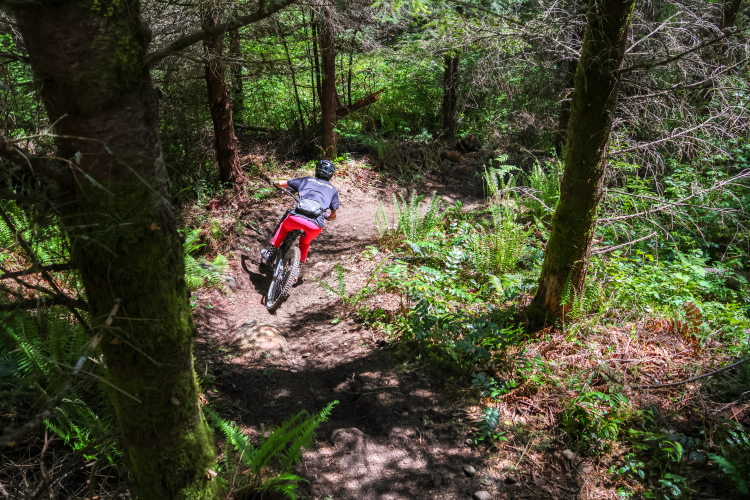
The singletrack trails at Mount Kessler are easily the highlight of day two. Rising to more than 1,800ft above sea level, this is the highest point on the route, and involves a roughly 600ft climb over just a couple of miles. Fortunately, the trail features plenty of switchbacks, giving riders a chance to catch their breath. Still, there are a few steep and rocky sections where most riders will choose to push their heavily loaded bikes.
Compared to the other trails along the route, the Kessler singletrack feels much wilder and natural. Toward the top, I was reminded of remote sections of the Appalachian Trail out east, which is all the more remarkable given how close the trails are to town.
Again, we were forced to cut our route short due to trail conditions. With so many trails in the system to choose from, it was easy to find shortcuts that had us quickly back on route.


Night 2: Where to stay in Fayetteville
- Camp: The Hideout Airstream (about $150 per night) in downtown Fayetteville or the Lake Wilson Retreat (about $60 per night) located a few miles off route
- Hotel: The new Stonebreaker Hotel (from $200 per night) is located directly on route with a hot tub, pool, and everything you need for a comfortable stay
Fayetteville is a college town, which means there are plenty of lodging options available — just as long as it’s not a football weekend. One of the newest hotel options is the Stonebreaker, a modern 3-star property with a pool and dining on site. Located less than a block off-route, it’s an easy choice. The staff helped us secure covered bike storage, and we were able to borrow a garden hose to clean our bikes before heading out in the morning on day three.
Another fun lodging option on route is The Hideout Airstream Camping, which you can book on AirBNB. The location can’t be beat as it’s right on the Razorback Greenway and sits in the heart of the vibrant downtown restaurant scene.


For the more hard-core bikepacker, there are a few camping options in the area listed on HipCamp, like the Lake Wilson Retreat, which is located a few miles off route. Lake Wilson Retreat host Jeremy tells me there are many gravel roads surrounding the property that are popular with cyclists.


Excellent dining options abound
- Doomsday Coffee: Great coffee and excellent breakfast tacos
- Feed and Folly: American-style public house with a rooftop patio
- Hugo’s: Popular burger place in Fayetteville square
After riding all day, you’ll be hungry, and Fayetteville does not disappoint. For dinner, we dined on the rooftop patio at Feed and Folly, where they serve delicious burgers, sandwiches, and fish and chips. They also offer vegetarian options like a yummy black bean burger.
Everyone agreed that Doomsday Coffee was one of the best places we ate during the trip. The coffee is good, yes, but the real highlight is the breakfast tacos. I don’t usually get excited about breakfast, but I’m still dreaming about those yummy tacos at Doomsday.

Day 3: Lake Fayetteville trails, Hand Cut Hollow, Slaughter Pen, Lake Bella Vista, and Blowing Springs
- Start: Fayetteville Traverse / Razorback Greenway, Fayetteville
- End: Blowing Springs, Bentonville
- Total: ~48 miles
- Singletrack: ~33%
- Elevation gain/loss: 2,100/2,400ft (more downhill than uphill!)
- Don’t miss: The singletrack at Lake Fayetteville, Cousin Eddie’s RV at Area 51
- Optional: Add more singletrack in Hand Cut Hollow and Slaughter Pen to extend the ride
On day three, the route follows roughly 30 miles of the Razorback Greenway, which connects Bentonville and Fayetteville. The greenway weaves through neighborhoods, across fields, and over streams, and only occasionally parallels roadways, though always with a protected bike path or lane. Dozens of tunnels and bridges allow riders to avoid most roadway intersections, so you can really hammer through this section if you like.

On the day of our trip, the annual Square 2 Square bike ride was taking place. Held twice a year, the event sees thousands of riders making the trek from Fayetteville to Bentonville — or vice versa, depending on the time of year. For the May ride, everyone biked from Bentonville to Fayetteville, which meant we were going against the flow and got to see everyone coming through. We felt the energy of the crowd, and it was amazing to see riders of all ages and abilities making the trek!


The Razorback Greenway section takes riders through the town of Springdale, which has a beautiful riverfront area with shops and restaurants that are worth visiting. The Natural State Beer Company brewery is also directly on route as the greenway passes through Rogers, and on the Saturday we rolled through, the bike rack out front was packed.

Lake Fayetteville trails
Relatively flat and natural trails skirt the edge of a scenic lake.
About a quarter of the way along the Razorback Greenway, the bikepack route dips onto a bit of singletrack to break things up. This four-mile trail section skirts Lake Fayetteville with beautiful views of the lake. The tread here has a natural feel — bumpy with roots and rocks. During our May ride, we found wildflowers blooming in the meadows interspersed between long, forested sections of trail.


Hand Cut Hollow
The trails in Hand Cut Hollow are extensive, and it’s worth making a slight detour up to the main trail hub and descending one of the flow trails like Interplanet Janet.
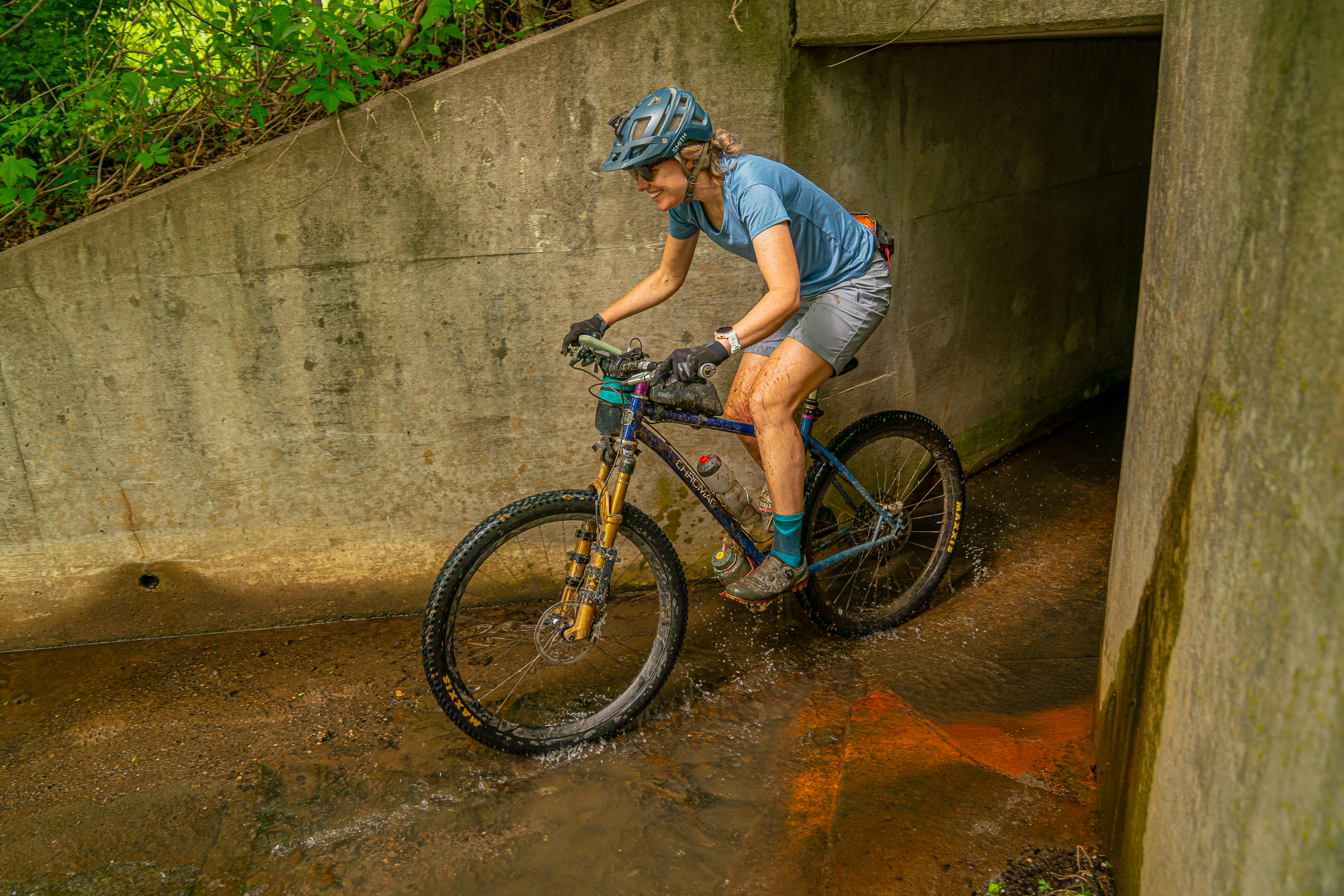
Back in Bentonville, the route enters the Hand Cut Hollow trail system through an unassuming office park. After riding pavement for dozens of miles, we felt like we were stepping into Narnia for the first time. This part of the trail system isn’t as well-traveled as the northern side, where the main trailhead and hub are located. Splashing through a clear stream crossing here was refreshing in the midday sun.
Technically, the hub at Hand Cut Hollow isn’t on route, but we couldn’t resist taking one run off the top. We chose Interplanet Janet and had a blast, even with fully-loaded bikes. “You can go over jumps but brake right before them so you’re not just lofting yourself into the abyss,” Katie said.
The singletrack leading up to the main trailhead ducks in and out of hollows and ravines. It’s steep in places but rideable for the most part.

Slaughter Pen
The Slaughter Pen trail system features some of the most popular trails in Bentonville, including All American, which is a blast even on a fully loaded bike.
After a short stretch of gravel road, the route picks up singletrack once again. If you’re running ahead of schedule and still have the legs for it, you could easily spend hours riding the singletrack in Slaughter Pen. The route takes a pretty direct line through the network via the All American Trail, which is one of my favorites in Bentonville. Yes, it’s a beginner-rated green trail. It’s also fast, flowy, and fun, which is why I love it.
From the All American Trail, follow the Razorback Greenway beneath the interstate. A temporary detour has riders backtracking a bit, but the ride’s not over yet! There’s more singletrack to go before the finish.


Blowing Springs trails and Area 51
Highlights along this stretch include funky trail art, flow trails, and a scenic traverse to the finish line.
By the end of a typical bikepacking trip, most riders are anxious to finish. But not us! We wanted more. This route has a fun singletrack finish, starting with the Area 51 trails. Many of the trail names come from Alice in Wonderland, which is fitting because it feels like you’re riding through a fantasy land. The main hub routes riders through Cousin Eddie’s RV for a truly unique experience.
The Cooper Creek trail is short but scenic, with a boardwalk that hugs a limestone formation jutting out of the hillside. From here, it’s a fast downhill finish to the Blowing Springs trailhead parking lot.

Finish!
What better way to end a ride than to enjoy a drink with friends! The Gear Garden at Blowing Springs is an open-air beer garden serving alcohol and soft drinks. There are food trucks, too, in case you’re hungry. On the Saturday afternoon that we finished, the Gear Garden was full of families celebrating birthdays and enjoying the warm weather. For us, it was a time to reflect on the ride and to begin planning our next Arkansas singletrack adventure!
Route information
If you’re new to bikepacking, this route could be a fun and low-risk way to get started! That being said, it’s important to be flexible and prepared. On our three-day trip, we encountered multiple trail closures due to weather and construction that required on-the-fly reroutes. Downed trees forced us to hike-a-bike in places, and we experienced multiple bike failures that required repair. With the right attitude, these obstacles are part of the fun and adventure!
“We hit a bridge that was out, and were able to re-route onto another trail,” Katie said. “You can’t do that at home.”
The route shown here will surely need to be modified to suit your plans for lodging and food, your trail preferences, and any situations you encounter along the way. Given the pace of construction in Northwest Arkansas, conditions and infrastructure are constantly changing.
Despite several trail closures, we never had to go very far out of our way to get back on route. For example, a roughly two-mile section of the Tunnel Trail was closed at the time of our ride. However, signs posted on the trail clearly described a detour via the Lago Vista trail, which we found was easy to follow.
Though Nick and Katie are strong, experienced bikepackers, this was Aaron’s first overnight bike trip. In the end, all of us agreed that roughly 50 miles per day was the right amount of riding for us, though if we did decide to extend one of the days, we would add more Hand Cut Hollow and Slaughter Pen singletrack on day three.
There are numerous bike shops located close to the route, aside from the western stretch between Bentonville and Fayetteville, in case you need repairs or supplies. Just be sure to keep your smartphone charged, and you’ll be fine. 🙂

Equipment recommendations
Though this route does include some long stretches of road riding, we don’t recommend riding a gravel bike unless you’re very comfortable on singletrack and riding trails that can be rocky and rough at times. Everyone in our group rode a hardtail, though a short-travel full-suspension bike could work well too.
If you’re camping along the route, obviously you’ll need a tent and sleeping bag, and probably an air mattress, too. If you plan to secure lodging for your ride, all you need is your clothes, a decent repair kit, and a way to carry water and snacks during the day.
Self-supported alternative
The experienced bikepackers in our group agree that this route would be more fun to ride fast and light without camping gear, staying in hotels or cabins along the way. That being said, the route can be ridden completely self-supported. In fact, it’s possible to complete the route car-free; the west side of the route conveniently takes riders within a mile of the Northwest Arkansas National Airport.

1 Comments
Jun 9, 2025