

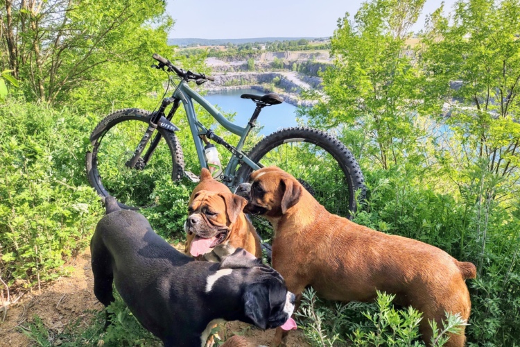
The Southwestern mountain town of Tucson offers an overwhelming amount of stellar trail riding, bike-friendly places to stay, and great places to eat, drink, and hang out when you’ve had your fill of shredding for the day. Tucson is also a Silver-Level IMBA Ride Center, meaning it has extensive and diverse trail networks for mountain bikers plus close-by amenities.
If you’re reading this, it likely means you’re planning a trip to Tucson. Here is everything you need to know, from the perspective a local guide.
When to visit Tucson
Tucson has an airport, but is also only a two-hour drive from the Phoenix airport which usually offers cheaper and more frequent flights.
Spring is the most beautiful time to be in the Sonoran Desert—the cactus flowers are blooming, temperatures are still relatively mild, and rain is rare. In the fall and winter, Tucson still offers a lovely reprieve from the cold weather setting in further north. Avoid the triple-digit temps from June to September.
Best Local Guides for Tucson
If you’d like to rent a bike, hire a guide, organize a day of shuttle service, or all three, Homegrown Mountain Bike Tours is a great resource.

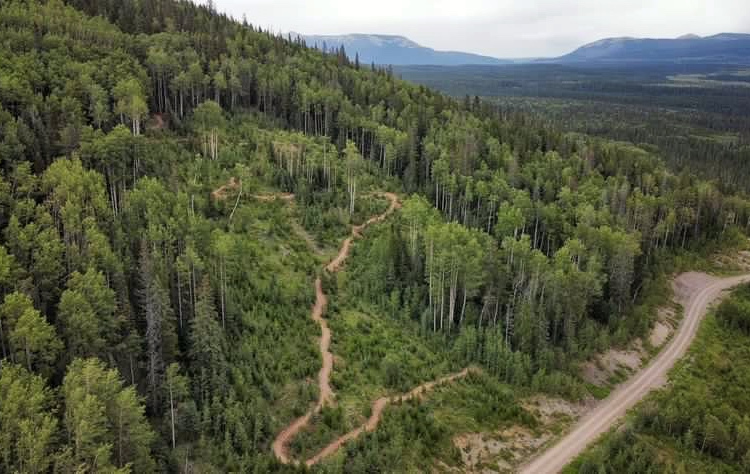
Where to Ride
Sweetwater Preserve
This local favorite is a gorgeous place adored by riders of all levels, but the majority of the trails are rated beginner or intermediate—expect rocky features and tight turns but no arduous climbing or long descents. The extensive trail network is well marked with a map at each junction as it winds through typical Sonoran Desert plant life: towering Saguaros, Prickly Pear, wispy Ocotillos, and cholla. Take Broken Arrow trail for the most technical section in the park, or add on the Desperado Loop to the recommended ride for a 10 mile day and some killer views of the Santa Catalina Mountains.
Parking: Sweetwater Preserve Trailhead

Recommended Ride: Start on the Saguaro Vista Trail and take it through Sun Circle Loop to the Black Rock Loop. Continue to Lost Arrow Trail to Red Canyon Trail, Red Tail Ridge and back to the start on Wildflower Ridge Trail.
~8-miles
Colossal Cave Mountain Park
This beginner-friendly area is full of flowy, gently-sloping trails with few features or obstacles, but plenty of vista views. The park offers a look down at the valley from the southeast. There’s no trail use fee or permit required. The Colossal Cave trail system links up to a section of the famous Arizona Trail, a popular thru-hike or bikepacking route which runs the length of the state from top to bottom. The cave itself is definitely worth checking out as well—tours run every hour and you can book online.
Parking: Off E. Colossal Rd.
Recommended Ride: Take Old Mesquite out to Pistol Hill and soak up the views. For a longer ride, Ride Coyote Canyon west to meet up with a section of the Arizona Trail and make a clockwise loop.

Starr Pass
This intermediate trail system offers a variety of terrain that can be enjoyed by all types of riders. Nestled within the Tucson Mountains, Starr Pass has over 20 miles of well-marked, interconnected trails that wind around a few hillsides and through some dry river beds, with a good number of rocky sections and a range of moderate climbs. From the Genser Trailhead, make a counter-clockwise loop with the Starr Pass Trail and the Yetman Trail.
Parking: Richard E. Genser Trailhead
Recommended Ride: Starr Pass Main Loop, ~9-miles

50-Year Trail
This advanced trail up in the town of Catalina is a popular mountain biking destination for riders all over the country, especially during the winter months. Starting from the Golder Ranch parking lot, you can take the 50-Year about three miles north to a small loop called The Chutes, which is full of flowy, bermy corners. Once you get back to the top, take the trail right and ride the Upper Fifty and Gem trail, a rowdy loops that includes rocky sections, technical descents, and amazing views of the Samaniego Ridge. That will tee you back up onto The Chutes, and you can head back home on the 50-Year from there. Unfortunately these trails aren’t marked at all, so if you’re going to ride out here without a guide make sure you have an app or a map.
Parking: Take East Golder Ranch Drive from Oracle Rd until it dead ends in a gravel parking lot.
Recommended Ride: Golder Ranch Advanced Loop, ~12 miles

Mount Lemmon (Bug Springs to Prison Camp to Molino Basin)
There are tons of trails along the road up to Mount Lemmon, but this stretch is a local downhill favorite. It starts out with a bit of hiking—about 20 minutes up a section of railroad ties—but is worth every step. From the top you can get on your bike, but don’t drop in without taking in the views of the city from 3,400 feet above the valley floor.
This elevation means the air will be a tad cooler than it is down in the valley, so it’s a great option if you’re visiting during the warmer months. The exhilarating descent offers super exposed sections of chunky granite, as well as some flowy patches through trees and a few creek crossings (which could be dry depending on the time of year), as well as a few two-to-three-foot rock drops. Take a break after the first long rock garden to admire the gorgeous rock towers called hoodoos. A full-suspension bike is recommended for this trail.
Parking: Because this is a point-to-point trail, you can park at the lower trailhead (Molino Basin) and shuttle up or ride the road, which takes about 45 minutes.
Recommended Ride: Bug Springs


Tips from a Local MTB Guide:
Bring more water than you think you need
You’ve heard people say it before: It’s a dry heat! This means your body will be expelling more moisture as you breathe in order to humidify the air you inhale. Your sweat will be evaporating faster than you’re used to, so it might not feel like you’re sweating even though you’re losing moisture. Also, things can go downhill fast in the desert if you’re out there longer than you plan to be. Carry at least a two-liter Camelbak and a bottle of electrolyte mix for every hour you plan to be out.
Carry a fork
Hear us out: if you get a cactus stuck to you (chollas are notorious for this), you don’t want to pull it out with your hands. Slide the fork between your skin and the segment and flick it off. Cholla spines are barbed so flick like you mean it. Tweezers can come in handy for the leftover spines.
Wear sun protection
A combination of sunscreen and protective clothing works great. The sun is stronger at higher elevations, and while the valley floor sits around 2,800 feet, some of the trails on this list reach much higher—up to 6,000 feet above sea level, which is a serious amount of sun exposure.
Where to Stay
The Tuxon
Tucson has no shortage of hotels, but this trendy little spot is one of our favorites. Located downtown, the Tuxon’s adorable, southwest-style property includes a pool for you to cool off in post ride. It offers complimentary bike storage as well as free bike rentals for cruising around downtown. It’s a 10 minute drive from Starr Pass and 15 minutes from Sweetwater Preserve, and a five minute bike ride to the Mercado District. Onsite laundry is card-only, and costs $2.50 per machine (things usually hang dry pretty in the desert). The front desk also has a bike pump and basic tools available for guests to borrow.
AirBnB
Cute Airbnbs are plentiful in the Tucson Valley, and some are made especially for mountain bikers (and their dogs). If possible, try and stay close to The Loop, a paved route that goes all the way around the valley and you can take a 20 minute ride on it to get to downtown bars and restaurants.

Camping
For van-lifers, there is a ton of public land surrounding the town. State Trust Land and BLM land means minimal fees and crowds, but it is rustic camping. There are no amenities like public bathrooms or water. One of the most picturesque and bike friendly spots is an area of state trust land just north of Catalina State Park right along the 50 Year Trail. This trail is on state trust land, which requires users to have a permit. You can purchase a year-long individual permit for $15 here.
From the trailhead on Golder Ranch Drive, the road forks. Take the left fork until you see the cattle pens on your right, and turn in there. That road has camping pull outs where you can watch the Samaniego Ridge turn pink in the sunset. And once the sun goes down, the stargazing is unbelievable. Tucson is a member of the International Dark Sky Association, and has ordinances that prevent city light pollution from getting in the way of seeing the night sky. The view of the stars is pretty awesome.
For a list of dispersed camping sites on nearby USFS land see this web page.
Eat & Drink
This local Mexican favorite serves large, flavorful plates of food in a lively colorful setting. Complimentary salsa is made to order tableside so you can choose your flavors and spice level. There are four different locations around town, but the original is the one on Prince Street and features live Mariachi bands almost every evening.
This bougie little neighborhood bodega holds one of the best pizzerias in Tucson. Order a single slice at the walk-up counter or share a whole pie in the shady courtyard. The bar has a small selection of beer and wine, as well as a full menu of sandwiches and other food if pizza isn’t calling your name. Or, swing by in the morning before your ride for an espresso and a breakfast sandwich—grab a slice of olive oil cake, too.
This cozy neighborhood tap room pours an ever-changing list of local and regional craft beer, as well as wine and cider. It has a huge, dog friendly patio with a backyard feel and tons of bike parking, and hosts group mountain bike rides departing from the parking lot on Tuesday nights at 6:30 (bring lights). Take some cans home from the to-go cooler to enjoy post-ride tomorrow.

11 Comments
Nov 24, 2023
Sep 8, 2023
Any Sedona trail information that might work for a couple of Florida retirees? Thinking of stopping there on the return trip.
Sep 8, 2023
https://www.alltrails.com/trail/us/arizona/chuckwagon-mescal-mountain-and-long-canyon-loop?sh=k10sbr
Sep 12, 2023
Sep 12, 2023
Colossal Cave is an interesting recommendation. There are a few good trails out that way, but it's far from making the top 5 trail systems in Tucson. It's also not very beginner-friendly, either (unless you mean to refer to the nearby Vail Vortex... but that's not Colossal Cave). For a better beginner-friendly recommendation, try the massive (and beautiful) Honeybee / Rail-X Ranch trail system a bit to the north near Oro Valley (just across the highway from Golder Ranch / 50-Year).
Sep 19, 2023
Sep 9, 2023
Just take a different turn to changeup the ride.
Tucson is my destination for a 30 day holiday in January when Colorado is frozen an I'm needing to thaw out.
Mom's place is a great place to hole up and at the end of the street is one of the many trailheads for Cat Mountain. Fat bikes and plussers love it there!
Sep 14, 2023
Sep 10, 2023
Sep 20, 2023
Sep 20, 2023
There are obviously 2 peeps that don't like valid information that gave ya a thumbs down however, if someone writes such an article, they should include valid information on rules and regulations in those destination writeups.