
Finally, after 14 months, all 9.5 miles of the Apex Trail is fully open. Woohoo! How does this affect you if you don’t live near this trail in Golden, Colorado? Quite simply, what happened to Apex could happen to almost any trail in the world… and having your favorite trail shut down for over a year is a real bummer.
For those of you who may not be familiar with this system, this 697-acre park is a local favorite in the Denver metropolitan area. Located in southwest Golden, it was closed after the massive flooding Colorado received September 2013. Apex was reopened in phases, as I mentioned in this article, but the third and final phase was completed November 24th and is now fully operational.
Jeffco Open Space, the county agency responsible for maintaining this venerable trail, applied for federal funding to repair sections that were severely damaged by floodwaters. In order to qualify for funding, an environmental impact study was required to maximize future trail sustainability. This required several bridges to be placed in what once was a continuous ribbon of packed dirt singletrack. Friends of Apex volunteers, along with Jeffco Open Space volunteers, constructed these bridges in Golden while the study was being completed to maximize efficiency.

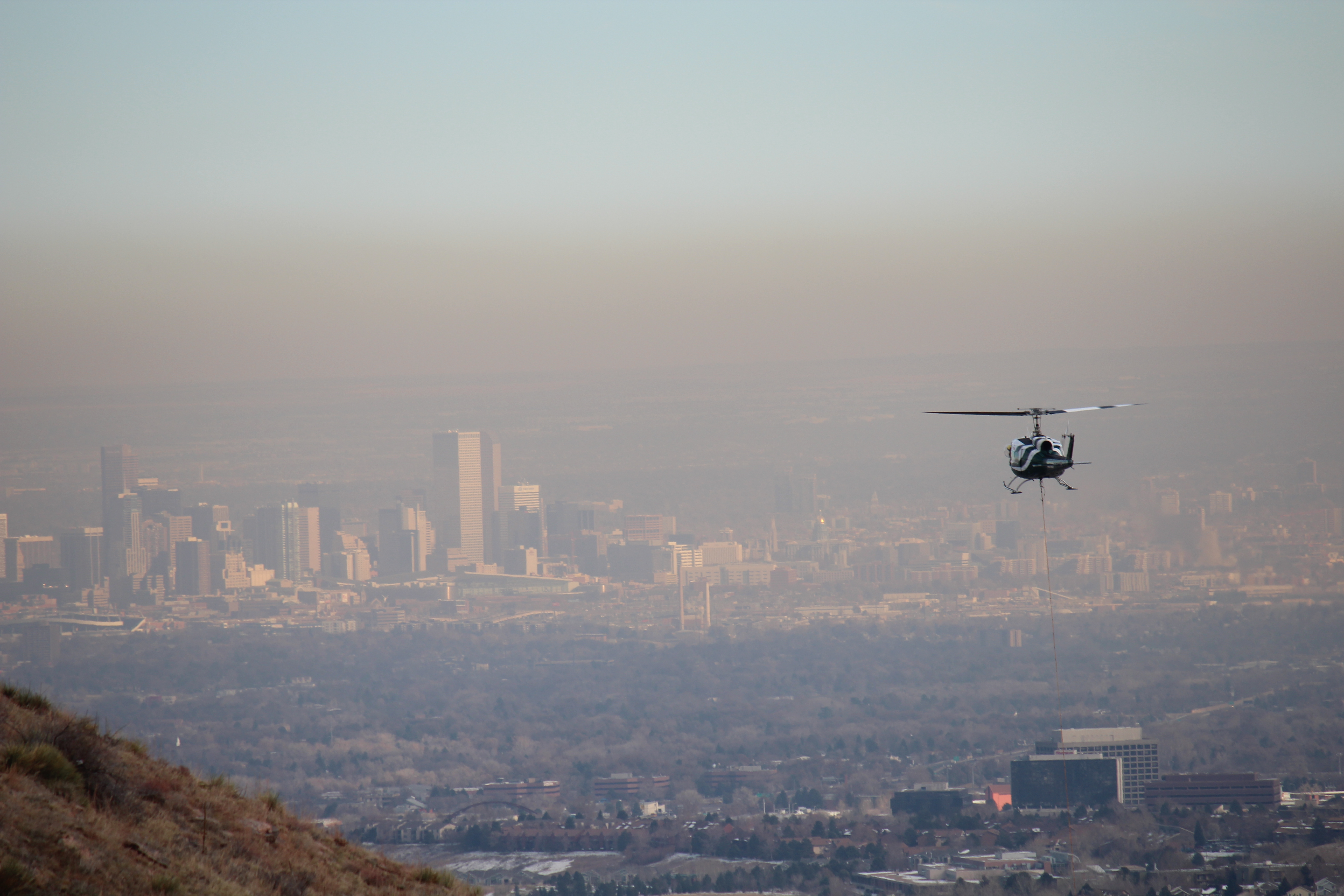
Immediately prior to opening, volunteers and Jeffco staff installed these bridges and abutments into the existing bench-cut trail, which were delivered by helicopter, in the lower section of the Apex Trail. You can see a unique chopper action cam shot of a truss being lifted to its final resting place, here.
From Jeffco Open Space, Tim Sandsmark, Lookout Region Supervisor:
“With the full reopening, odd-day directional travel by mountain bikers will be reinstated on Apex, Argos, and Enchanted Forest trails, as had been in effect prior to the flooding events. The flood event severely damaged 3.8 miles – roughly 40 percent – of the trails at Apex Park, which was one of two Jeffco Open Space Parks closed in its entirety. Using a phased approach to recovery, staff and volunteers repaired washed-out segments of the Apex, Pick ‘N Sledge, Sluicebox, Enchanted Forest, Hardscrabble, Grubstake, Bonanza, Poco Calle and Argos trails.”
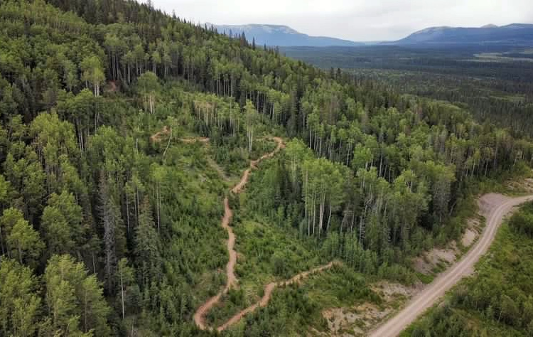
So, the real question that everyone now wants to know is: what is the trail like compared to what it used to be? Before I answer that, I want to set the stage for the reader who may be unfamiliar with this trail. Apex Park is basically a system that carves along the walls and the ridges of a valley, with trails that follow a small stream in the valley. All of this, amazingly, is between two residential systems in Golden, but you would hardly know it except by the amount of traffic this trail receives. It’s not uncommon to see deer, elk, and bear while riding… and there are plenty of other things watching you, like mountain lions, that you will never see.

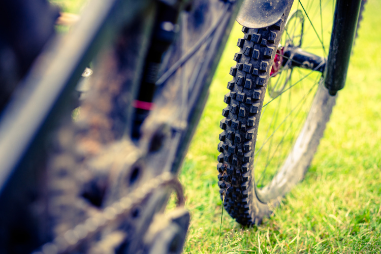
The trails that approach the summit of the ridge are hardpack singletrack interrupted by sections of really technical rocks. There is also a very popular section dubbed the Enchanted Forest, where Yeti does their lunch rides and tests bikes. The section that parallels the creek, the Lower Apex trail, or the “Apex gut,” is the section that was recently opened. It is a favorite among certain riders because after descending the rooty woodland part of the Enchanted Forest, the gut is full of ragged, edge-of-control gnar littered with rocks of varying sizes waiting to chew you up if you make a mistake.

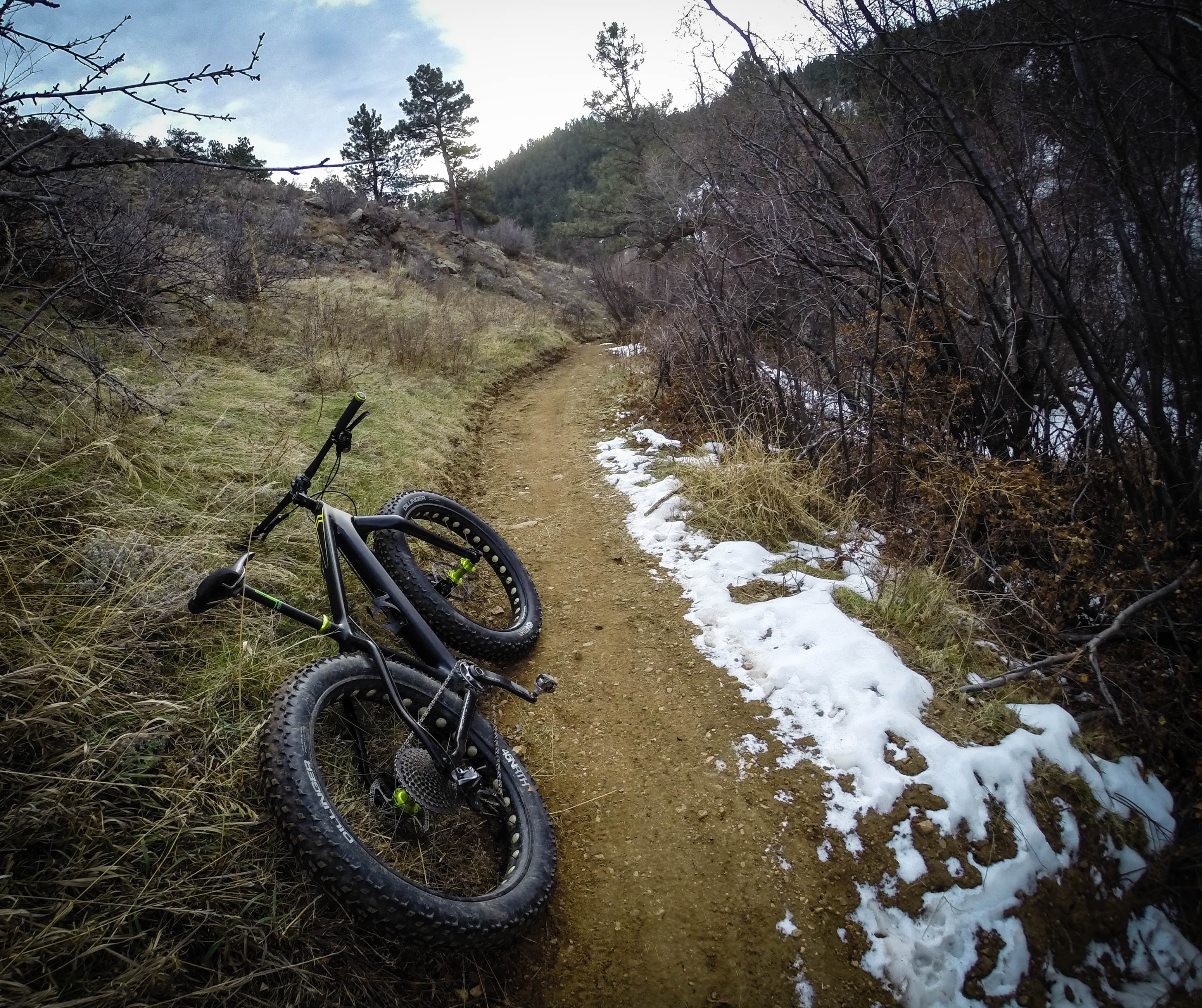
Many of the more aggressive riders were understandably apprehensive that this section of trail, with a high concentration of technical features, would be neutered. I was one of those riders. Because Apex is so popular, Jeffco Open Space instituted an odd-day rule (bikes can only go certain directions on odd days of the month) years ago to ensure that hikers had a fair chance of survival if they were hiking up Enchanted or Lower Apex–where some Stravaholes have been known to fly like a bat out of hell to the bottom throwing common trail etiquette to the wind. I chose to ride this trail the day after it opened, on an odd day, meaning that I climbed it with friends instead of being afforded the opportunity to see what the flow of the “gut” felt like. I elected to ride with my fatbike, as there was still a fair amount of packed snow on the ground, making what was already a difficult climb even more so.

I have to say, the three of us were a little disappointed initially. Sure, there were still lots of rocks waiting to destroy you on a warp-speed descent, but there seemed to be long sections of trail which were wide and buff, in places that were once harrowing. We joked that this section of trail should have been renamed “Dolphin Smooth” and pondered the ramifications of this new-found flow section in place of its former DH paradise. We surmised that it certainly gave the trail a different character, but that in some ways it made Lower Apex more dangerous: you could probably hit 30mph easily if you were hauling through the smooth sections, spelling disaster for hikers around blind corners, or riders not prepared for unseen rock gardens. We were eager, of course, to test the downhill quality of this trail, but adhered to the rules (as always–no one wants to give anyone a reason to shut this trail down to riders).
A few days later, on an even day, when mother nature did us a solid and melted most of the snow that blanketed the trail, I rode my regular counter-clockwise route up Argos to Pick n Sledge, up Apex, then rested before descending the Enchanted Forest and Lower Apex trail. I was ready to be disappointed, again, and tried to focus on the positive aspect: that this trail was just finally open. But to my surprise, the Lower Apex trail was a freaking blast. Those smooth sections of trail were still there, of course, but I rolled through them so fast they were practically unnoticeable, giving me a brief mental break to shift or prep for the next section of chunder. I will say this with no reservation: the Lower Apex trail is better now than it was before Sept 2013, and major kudos to those who worked tirelessly to make this trail easier to climb and more fun to descend. I honestly cannot believe how much fun it is now.

The moral of this story, folks, is that disaster can strike anywhere, including your favorite trail. I could write for hours about how you should enjoy your favorite trail while you still have it (and your health), or that every once in a while you should get off yer keister to volunteer to build/maintain trails… but that is a different story for a different day. So just know this: Apex is open, and it friggin’ rocks!


1 Comments
Dec 14, 2014