
“I won’t rest until [the Arizona Trail] is an 800-mile trail between Mexico and Utah,” said Matthew Nelson, Executive Director of the Arizona Trail Association (ATA). “So there’s about 80 miles right now that are co-located with dirt roads.”
That 80-mile number used to be much higher. Over the past 10 years, Nelson estimates that the ATA has completed about 40 miles of singletrack trail projects across the state. And they’re continuing to chip away at the remaining road mileage.
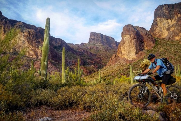
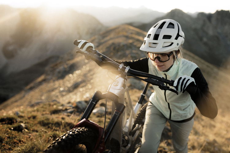
I recently rode a 37-mile segment of the Arizona Trail from Oak Tree Canyon to Casa Blanca Canyon near Sonoita and Patagonia, and I noticed several newly built sections of trail, as well as a reroute that appeared to be in progress. As I switched back and forth between singletrack and rough dirt roads, I realized that they were obviously rerouting the trail to be almost entirely singletrack, so I reached out to the ATA and Flagline Trails learn more.
A non-motorized national scenic trail
The AZT went from concept to completion in about 30 years. “Normally, a project like this would take much longer, 50 or 100 [years],” said Nelson. “But the good news is that when the vision of a cross-state trail was first dreamed up, early visionaries looked at existing trails that had a general north/south alignment through the most beautiful parts of the state, and then, where did dirt roads exist to link those bits of trail together? And then wherever there were gaps, that’s where the organization focused on trail construction.” The gaps were filled in 2011, creating a complete dirt pathway from Mexico to Utah.
While the entire pathway is dirt, the AZT has been designated as a non-motorized National Scenic Trail for hiking, mountain biking, and horseback riding. Nelson said repeatedly that the AZT “is incompatible with motorized uses,” so the current miles that are colocated on dirt roads are a big problem that the ATA is working to solve.
The increase in UTV traffic has galvanized reroutes around dirt roads
When these remote dirt road segments were originally used to connect the AZT 15 years ago, vehicle traffic was extremely rare — sometimes just a few times per year. But with the introduction of the side-by-side, that all changed.
“The increase in popularity of UTVs, so Razors or whatever you want to call them, has just gone nuts, especially since 2020,” said Nelson. “We see that there’s more motorized recreation happening, both here in southern Arizona and throughout the West, like exponentially, every year. So dirt roads that used to be kind of quiet, maybe only occasionally [used] by ranchers or hunters seasonally, are now [used] every single weekend — not an exaggeration, every single weekend throughout the year.”
Nelson called out specific dirt roads that the AZT follows that are choked with side-by-side traffic, going on to say that he’s “not opposed” to motorized recreation. “If they’re staying on the road, it’s all good. However, a National Scenic Trail where people are hiking, people are mountain biking, and people are horseback riding, that is incompatible with motorized uses. So we felt this increased responsibility to move projects like this forward, especially if there’s potential for motorized, non-motorized conflict.”
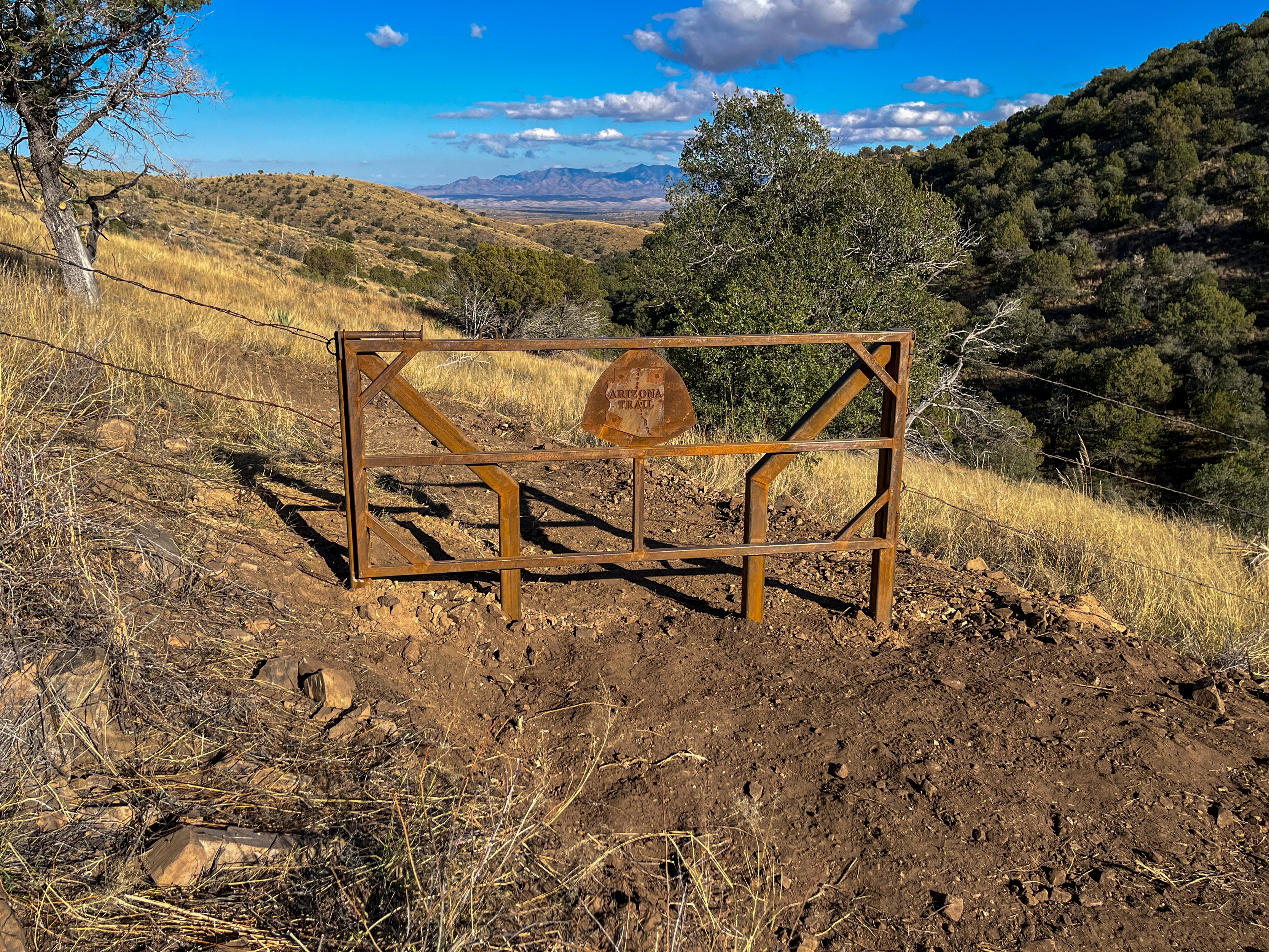
The Santa Rita Foothills Traverse is the AZT’s newest reroute
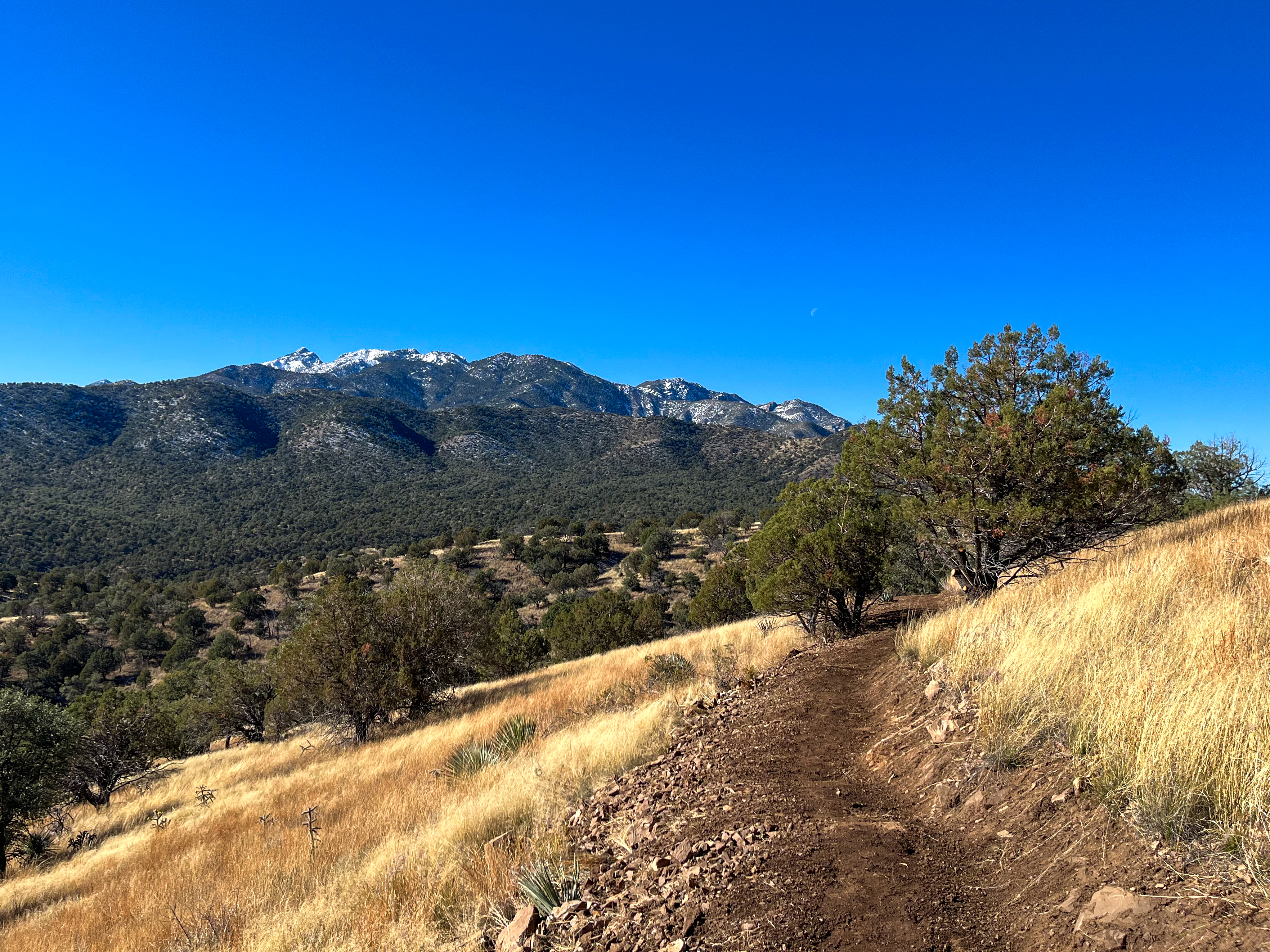
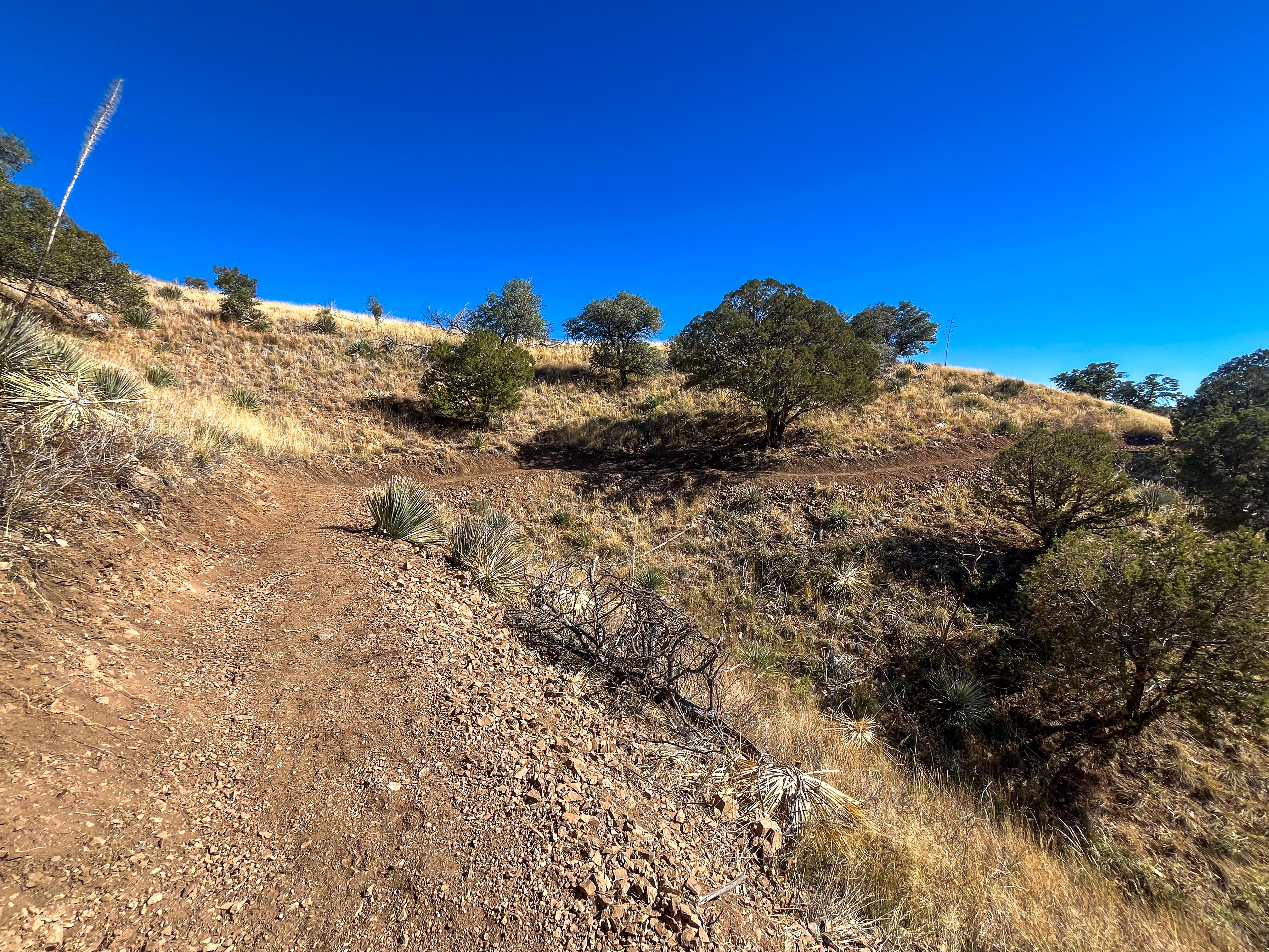
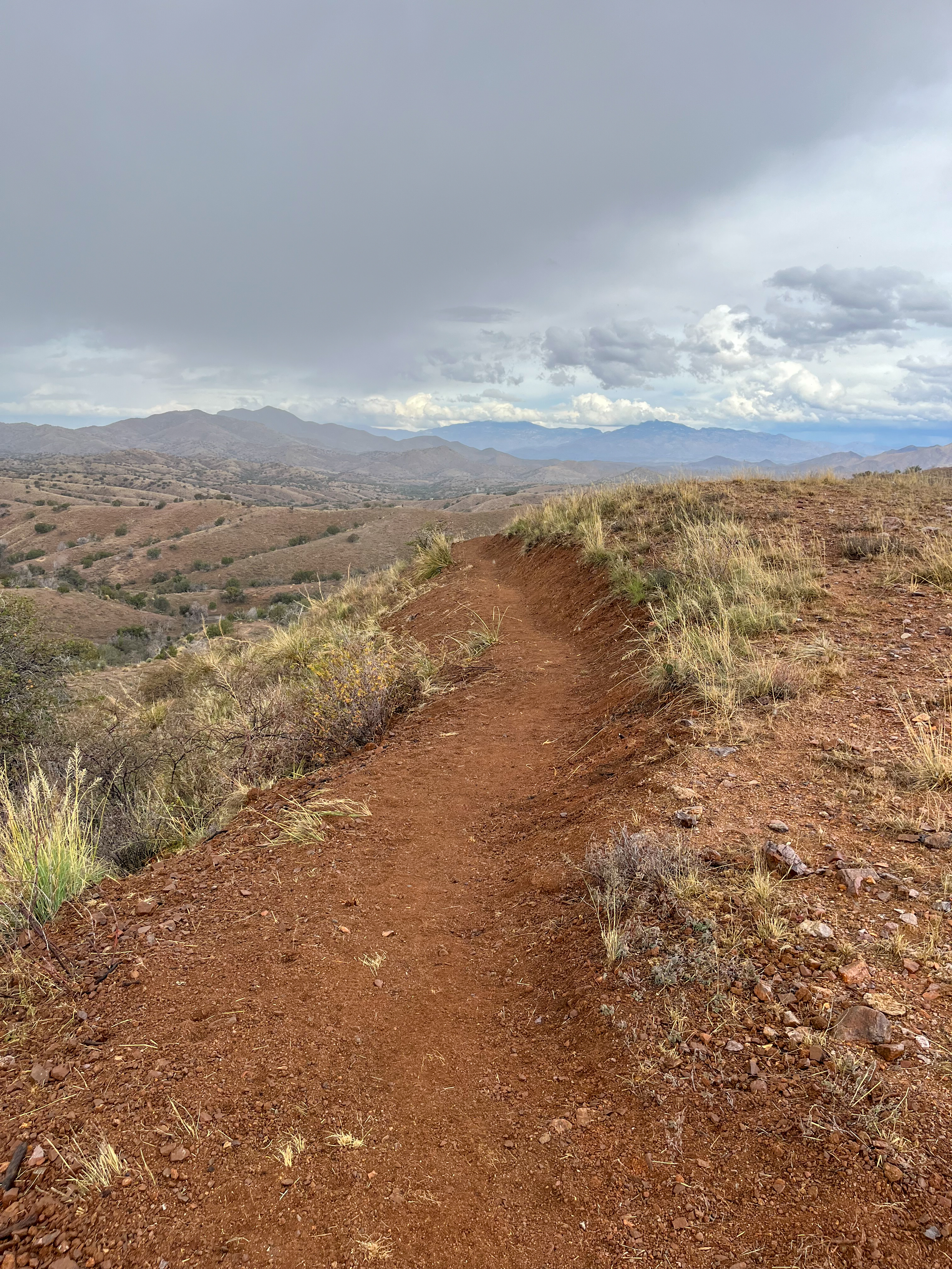
The 11-mile reroute currently in progress forms part of the “Santa Rita Foothills Traverse.” Here, a high elevation grassland with sporadic juniper trees and oaks rises up the flanks of the Santa Rita Mountains, high above the surrounding terrain. While even many Arizona locals consider southern Arizona near Tucson to be flat and low elevation, along the Santa Ritas the AZT runs at over 5,000 feet, giving riders expansive views of the grasslands below and Mount Wrightson towering above.
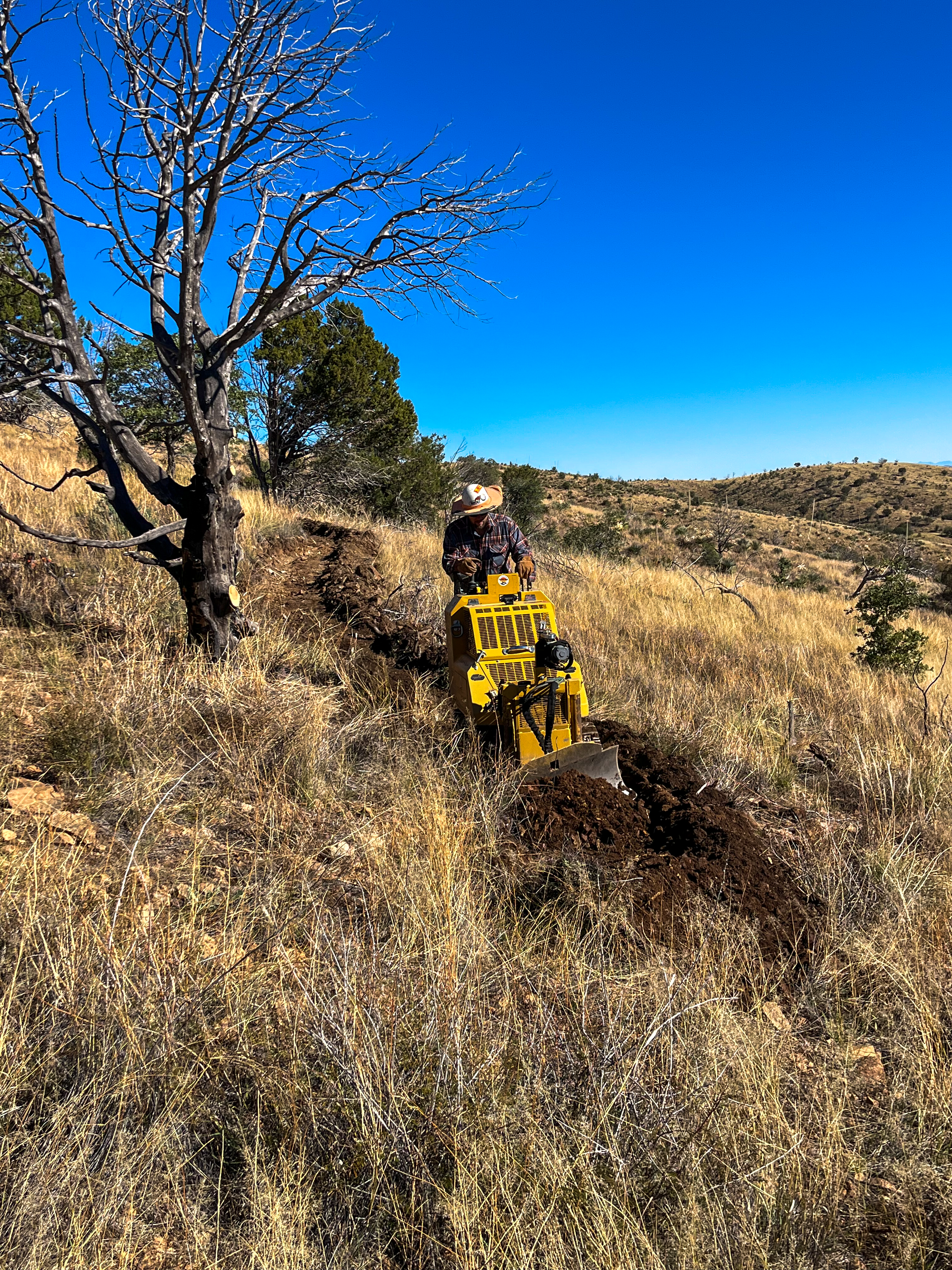
“The whole area is big fingers of land off these ridges, so it’s very in and out drainages,” said Matthew Roberts, Owner and Founder of Flagline Trails, the machine contractor working on the reroute.
The singletrack they’re building through this area will offer “a nice, sustainable 5% or thereabouts grade with the occasional punch, but very, very flowy with the natural landforms.” Flagline always tries to use a “light touch on the landscape [by] following the natural contours,” according to Roberts.
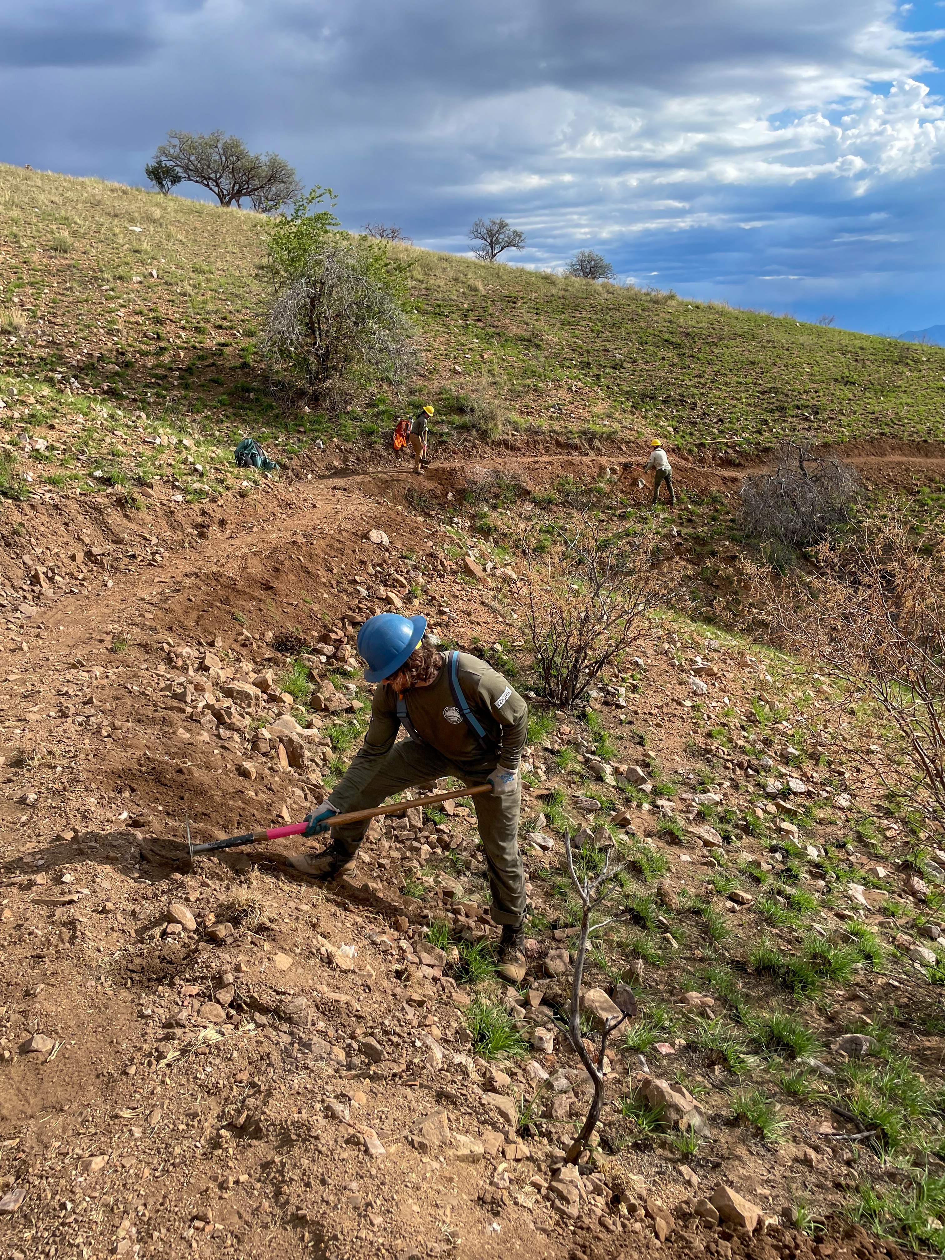
Flagline is doing the rough cut of the trail with a pair of different machines, and an Arizona Conservation Corps (ACC) ancestral lands crew is doing the hand finishing of the trail. This is a trail building strategy the ATA employs often, by using either the ACC or their 2,000 engaged volunteers for hand finishing. “The more people that get their hands dirty doing trail construction, the more likely they are to be stewards and protectors of the trail in the future,” said Nelson.
The current project has been underway since October 2025 and looks to wrap up in April 2026.
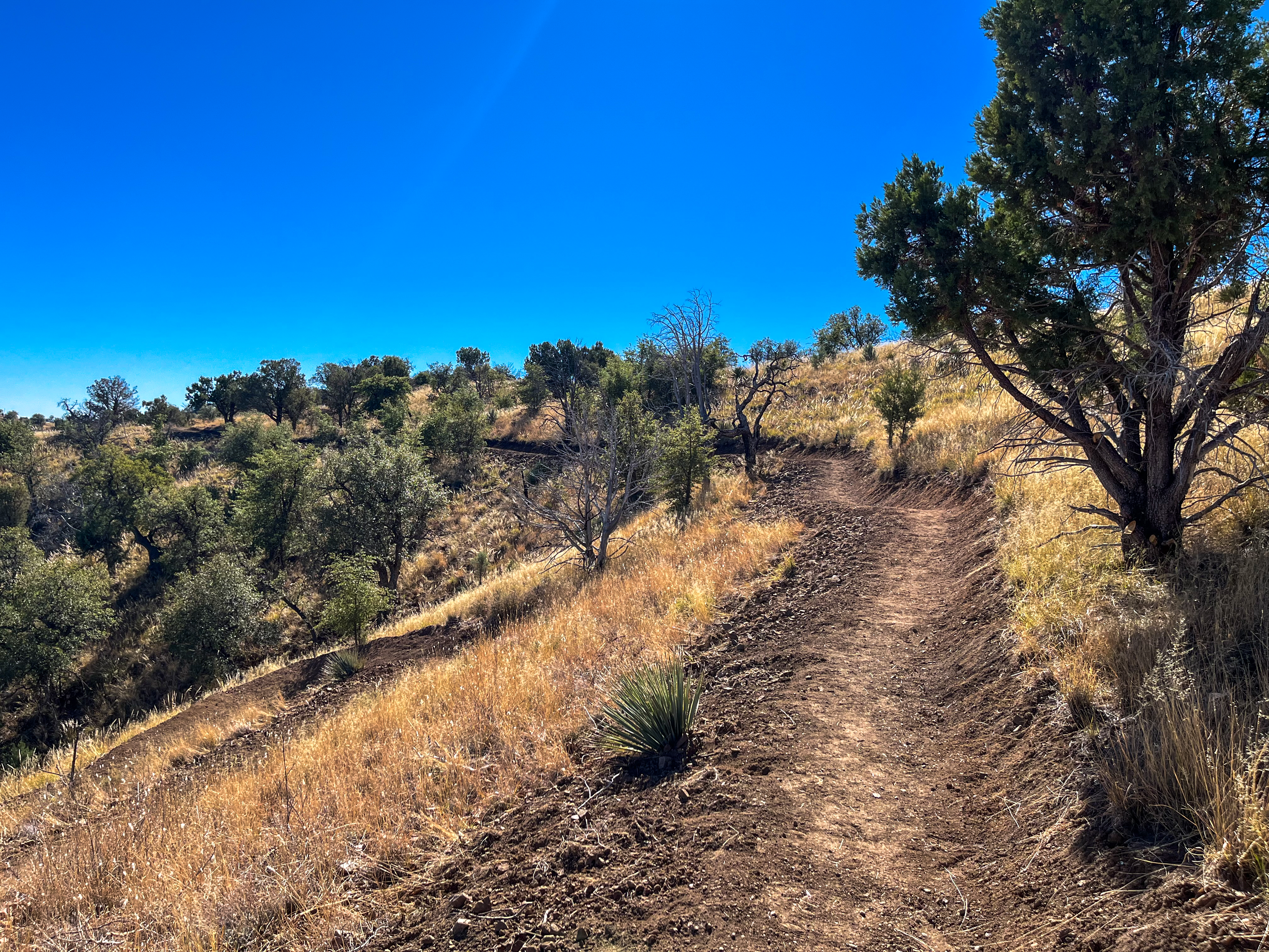
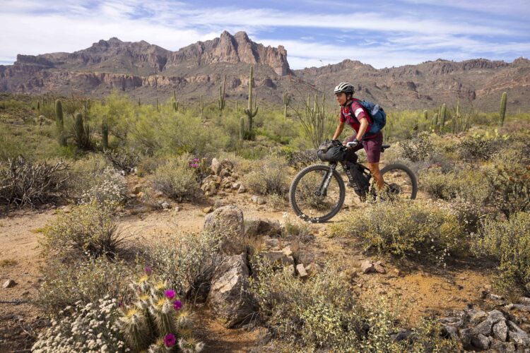
This 11-mile reroute connects to a massive 25-mile reroute through Casa Blanca Canyon that the ATA completed a couple of years ago, with Flagline doing roughly seven miles of the project. I also rode that section, and the swooping, flowing, sustainable singletrack was a kinesthetic joy to roll through. Compared to the dirt road sections I had previously endured, with steep uphill grinds and loose babyhead descents, the newly rerouted singletrack was bliss. Once the new Santa Rita Foothills Traverse is open to the public, this zone will be dramatically better than when I rode it!
Up next? Wilderness reroutes for mountain bikers.
“Honestly, one of the reasons I work for the Arizona Trail Association is because it’s all non-motorized users,” said Nelson. “If it was just a hiking path, I would not work here. If it was just hiking and equestrian, I probably wouldn’t be doing this. But because I’m a mountain biker, and have been ever since I was 12 years old — I’m 51 now.” Nelson went on to share that mountain biking has been important to the ATA since its inception in the late 80s and official foundation in 1994.
While there’s still 80-some miles of reroutes to go on the main trail, Nelson — who has been with the ATA for 15 years — already has his sights set on the next objective: one that will greatly benefit mountain bikers.
Currently, the AZT passes through eight designated Wilderness areas, which require mountain bikers to bypass around them. Some of these reroutes follow segments of singletrack, but inevitably riders end up on dirt roads, and sometimes pavement… and even the singletrack sections are of questionable quality.
“I want to build trail around those Wilderness areas,” Nelson stated emphatically. He’s planning this phase of development immediately after completing the 80 miles of missing singletrack. Once that’s done, he wants to dive headlong into the Wilderness reroutes.
“We love wilderness areas,” Nelson clarified. “The level of protection is amazing. The protection of species, natural quiet, that’s essential. I don’t want to mess with that, but what I do want to do is to have an 800-mile trail for people to ride, and so we will begin to design and then hopefully get approval to construct singletrack around these eight wilderness areas. That is hundreds of miles, because some of these wilderness areas are immense.”
“We will have a massive job ahead of us to design and construct new trail, but that’s my vision for the Arizona National Scenic Trail,” Nelson concluded, noting that the board and the rest of the staff is 100% on board with that vision.
Who knows how many decades it will take to complete this 800-mile continuous singletrack mountain bike trail? The vision is grandiose and daunting, but with dedicated, inspiring leaders like Nelson driving the process, anything is possible.
Know about a new trail project we should cover? Whether you’re breaking ground on the next must-ride destination or putting the finishing touches on a neighborhood flow trail, we want to hear about it. Drop us a line at [email protected] with high-quality photos of your build, plus details like trail mileage, location, difficulty, and what makes it special. We’re always on the hunt for the next great trail story, and there’s a good chance your project could be featured in an upcoming article.
3 Comments
Feb 19, 2026
Feb 19, 2026
Feb 19, 2026