
While I love to travel and go ride far-away places, I also love to explore in my own backyard. It never ceases to amaze me just how much great riding there is within a few hours’ drive, and I haven’t even scratched the surface yet!

A couple weeks ago, my husband and I took a much-needed “staycation” for a few days and vowed to ride somewhere that was new to both of us each day. One of those locations ended up being Yellow Creek State Park, which boasts a 20-mile singletrack loop that circumnavigates Yellow Creek Lake, the 720-acre centerpiece of the park. Yellow Creek is just outside of Indiana, PA, a little over an hour east of Pittsburgh and about an hour and a half west of State College.
The mountain bike trails at Yellow Creek were built by the Laurel Highlands On and Off Road Bicycling Association (LHORBA), in conjunction with the Friends of Yellow Creek and with the cooperation of the Pennsylvania Department of Conservation and Natural Resources, who oversee all the State Parks. Trail construction began in 2004, and there are still plans to add some sections of trail, as well as better signage. The trails are currently maintained by LHORBA and the Friends of Yellow Creek.
After doing the entire loop around the lake, I have to say I highly recommend it, but if you’re not up for 20 miles or only have a limited amount of time, there are also plenty of great out-and-back rides you could do.
To do the entire loop, you can start at any of the parking and day use areas, but we began our ride on the South Shore. There is ample parking and restrooms, so it’s an ideal spot. There’s also a swimming area and boat rental for post-ride activities on a warm day. The recommended ride direction is clockwise around the lake, so that’s what we did. This map is available at the park office, or you can print one out before you go.

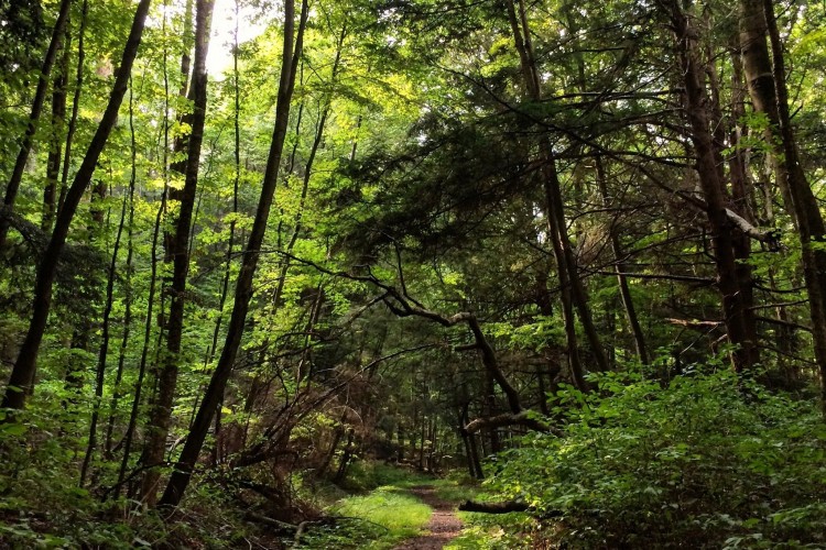
From the South Shore Area, the ride begins on Simpson Trail, which starts out grassy, marshy, and a little bit thorny. For the first mile of the ride I was slightly skeptical, but then it got much better. The trail soon winds into the pines, and it becomes a lot drier, fast, fun, and flowy. This section is mostly pretty smooth, with some roots here and there. There isn’t a ton of elevation gain, but that changes once you get farther towards the western shore of the lake and the spillway.
We found that most of the loop around the lake is very well-labeled with white plastic signs with red arrows, courtesy of RideYC, who puts on a grassroots race series at the park each year.


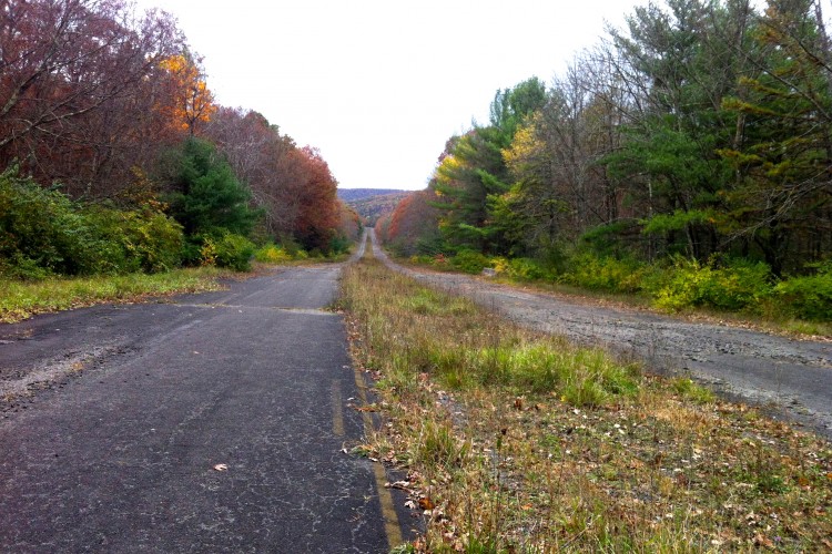
On Damsite Trail, the terrain becomes steeper as the trail dives into tiny valleys formed by tributaries of Yellow Creek, and then ascends back up the hillsides. The climbs aren’t long, but they sure are lung-busting. After a descent down to the spillway, the trail heads left, and appears to go straight into the stream which, when we were there in mid-April, appeared to be fairly deep and fast-moving. Evan and I looked at each other for a moment, slightly bewildered. I had read in my small amount of research about the trails that there was a stream crossing that would result in “wet feet,” but looking at the rushing water, that seemed like a pretty big understatement.
We were determined to finish the loop, though, so after briefly checking downstream to see if there was a better spot to cross and finding nothing, we ventured into the water. It came up to my upper thighs, and I’d be lying if I said that I wasn’t nervous. But we made it across, and luckily it was a warm and sunny day, so things dried off quickly. I talked to some locals later and they said that during spring the water tends to be higher, but in the summer it’s lower and much more manageable.

On the other side of the spillway, after you cross the dam, it’s a little difficult to find the trail again. At first we took the first right after the dam, which appeared to be a trail, but it petered out after a couple hundred feet. The actual trail begins farther up the gravel road, off on the left after passing the entrance to another gravel road (also on the left). This section of trail continues to have a lot of short climbs and starts to get a little more rocky, but still retains the flowy vibe prevalent throughout the loop. The trail passes through a Boy Scout camp, then soon after, a few houses become visible, and it crosses a paved road. This paved road (Ray Road) is the access to the McFeaters Cove Overnight Area, which is the home of the six cottages and four yurts available for rent at the park.
On the northern end of the lake, the trail weaves through and over boulders, and there are a ton of really fun rock lines to try.


After the rocky section, you’ll need to ride on Route 422 for about half a mile, then make a right onto Route 259, and the trail will pick up on the left. It climbs and descends a small hillside a number of times before dropping back down to Rt. 259 again and then continuing on the other side of the road for the final stretch. The last mile meanders along a stream and then pops out back at the South Shore Day Use Area.
After our ride, we were hungry and a couple hours from home, so we ventured into downtown Indiana to find a bite and brew. We ended up at Fire House Brewing Company, which served a variety of craft beer, included a few of their own, and some great burgers. It was definitely a great spot to stop post-ride.
If you’re in the area for more than a day and want to get some more riding in at other nearby locations, check out Roaring Run, Laurel Mountain, and Blue Knob State Park, all within about an hour of Yellow Creek. Venture farther east or west and you could hit up my home trails in Central PA, or some excellent riding opportunities in Pittsburgh.
Also check out the LHORBA website for more information about riding in the area.


2 Comments
May 5, 2016
May 6, 2016