From the triangle, ride in Victoria Lake Road. Cross the the cattle guard and after a tenth of a mile, look for a jeep road on the right. About 20 yards in there is a large rock placed to block vehicle access.
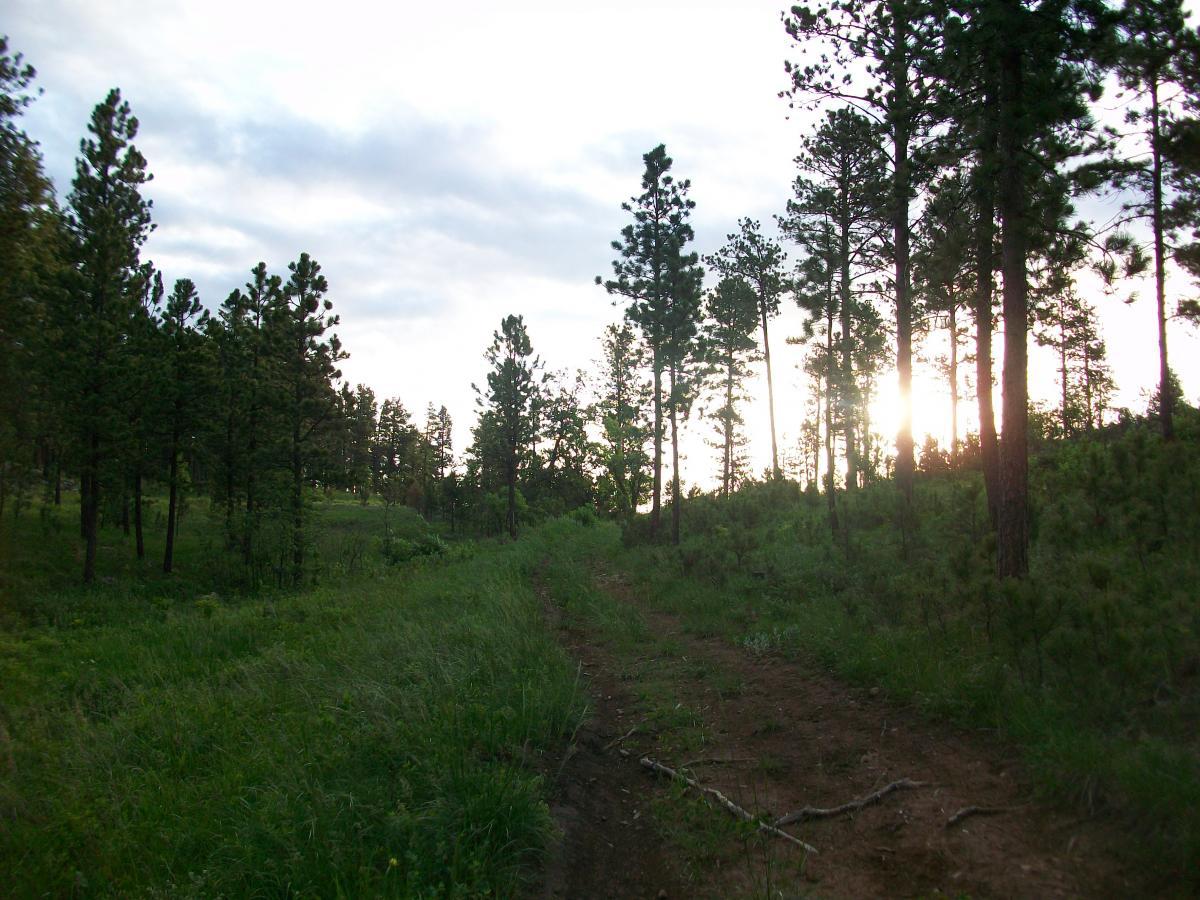
From here the trail is fairly well defined, and there are signs as needed. Initially arrows on small, white signs, and later orange paint on trees, then back to the signs.
There are a couple of navigational gotchas:
First, at 5.8 miles, immediately after crossing a creek bed on a short section of jeep road, look to the right. The trail goes back to singletrack here and the sign for the turn is easy to miss.
Second, you will come to a well defined jeep road (the same road you left after the creek bed) and it will be unclear which way to go. Go right for a short distance and look for the orange paint on several trees on the left side of the road. Continue the singletrack here.
Heading on, the trail continues to be well defined, and most of the intersections are marked with orange paint, cairns, or signs. There are a couple of singletrack intersections that are not marked, but either go straight, or take the one that is obviously more traveled. It's easy to get a little lost, even using the printed directions from the local club's website, so it is HIGHLY recommend to download the GPX file from here and load it into a smartphone or GPS device.
The trail itself is a solid intermediate ride with lots of rocks, both loose and embedded. There are some small ledges and a handful of mild switchbacks. The few technical features are well marked, giving riders enough time to either dismount and check them out, or let out a WHOOP and drop in. 100% of this trail is ridable, including the tech features once you scope out your line.
The terrain is rolling with short, fairly steep descents immediately followed by quick, punchy climbs. The scenery is amazing as you traverse deep forest, hillside meadows, and the tops of several cliffs. There are lots of sharp rocks, so tubeless tires are ideal. With tubes, run slightly higher pressure to help avoid pinch flats.
There is cell service only on the ridgetops, and there is not much traffic, so keep that in mind if riding it alone. Also, there is poison ivy everywhere.
The trail is a 'lollypop' with a very short stem consisting of the doubletrack just off of Victoria Lake Road, as well as the short section of road leading back to the parking area.


 1
1
Not a fan for what I prefer. Its almost all rock garden including the numerous climbs. Its not crazy tech, but there is no flow whatsoever. No signage or facilities. I love the surrounding scenery, but that's the only reason I didn't go 1 star.
| ThankNot a fan for what I prefer. Its almost all rock garden including the numerous climbs. Its not crazy tech, but there is no flow whatsoever. No signage or facilities. I love the surrounding scenery, but that's the only reason I didn't go 1 star.
| ThankOld school MTB trail...rocky challenging ascents and fast technical descents. Incredible views from the rim of the cliff line. We did run into a huge logging operation at mile 6.5, which has completely obliterated the remainder of the loop. We had to double back
| ThankOld school MTB trail...rocky challenging ascents and fast technical descents. Incredible views from the rim of the cliff line. We did run into a huge logging operation at mile 6.5, which has completely obliterated the remainder of the loop. We had to double back
| ThankWhat a great trail! Some punchy climbs with some sweet descents afterwards. One felt like it would never end!
| ThankI rode it counterclockwise like Islandcrow suggested, it was definitely fun that way.
I'll second the "bring a map" suggestion. I took two wrong turns and ended up adding about eight miles to the ride. Not exactly a bad thing, unless you're a bit pressed for time like I was.
A definite must ride!
What a great trail! Some punchy climbs with some sweet descents afterwards. One felt like it would never end!
| ThankI rode it counterclockwise like Islandcrow suggested, it was definitely fun that way.
I'll second the "bring a map" suggestion. I took two wrong turns and ended up adding about eight miles to the ride. Not exactly a bad thing, unless you're a bit pressed for time like I was.
A definite must ride!
One of my favorite trails in the hills! Although there are a few sections that will bite you if you don't know what you're doing, overall, the trail isn't too technical. What it does have is some brutal climbs rewarded by some nice, flowy downhill. Counterclockwise is the accepted flow, though it doesn't get a ton of traffic, so you could probably get away with riding opposite direction during the week. If possible, bring a good map and a GPS or better yet someone who knows the trail, because although most of it is pretty straightforward, it's not very well marked, and there are a few places where you can get turned around or just plain lose the trail. Oh, and bring an extra tube (or two), even if you're running tubeless. The rocks are sharp, and if you're careless like me, this trail will eat a sidewall for breakfast.
| ThankThis is one of the best trails I have ever ridden, including all my riding in Colorado and Utah. It has stunning scenery, epic singletrack, several technical features to entertain the expert riders, and overall is a fairly challenging ride with enough short, steep climbs to keep your heart pumping, and small, angular rocks strewn everywhere to keep you on your toes. Also, leave those ultra-wide handlebars at home, they won't help here due to some narrow tree gaps.
| ThankI rode it on a weekday morning and saw zero other riders. The wind in the pines and the occasional birds were the only sounds, in addition to my labored breathing, of course. :D
If you are in the Black Hills for any reason, make a point of hitting this ride. If you have time for only one ride, like I did, then this is an excellent choice due to proximity to town, awesome riding, length, and of course, the scenery.