95% downhill, flowy, rugged, very dusty when dry. Good signage along the first half of the trail. Latter half you'll just turn on whatever trail points you most downhill. You'll eventually be dumped out onto highway where you cross and follow the singletrack that parallels the highway all the way back to Rhododendron.


 5
5

As other reviewers have mentioned take the $2 shuttle up to the lodge. The trail starts just up the road. It is well laid out with many nice bermed turns. There are also some small alternative jump lines along the way. It gets heavy usage and is a bit dusty when its dry. Fun downhill run in a great area.
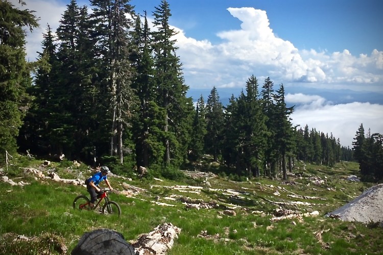
| ThankA wonderful flowy ride from the Timberline Resort Car Park through unspoiled forest on the side of Mt.Hood down into Government Camp with an easy extension all the way to Rhododendron. One of the most amazingly well built MTB trail packages I've ever experienced. 14 miles of downhill single track with an easy super cheap shuttle service. Perfect once the snow melts in spring and before it starts in fall, can get blown out to mood dust in the summer months.
| ThankVery entertaining downhill run that is mostly high on flow and low on tech. You get 4,400 ft of descending for only 200 feet of climbing. Over that drop, there is nice variety in both the trail surface and the surrounding environment. The bust to the top is just $2, making for an excellent entertainment value!
| ThankTrail (#756) begins just off the Timberline Lodge parking area. The fun begins immediately and doesn't end until you ride off the trail. 5.5 miles in you come to a major, well marked, intersection of several trails. You can ride Crosstown Trail (#755) east to Government Camp or swing west (right) and hit a section that will make an old man feel like he's in love again. Crosstown Trail ties into Pioneer Bridle Trail for extended trip through the woods along Highway 26 (you cross it once). The final 3 miles is a drag strip, where you fly through the woods. Trail ends at Tollgate CG; a half mile from the bus stop at Rhododendron. Use the bus (Mt.Hood Express.com for schedule). It is convenient and they pull a bike trailer..... Best $2 I've ever spent. My only question is "why haven't I ridden here before."
| ThankVery fun downhill you can shuttle on the Mt Hood Express public transit. $2 gets you from Rhododendron to the Timberline Lodge on Mt. Hood. First third is tight and twisty. You can bail about halfway down at Government Camp and catch the bus back up for a half lap or keep bombing through deciduous forest along the Mt Hood corridor. After the Govy Camp section, you'll come out to the highway where you cross and coast down a singletrack paralleling the highway all the way back to your car. 16 miles of DH!
| Thank