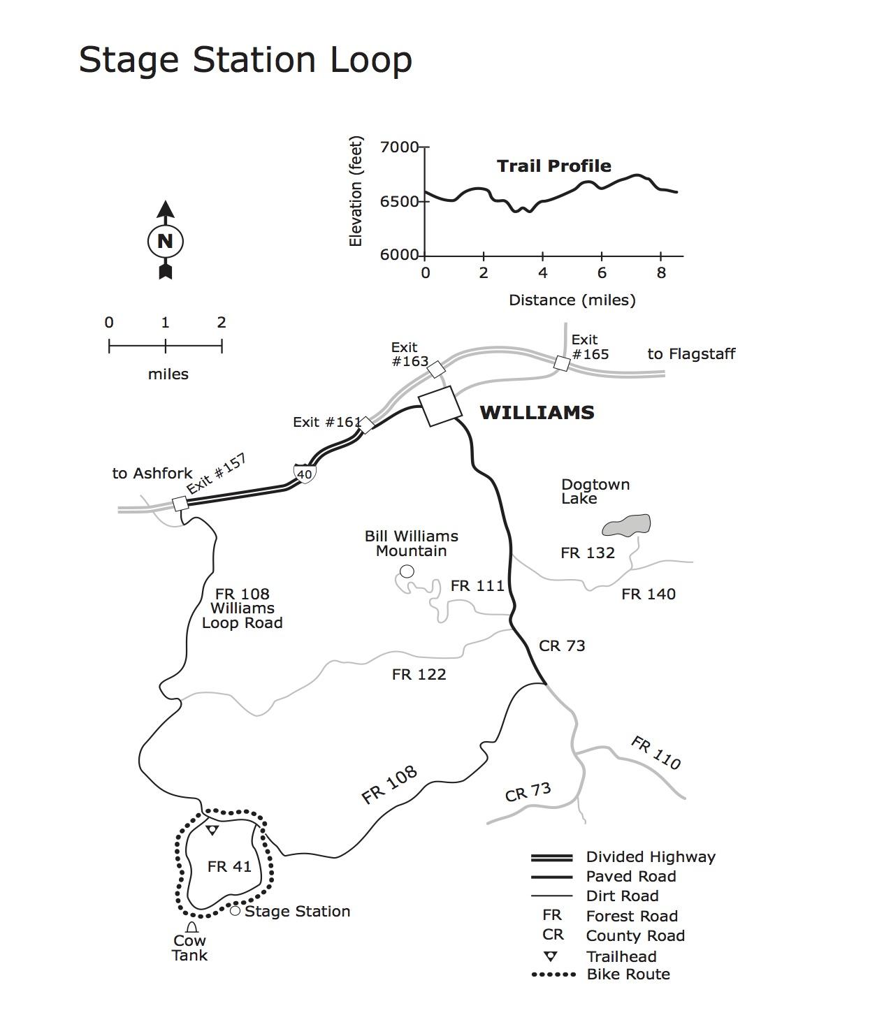
This is a pleasant ride over rolling terrain along a primitive road that winds through ponderosa pine forests, pinyon and juniper stands and open grasslands. The scenery consists of forest and meadows. The wide variety of habitats along the route supports a diverse community of wildlife such as elk, mule deer, coyotes and goshawks. Wildflowers are plentiful in the spring and summer in the meadows along the road.
The remains of an old cabin are visible on the right side of the road about half way through the ride. A few of the timbers remain from this turn-of-the-century structure that marked a water and rest stop along an old stage route between Williams and Prescott. Here, you might imagine that weary travelers stopped for a change of horses and rest.
The Stage Station Loop has its ups and downs but they're all of moderate length and gradient. The ups are just long enough to get the heart pumping and the downs are just steep enough to add a little zest to the ride. The road surface is mostly smooth with only a few rocky places to bounce over.
You can ride this loop in either direction, clockwise or counter-clockwise. We recommend that you ride it counter-clockwise. That way, the last 1.2 miles of the ride, along heavily traveled FR 108, is downhill and over in the shortest amount of time possible. source: fs.usda.gov
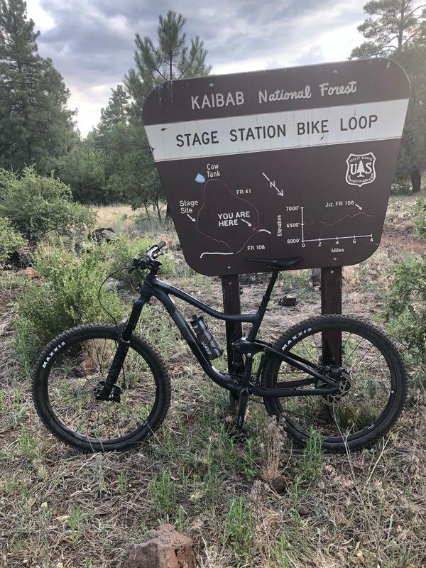

Fun little ride. I rode it clockwise. On your way down to stage site, it's rocky. The trail is mostly old Jeep trails and then you get back onto forest roads. Saw some deer. Pretty isolated area. I wouldn't say it's smooth, there is a little elevation and as mentioned before some rocky areas, it's a little less than intermediate.
| Thank