From the trailhead at the top of the Smith Creek drainage, take a good long look downstream at your hike-a-bike future. If you are still inclined to surf the pum down into Smith Creek (and then pedal back out), go back to your car and load up on more energy bars, warm clothes, and a flashlight for good measure (even though you're making a decision that doesn't make much good sense). With a few more racks of fig bars in tow, start down Smith Creek Trail 225 on an easy traverse that belies the radical drop-off that lurks around the first corner.
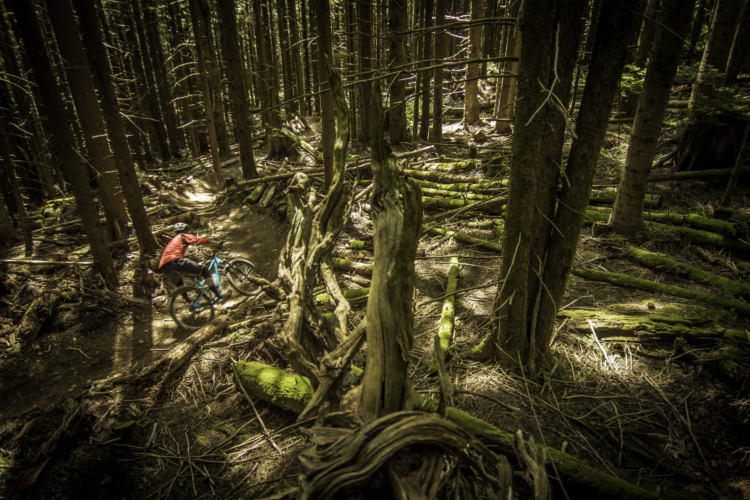
Serious pum surfing and switchbacking hike-a-bike begin as the trail careens down the wide ridge toward the creek. In some sections the trail is distinct, compact, and ridable; in others, no trail seems to exist as wands and red f**ing guide you through dense shrubbery and across washouts. Near the valley floor on a long, westward traverse, the trail becomes even more difficult to follow despite the f**ing. Stick with it and you will eventually find wood posts that mark the route across the small middle fork of Smith Creek, 3.6 miles.
Across the creek, find the faint trail and bear left, riding down the long rise between the two forks of Smith Creek. Use the tall wood posts to follow the trail, which is sometimes obvious and fast, other times difficult to follow and slow. At 5.1 miles, the trail abandons the rise between forks, bearing right and crossing Smith Creek's west fork.
WHOA! From here the trail is again difficult to follow. Across the creek, bear left and hike-a-bike south. With luck you will soon find the trail. At 6.3 miles, the trail crosses Ape Canyon Creek. Watch the route carefully: It is crucial to cross at the correct spot so you can find the trail that heads away from the creek, climbing. Hike-a-bike to the 6.7-mile point.
From here, the trail opens up and becomes considerably more ridable. At around 8 miles the trail again climbs away from Smith Creek. At 8.4 miles, the trail widens to become an old road. Follow the road down, ignoring both a spur road and then Trail 184, both on the right. Continue down the road to the creek that flows out of Lava Canyon. Only half the bridge remains - a washout - requiring a dangerous ford. From the opposite side, ride down the road, FR 8322, passing a gravel parking area and a lesser spur road on the right.
At 9.7 miles, the low point of the ride, FR 8322 bears right and begins climbing out of the Smith Creek valley. The road heads up at a steady climb. Pass a spur road on the left at 10.3 miles. At 13.6 miles, ignore a spur back to the left. When you reach a T at 13.9 miles, turn right. At 14.4 miles, reach another T - turn right on paved FR 83. The paved road drops, crosses the appropriately named Muddy River, and ends at Ape Canyon Trailhead.
From the trailhead, pedal up Ape Canyon Trail 234, tracing the east edge of**igantic mudflow. After some relatively easy twists and turns, the trail enters a forest of big trees and mounts a ridge that - amazingly - escaped much of the St. Helens eruption unscathed. The trail, steep and unrelenting though smooth and ridable, switchbacks up the ridge through a seemingly normal forest. However, occasional views off the ridge of trees strewn like matchsticks and huge, gray mudflows prove how anomalous this small patch of forest is so close to Mount St. Helens.
By the 19-mile mark, most of the difficult climbing is over. At 19.6 miles, stop to appreciate the haunting views of the mountain above and Ape Canyon below. Reach a fork, 20.1 miles, and bear right. Soon after, the trail bends north and enters the Plains of Abraham, a gigantic pumice shoulder on the east side of Mount St. Helens, which is peppered with black rocks that seem to float in the pumice like miniature icebergs. The trail across the Plains of Abe is fun and quick with some ups and downs; watch out for other trail users and yield to them all. At 21.9 miles, the trail forks: Go right.
The trail traverses, winding in and out of several drainages before emerging at the top of a knife-edged ridge, 23.2 miles. The trail mimics the top of the ridge as it heads down. You will need to carry your bike down several sets of stairs that begin at 23.5 miles. After negotiating the stairs, continue down the ridge top. At 24 miles, reach a dirt road and turn right. Climb up this gated dirt road toward Windy Ridge Viewpoint. At 25.8 miles, arrive at the viewpoint parking area. Bear to the right on the paved road, FR 99, and continue the ascent back up to Smith Creek trailhead on the right, 27.4 miles, to complete the loop. (Taken from NWsource)
FR 99 IS CLOSED AT THE BEAR MEADOWS VIEWPOINT, SO BE PREPARED TO ADD 22 MILES TO YOUR LOOP. We had to do quite a bit more hike a bike then what is written in the trail description due to the loose nature of pumice but, there was plenty of great singletrack and the views are simply amazing.


 8
8
This is a loop everyone should do at least once. Don't start at Windy Ridge as described though, either park at the bottom or at Ape Canyon. Pum surfing takes some getting used to, and yes there is some navigational challenges, but it's so worth it for the volcano experience.
| Thank