×

|
Rate it:
Tags:
Level: Intermediate
Length: 17 mi (27.4 km)
Surface: Other
Configuration: Loop
Elevation: +1,115/ -816 ft
Total: 36 riders
Mountain Biking Sisar Canyon / White Ledge
#421 of 1,005 mountain bike trails in California
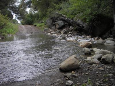
This trail is a mixture of single track and fire road. It is intermediate technically and intermediate to advanced aerobically. This trail can be combined with others to form so long painful and punishing rides. The trail starts off climbing up the fire road with a couple of creek crossing before abruptly leaving the canyon and exposing you to the full sun. Stay on this road for about 8 miles until you intesect with road 5N08. Turn right on 5NO8 and climb some more short ups and downs for about 2 miles until you find the marked trail 21WO8. Turn onto this single track and begin your descent. There are some fun opportunities for jumps and tricks. Be careful though because there are some sharp switchbacks. Head down into the White Ledge backpacking camp and look for the trail to continue on the right. Flow through the rock gardens until it spits you back out on Sisar Canyon fire road and head the three miles back down to your car on the gravelly fire road.
First added by gab26 on Apr 3, 2006. Last updated Apr 30, 2020. → add an update
Before you go
- Drinking water: unknown
- Lift service: unknown
- Night riding: unknown
- Pump track: unknown
- Restrooms: unknown
- Fat bike grooming: unknown
- E-bikes allowed: unknown
- Fee required: unknown
This trail information is user-generated. Help improve this information by suggesting a correction.
From Highway 126 take the 10th Street/Highway 150 exit and travel northwest 9.1 miles. Turn right on Sisar Road. Or, take Highway 33 through downtown Ojai and up the hill into upper Ojai. Just past Summit Elementary School on the left is Sisar Road. On Sisar Road go about .6 miles to some parking next to some water tanks. Another option is to drive 0.4 miles up the dirt road where there are a couple of more parking spaces right next to the gate for the trailhead.


Loading reviews...View more