As far as trails go, it's got a mix of beginner to intermediate. There are stretches of flat area, with some technical parts of roots and bends and small dives. Then there are some parts with steeper declines that, in the summer especially, you have to make it over flooded areas on wood bridges that can be sometimes tricky to get on to, depending on what roots or rocks the most recent rains have uncovered at the bridge lips.
There are technically two trails of note for mountain bikers looking for a little technical fun, and then there's a connecting third that's longer but flat and really is a good trek if you want to see some of the Central Florida environment and wildlife, but it's for hiking mostly, and not technical at all really.The two trails for MTB are both to the left when you're entering through the main entrance by way of the school.
The first and more technical and long of the two trails is the first one off to the left when entering by way of the middle school. This trail will take you through the woods and up and down a bit, over a few bridges. It eventually opens up into a wood flat area where local bikers have attempted to put different features like ramps and drops and tabletops. Not the best in the world, but it's local and cared for, so I won't bash it, I love it. Anyway, you can continue on past the flat area till you get to a clearing where there's an overpass. The overpass is a major highway, so you'll go under it, on a small but fun kind of a skinny where if you aren't paying attention you can end up in the creek. You can opt not to follow the skinny and just ride the concrete bumps made as a part of the overpass construction, but the skinny pass is more fun.
After you make it past the overpass, you're going to find yourself in what is a large easement to a local neighborhood, used for creek maintenance and water management. You'll bike past a few backyards on the easement before finding yourself back in the woods on another singletrack. It's a cute little push, that with enough imagination you can make fun with. It will take you over one last wooden bridge, that sits atop a 5 foot (ish) drop to a running creek, and into another clearing with another overpass, this time for a more local road. But you'll bike under it as well, until you get to the picnic table.
Now, here you have some options. Most local bikers stop here and then double back to the trail head, seeing the features from the other side, which really does make it feel entirely different. Others, will actually follow a simple path onto the local road where you can easily peddle some local sidewalks back to the trail head by way of the middle school. Or, you can continue on through a path known as the Rabbit Trail. During the summer though, it's usually pretty muddy, so it's not a well worn path by bikers. Usually just hikers, kind of spooky to.
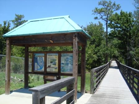
So, that's trail number one. The second trail by way of the entrance from the middle school, is all the way down the boardwalk / bridge, you'll go down some stairs to the right, but you'll immediately turn to your left. That's the start of the second trail. This trail doesn't have any major milestones, per say. Itcan get technical with some batches of tricky roots, and a few ups and downs, nothing heinous. You'll go over two wooden bridges on your way to the end of the trail where there's a small loop you can go around to double back down the trail.
Honestly, it's a good work out, and like any local trail when you know the ins and outs you make the best of the things most others don't notice, like roots to pop up off, or banks to dive down, etc.
That's it, Shingle Creek, simple, local and loved.

I love this trail. It's my local trail and I added it to Singletracks, so, I'm biased.
Here's my most unbiased review. Shingle Creek trail isn't paid for, no one gets money to manage it. It's mainly a hiking trail that bikers have built on and around. We're in Central Florida so there aren't any elevation changes to speak of.
The Shingle Creek trails are the best of what we can get, especially locally. To be harsh on it would be unfair. If you go into it knowing what to expect, you don't judge it against more professional or pay to enter locations.
I love it, and ride it multiple times a week. It's quick, fun, and local.
| Thank