


This trail system is locally known as The Quarry. Usual entry is parking at the Virginia Outdoor Center. There is a lot and a new pedestrian bridge that takes you to the canal path. A map and trail information are posted on a bulliten board at the entry. Follow the canal path to the scout trail. A bridge is out so either carefully go through the creek to the left or dismount and walk across. This will take you to a large graveled circle area. The gravel road left takes you to Sunshine Park, some baseball fields. If needed, there is a water faluntain and a porta john. If you go right, the gravel road will take you to the quarry. If you go left just a few feet, you will see a trail entry on your right. It is a quick pop up hill and quickly makes a Y. This is entry to Naysayer, the left, or Monolith, the right. Go left and Naysayer is a climb, with difficult rock and root elements, a few log crossings and tight turns. A difficult trail so recommended for riders with some experience but a really great, classic single track. You end Naysayer at a T in the trails, you will see that if you continue up the hill, you will ride the second half of Monolith trail. Monolith is also a difficult because it is gnarly climbing with lots of roots. At the end of Monolith, you will come to a four way with a wooden arrow pointing left. Straight is Fall Quarry, which will take you back to the gravel road you came in on. Go right, a sharp right up the rocky, rooty hill and you will ride Dishwasher. This is another great, but short tight, hilly trail with three really tiht down hills at the end. At the bottom of the trails after the three turns, you will see a creek in front of you. This is Fall Quarry again and it is the beginning, which takes you out to the gravel road. So go quick left and travel through Fall Quarry. This is a slightly less technical trail than the earlier trails, it will lead you back to the four way arrow, this time, go straight. Cross a creek and head through more tight rooty trails until you get to a tunnel. Cross the creek and go through the tunnel. It goes under interstate 95. Out of the tunnel, stay left and ride up and across the two log crossings. This takes you through Epiphany trail. Two creek crossings and an old tent makes this an interesting trail. After the second creek crossing continue through several logs that attempt to keep your bike from getting swampy. You will see a fire road straight and single track to the right, head right and climb, climb, and climb more through Pins and Needles. This is a short, but tight and rooty trail that will take you to the ER bulliten board on a fire road. You can see this part of the trail, and the bulliten from 95. Take the gravel downhill into the Ridgeline. This is a more intermediate trail and about four miles long. Great poppy hills, a couple nice downhills sections and again more roots. Cross the first fireroad to get the extra trail miles and it will dump You onto another fireroad. You can take this road straight down, back to the river, or go about fifty yards and make a sharp left and cross the creek to ride Owl Loop. This trail is more difficult than the ridgeline but well worth it as the final downhill is really fun. This willloop back around and take you back to the river. Once at the river, you will see a Y. Take the right to ride Gratitude. Stay straight if you just want to stay low and ride out. Gratitude is again, very tight and very rooty, but fun and will take you to a creek crossing, go tight left around a very large tree and it will loop back to the flat river trail. The river trail is very flat and will take you back to the road with the Quarry. If you still want to ride, go left or right, up a pool pass. Or take the gravel road back to the gravely circled road and you will see the trail to the left that will take you back to your car. Enjoy your ride.


Update: There is a new trail head at Sunshine baseball park. There is construction on the 95 bridge so an easier way to park and ride is at the ball fields. nice newly graveled entry. 1/8 of a mile and it will take you to the top of the Monolith trails. Check out the maps at fredtrails.org more more information.
| ThankAmazing trail network that challenges you throughout.
| ThankUpdate. The trails have had new maintenance days. Come out and ride the improved Quarry Pool Pass trail on the west side of the quarry. The entrance has moved to the right about 30 feet, the trails widened and derooted, and retaining walls constructed to hold integrity of trails. Go to the bottom and make a right and play in a new rock garden.
| ThankOn other trails, trees are cut and cleared, weed wacked so trails are bit wider, and a reroute on epiphany so you are not riding theough a swampy mess.
I'm a local in the area and ride these trails at least a few times a week if I have time. I would definitely consider these XC trails. Lots of very steep trails and are all very technical in my opinion. I have a hardtail but I imagine that a full suspension bike is probably want you'd want on this trails. If you're planning your first trip to the Quarry be prepared for steep technical climbs and fast decents. I recommend Ridgeline and Naysayer trails.
| ThankAKA the Fredericksburg Quarry. Bottom line up front: Lot's of potential, but most of it not realized. Okay, so the bottom line is probably a bit harsh. However, it's an accurate representation of how I felt after the ride.
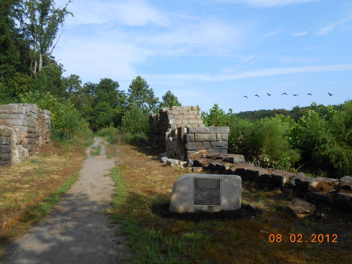
Let me start with the good. There's some really beautiful scenery here. The water in the quarry was clear and reflected the sky in an amazing way. Additionally, the river view was worth the visit by itself. As for the ride... The lower section of the trail is good single track and you can maintain some reasonable speed and flow through most it. There are several small wooden bridges to ride over and most were in good repair.
On to the not so good. The trail begins with you having to carry your bike over some rocks to get around the fallen bridge. After a short ride, you try to head up the trail only to find several fairly steep climbs that are littered with tree roots. Add some damp leaves and I found it manageable, but pretty frustrating. Additionally, the trail was confusing. There were places were it simply disappeared, intersections that crossed back to the trail for no reason, and almost no signs or trail markings. The one sign I found near the advanced trails was leaning over and barely held up by a pile of rocks stacked around it. Who knows if it was pointing in the intended direction or not. If not for the map on my phone, I would have missed half the trails I rode. Even then, I still feel like a missed a bunch (never found the rock garden that I read about). I ended up riding down a fairly technical descent (more like a rock filled trench) to get back to the bottom. Okay, that part was fun and put me out on what appeared to be a trail, but who really knows if I was even on the trail at that point. Additionally, the upper trails were riddled with downed trees (dozens...yes, really), erosion ruts, another broken bridge, etc. Although I tried, there was limited flow to be had.
With some TLC (AKA a chain saw), bridge repairs, some trail design changes, and basic trail markings this place could be amazing! There's plenty of space, good climbs/descents, lot's of rocks to build cool features, etc. So much potential. Wish I lived near by...I'd like to be part of the group that transforms this place into something special. So...it's worth the ride, but be prepared for frustration mixed with sporadic awesomeness.
| ThankI had a great time riding this trail system. The trails were very well designed and groomed. Lots of twisty tight single track and some good descents and climbs as well. I'll come back for sure.
| ThankThe good. It's here, it's singletrack, and there are a few fun technical sections.
| ThankThe bad. This place wrote the book on unsustainable trail design. Lots of fall line trail, which could be fun, but mostly dump you into off camber corners or pointless creek crossings. All that hard earned effort is scrubbed off on the brakes.
There is decent elevation here but it simply isn't used properly. I saw many places that, with some trail realignment, could be both much more fun and sustainable.
If your a cross country rider looking to improve your climbing this would not be a bad place.
One last thing. Get a map, there are no trail markings and its a bit of a spiderweb of a trail system.
Great trail system with a lot of variety. From scenic, flowing trails with minimum obstacles along the river to short but challenging downhill sections, this trail has something for everyone. It was a great place to learn the sport and it was my first trail.
| ThankAKA "The Quarry" - Nice trail system with a wide variety of trails and scenery (the quarry and river.)
| ThankThis was the first trail I've ridden in Virginia and I have to say it was pretty impressive. Plenty of skill levels and different challenges for all skill levels. Trail is maintained well by FATMUG and FAMBE.
| ThankI really liked this trail for its diversity. It starts on a fire road and then quickly turns into narrow single track with really tight turns and a lot of logs and creek crossings. The downside is that most of the trails are not marked. The entrance to the trail is behind the Virginia outdoor center. I also really liked having the couple miles of paved trail right next to the river to use as a warm-up and cooldown. Another review mentioned carrying and extra tube or repair kit and this is 100% justified. There are quite a few randomly placed rocks and sharp gravel along the trail.
| ThankI was here yesterday and had a good time on the trail system. With the construction going on I had a hard time finding the trailheads, but some locals pointed me in the right direction.
Be sure to bring a flat kit and/or extra tube along for this one. There are plenty of rocks and log croasings to cause equipment t problems while you're riding. I was a couple miles in and caught a flat tire, and its mostly an out and back format, so I had to walk the bike 2 miles back to the road.
Overall I had a good time, enjoyed the scenery and overall layout and challenge, and would return if I'm in the area again.
| ThankI always enjoy these trails when I'm in town and have a minute. Worth a peek if you're in town but I wouldn't make a pilgrimage over there just to ride them.
| ThankGreat trail system. If you are ever in the area you must try the trail system. Tight corners and fast paced hills. My favorite is going though the tunnel. Best trails around. Mountain biking club here in town does very well to keep up the trails.
| ThankThis is my second try here. This time I'm reviewing Pool pass and points E. It looks like part of an old Pool pass, which circles the quarry, is abandoned do to storm damage. but It branches off Ridge line, heads S. past the clearing w/ billboard and up the fire road, then back into the woods. If you go past the Pins N Needles split, it gets to be a kinda washed out difficult down slop back to the lake. Pins and needles is a quick connector to Epiphany. Plenty of gnarly rooty stuff with some log piles and flow bumps. Good trail, There's one dead fall tree that's currently looks like a work in progress, totally crosses trail at an oblique, but most of the trail is pretty simple, I had trouble because it was still damp in the morning and slid on every piece of wood including lots of roots. That all leads back to (hope I'm getting names right, it's by color code) Fall Quarry, which runs under I95 to E. side, where it loops around a little and has a 4 way junction. back to tunnel (you'll want to have a care at both ends, till you know it well) rest of Fall Quarry, Monolith, and I think Dishwasher. It's all some nice well maintained trail with lots of log piles, I liked the 4 in a row spaced out so I could manage. It can all be ridden as 2 loops pretty much any combination. they all connect back to Main Scout trail and meat at S end. FQ going S has great flow, not sure quite How I managed to endO on the last sweet down hill going to big intersection, but watch the roots. :)
| ThankI was only able to ride the double track Scout trail, USGS, Beach,owl, Gratitude(I think), ridge line, Big Bill, and part of Pool Pass. ( referring to the map at Fatmug dot org.(Quarry trail)
| ThankVerdict, I left with a SMILE, and wooden legs. This may be the best trails I've ridden. The only downer is no signage at all, Must Have Map.
Usgs is an easy trail and ends into Ridge line. Ridge line has some BRUTAL climbs to the west end but then mostly flows very well all the way to the Pool Pass which circles the quarry(lake), Epiphany is a nice mostly doable by me(novice) flowy bit out to stream crossing and back. (it may connect to Usgs not on map) Owl Loop is if you go up on the old washed out road part and down the single track, it's a mostly downhill flow with a stream crossing and climb in the middle, other way is a brutal climb up single track.(I think if I had a cardiologist he would be very cross with me :) I love this place and Fatmug is doing more work.
Really great trail system. A lot of different ways to make your ride. It's a cliche but very true that there is something here for everyone. Beginners can stay down by the river. Intermediate and advanced can leave the river and climb up the hills. It's a pretty good trail for just about everyone. Check out the FATMUG,org site for a map.
11/13/2011 update. There was a tornado last spring/summer that did some damage to the eastern portion of the trail system. That damage has been repaired and the east side of the system is really nice right now! To find the east side look at the map on the fatmug.org site or where the 2 track makes a sharp s-curve and branches left and right keep left and go uphill one hundred feet of so. The trail access to the east side is there. Riding the drainage culvert to the other side of the highway is interesting. It'll teach you to keep your eyes up!* Review edited 11/13/2011
| ThankGreat view of the river for a good portion of the ride on the lower trail. The upper trails are more advanced...pretty difficult. Lots of logs to hop, bridges to cross, and hills galore. It's more difficult than Lodi but still fun.
| ThankAs the directions describe, keep going down the gravel path and you will run into the trails. The mountain biking trails branch off to the left and right and disappear into the woods. There is a trail map as you first enter the area, but none of the trails are marked (except for a few flashes painted on the trees). You can wind along the river for a couple of miles (easy) or begin to break up hill where the real riding begins. I rode 8 miles in basically a large loop. The intermediate trail that runs along the top of the quarry has a sporty drop...you would not want to fall on that trail. There are plenty of good climbs. When I rode, the trail (and roots) were slightly wet. The wet roots, combined with a trail surface of loose stones, made the climbs all more challenging.
| ThankAt first I followed paved trail and didn't end up being anything exciting. Then I went down gravel road past canoe/kayak rentals and found mtn bike trail. Nice vews while going along the river. There were more challenging trails branching off this one going through hills and forest. The owner of the canoe rental place mentioned a triathlon for canoe, run, bike from here that sounded fun.
| Thank