Rancho Canada Del Oro trail photo
See all photos (9)
×
User
Today
 
  |   Rate it:

Tags:
Level: Beginner
Length: 10 mi (16.1 km)
Surface: Doubletrack
Configuration: Loop
Elevation: +676/ -758 ft
Total: 14 riders
 

Mountain Biking Rancho Canada Del Oro

  Add a review
#674 of 1,005 mountain bike trails in California
#10,656 in the world

Rancho Cañada del Oro Open Space Preserve is located in the foothills of the Santa Cruz Mountains west of Bailey Avenue and McKean Road in south Santa Clara County. The valley climate is cool and bright in the winter and hot during the summer months.

Mayfair Ranch Trail
New in 2007, this 3.1-mile trail begins at the staging area and climbs into oak woodlands and savannas to join the Longwall Canyon Trail. At this point visitors can continue into the preserve on a 4.7 mile loop or return to the staging area along a 1.2-mile route that passes into Calero County Park. It’s important to note that bicyclists are prohibited in the county park.

Longwall Canyon Trail
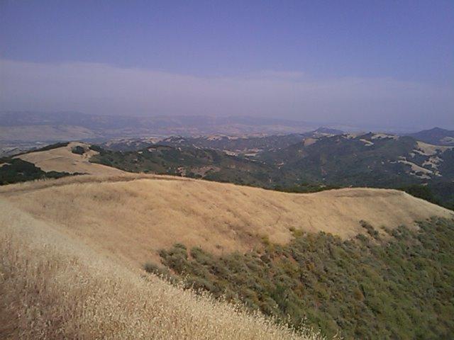
A steep climb, this 2-mile trail provides a picnic table and horse trough at its peak. The summit offers panoramic views of the valley floor, Diablo Range and surrounding ridges. It connects to the Bald Peaks Trail, which continues into the preserve.

Bald Peaks Trail
The 1-mile segment of the Bald Peaks Trail within Rancho Cañada del Oro joins the Catamount Trail, allowing bicyclists as well as hikers and equestrians to complete a loop that returns to the preserve’s staging area. Bald Peaks Trail also continues into Calero County Park, which is closed to mountain bikes.

Catamount Trail
This 1.7 mile trail has steep and moderate stretches as it rejoins the Longwall Canyon Trail. From that point it is possible to return to the staging area through the county park or along the Mayfair Ranch Trail. Bicyclists must use the Mayfair Ranch Trail.

First added by Mitch_A on May 31, 2009. Last updated Apr 28, 2020. → add an update
Before you go
  • Drinking water: unknown
  • Lift service: unknown
  • Night riding: unknown
  • Pump track: unknown
  • Restrooms: unknown
  • Fat bike grooming: unknown
  • E-bikes allowed: unknown
  • Fee required: unknown
This trail information is user-generated. Help improve this information by suggesting a correction.
Getting there
From Highway 101 or Highway 85. Turn west onto Bailey Avenue. At the intersection with McKean Road turn left. Where McKean Road becomes Uvas Road turn right onto Casa Loma Road. Rancho Cañada del Oro Open Space Preserve is at the end of the public access portion of the road.


Rancho Canada Del Oro Trail map

Add to or improve this map // Share this map on your website

Local Info

Club Sponsor

-

Local Bike Shop

Trail checkins

vinnyl26 (on Apr 10, 2019)
What's this?

Upcoming Events

None.
Add one

Trail conditions

Open (on Apr 23, 2013)
login to update

Camping & Lodging

Coming soon!

Rancho Canada Del Oro videos

Add a video
We don't have any videos of this trail yet. Add one here.

Mountain Bike Trails Near Morgan Hill, California

***
Beginner | 10 mi

Add a review

Rating
 
Difficulty
 
Review

Reviews

    Loading reviews...

Rider questions