×

|
Rate it:
Tags:
Level: Intermediate
Length: 8 mi (12.9 km)
Surface: Singletrack
Configuration: Network
Elevation: -
Total: 1 riders
Mountain Biking Phillips Lake Southern Bike & XC Ski Trails
#178 of 321 mountain bike trails in Oregon
There are several dual purpose summer and winter trails located south of Phillips Lake that offer a variety of recreation opportunities. In the winter these trails are open for cross country (XC) skiiers and snowshoers, and during the spring, summer and fall they are used by mountain bikers, hikers and equiestrian riders. The trails include: Deer Lick Trail #1636, Coyote Cove #1637, Rimrock Trail #1638, and Jeep Ride Trail #1639. The main access for these trails is from the Phillips Lake South Shoreline Trail #1610. The trails travel through open ponderosa pine and fir forests with occasional views of Phillips Lake.
The Phillips Lake XC Ski and Snowshoe Area Trail page has maps, difficulty levels and other access information about the trails during the winter, and the Phillips Lake Trails page has maps and access information for the spring- fall months.
First added by Chris_Barber on Oct 9, 2014. Last updated Apr 28, 2020. → add an update
Before you go
- Drinking water: unknown
- Drinking water: unknown
- Lift service: unknown
- Lift service: unknown
- Night riding: unknown
- Night riding: unknown
- Pump track: unknown
- Pump track: unknown
- Restrooms: unknown
- Restrooms: unknown
- Fat bike grooming: unknown
- Fat bike grooming: unknown
- E-bikes allowed: unknown
- E-bikes allowed: unknown
- Fee required: unknown
- Fee required: unknown
This trail information is user-generated. Help improve this information by suggesting a correction.
From Baker City, Oregon travel south on Highway 7 towards John Day, Oregon for about 16.5 miles to the Black Mountain Road (also known as Forest Road 1145); This road junction is before the top of the hill; Turn left on Forest Road 1145 going about 0.5 miles and crossing Mason Dam; Once across the southern end of the dam, park on the left side of the road near the information board; The trailhead parking area for the Phillips Lake South Shoreline Trail (#1610) is on the left near an information board; The trails can be accessed from the #1610 trail.
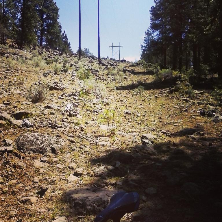

These trails are well maintained and marked. There is NO water source - so bring your own. There is some confusion on the Rimrock trail, as there is a portion that runs along the power lines that isn't clearly marked and looks more like a cattle trail - with LOTS of rocks. I had a map, so I was able to find my way but it could be troublesome without maps.
| Thank