×

|
Rate it:
Tags:
Level: Beginner
Length: 5 mi (8 km)
Surface: Singletrack
Configuration: Loop
Elevation: +598/ -588 ft
Total: 79 riders
Mountain Biking Peters Canyon Regional Park
#409 of 1,016 mountain bike trails in California
The loops starts only a few feet from the parking lot and ends on the other side of the same lot. There are a few different ways to take once you're on the trail. Theres a few good sized and pretty steep hills.
First added by andviceversa on Sep 22, 2008. Last updated Apr 28, 2020. → add an update
Before you go
- Drinking water: unknown
- Lift service: unknown
- Night riding: unknown
- Pump track: unknown
- Restrooms: unknown
- Fat bike grooming: unknown
- E-bikes allowed: unknown
- Fee required: unknown
This trail information is user-generated. Help improve this information by suggesting a correction.
From the 55 freeway take Chapman east, Turn right one Newport, then left on Canyon View the parking area will be on the right. It costs 3 bucks to park.


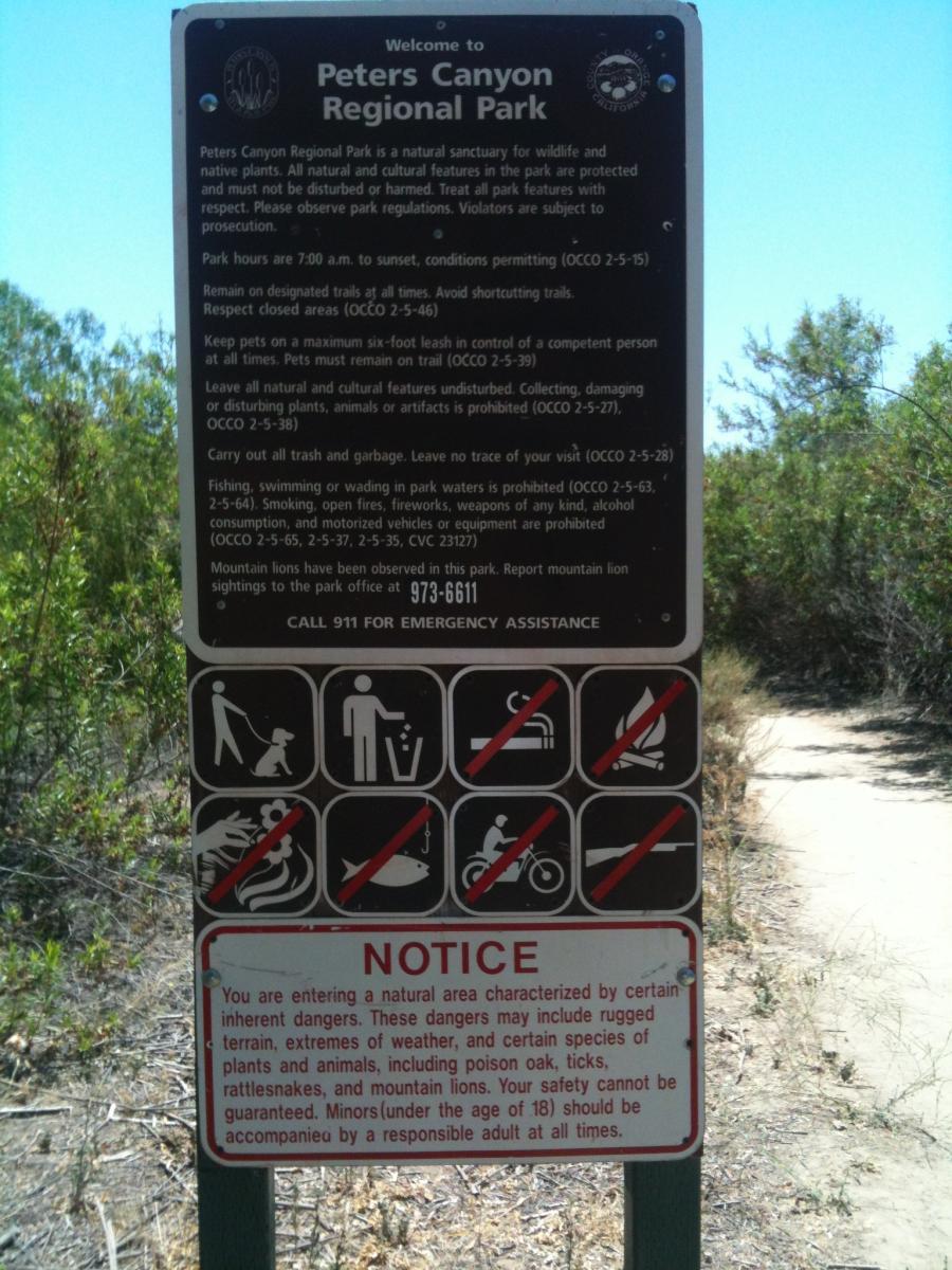

Do not follow the directions to this trail. It took me to the Kaiser Permenante in Irvine. Instead use the directions for Santiago hills.
| ThankSide trails and hills that will challenge most rec & weekend riders. Lots of hikers on weekends, so go earlier or later in the day, or week. Bring plenty of water!
| ThankMild trail network which offers a couple lung busting climbs a speedy descents. Excellent place for newbies or for a quick after-work loop.
| Thank