×

|
Rate it:
Tags:
Level: Advanced
Length: 5 mi (8 km)
Surface: Singletrack
Configuration: Out & Back
Elevation: -
Total: 2 riders
Mountain Biking Park Trail #66
#302 of 436 mountain bike trails in Arizona
From the Park Creek Trailhead, the trail crosses Park Creek and climbs gradually through lower Sonoran Desert and riparian vegetation for ½ mile. The trail then ascends steeply towards the crest of the divide, passing through chaparral, semi-desert grassland and juniper woodland. The final 1¼ mile follows fairly even contours until meeting the headwaters of Park Creek. It terminates at Edwards Park in a stand of large ponderosa pines.
Outstanding views of Tonto Basin and the Mazatzal and Sierra Ancha Mountains Trail terminates at Edwards Park, which is an open meadow with large trees, ideal for camping. Park Creek, at the upper end, runs near the trail and offers pools and waterfalls seasonally for the enjoyment of hikers. Travel by vehicles is very difficult due to rugged terrain. Difficulty level: more difficult. source: fs.usda.gov
First added by Jeff Barber on Nov 21, 2014. Last updated Apr 27, 2020. → add an update
Before you go
- Drinking water: unknown
- Lift service: unknown
- Night riding: unknown
- Pump track: unknown
- Restrooms: unknown
- Fat bike grooming: unknown
- E-bikes allowed: unknown
- Fee required: unknown
This trail information is user-generated. Help improve this information by suggesting a correction.
North End: Park Creek Trailhead (TH): From Punkin Center, turn onto Forest Road (FR) 409. Drive 1¼ miles east (4-wheel drive vehicles recommended). Turn south (left) onto a short spur/FR 1382. The trail begins at the end of this road. This trailhead has limited room for vehicles.
South End: Edwards Park Trailhead (TH): From the Four Peaks Road/ FR 143, drive north on FR 422 for 11.2 miles (4-wheel drive vehicles only). The trail begins at the end of the road. There is adequate parking for several vehicles.
CONNECTING TRAILS - None: However, the Arizona Trail is approximately 2 miles away accessible by FR 422.


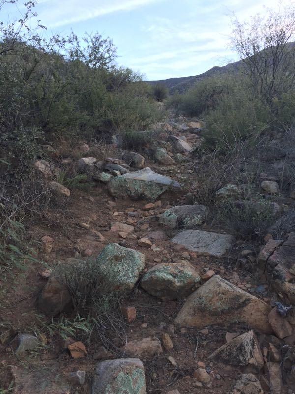

Clearly the person who added this trail did not ride it. Rocky and overgrown in places, it's also poorly marked and with all the cattle trails it's easy to get off the trail in the middle of the cat claws which are every where. Great views.
| Thank