×

|
Rate it:
Tags:
Level: Intermediate
Length: 5 mi (8 km)
Surface: Singletrack
Configuration: Loop
Elevation: +481/ -435 ft
Total: 24 riders
Mountain Biking Osage Hills State Park
#26 of 66 mountain bike trails in Oklahoma
3 loops one easy Intermediate, expert
First added by searsandrewj on Nov 14, 2005. Last updated May 3, 2020. → add an update
Before you go
- Drinking water: unknown
- Lift service: unknown
- Night riding: unknown
- Pump track: unknown
- Restrooms: unknown
- Fat bike grooming: unknown
- E-bikes allowed: unknown
- Fee required: unknown
This trail information is user-generated. Help improve this information by suggesting a correction.
Take Highway 60 east from B-Ville to Osage Hills State Park approximately 17 miles


This review is for the Red Trail
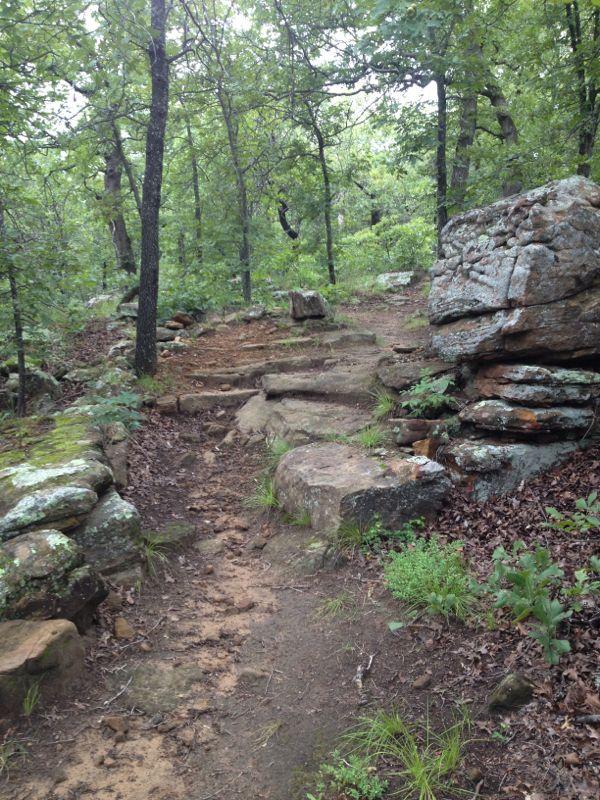
| ThankThe longest and most technical of the Osage Hills State Park Trails
It could be a really fun trail for an experienced rider, but novice-moderate riders will end up walking a few places due to large loose rocks and a few steep climbs.
?
| Thankno report of riding here in a while
| ThankRocky dustyot as much as I remembered. Grass high in places but not too bad. Dry n dusty.
| ThankNot a beginner trail. Rocky, and moderately technical. Single Speed is best at 32x20 or 32x19. Full suspension will save your back and hands on multiple laps and will make the descents a bit more fun. This trail is part of the tour de dirt series in Oklahoma. Worth a special trip. Exceptionally fun for those with a bit of mountain bike experience under their spandex. Park has many amenities, including showers, camping and a pool. Trail is obviously the best feature. Check strava for trail details. This trail will cook your goose in the summer, so take water.
| ThankThis track had some good spots to.open up and get speed but would shortly be followed by lots of rocks... the only downfall for this track is that it is extremely rocky. This track ad good views and lots of wildlife
| ThankThis is where I learned to ride. I am 49 Now and enjoy riding the Hills with the Buds in Bartlesville. Trails are in great shape and a bridge has been built up on the red that helps get through an almost impossible climb. Great trail so close to bartlesville.
| ThankAnthemRider
The expert trail was tough with a whole lot of technical climbing, but the payoffs were the fun technical downhills. The red loop is the expert loop and the blue loop is intermediate and the most fun. 7.5 total if you do both. We did Blue, Red, Blue for a 12 mile total. Trail was very well marked.* Review edited 9/14/2009
| ThankMore...This trail is coming along. There are individuals working on this trails. The expert trail is mostly navigable but their are spots that are unrideable. However, they are working on a detour around this,. It hooks up to an old Boy Scout trail that is wicked tuff.
| ThankIt is pin f**ed mostly and lots of trails split off. The views are nice. Watch outfor poison ivy!!!!!