This trail is only open from October 15 - April 15. This trail is very worn and is more suitable to hiking, but it is an interesting bike trail nonetheless.
Start from the parking lot and ride across the paved bridge. Continue on the paved road to the right through the campground guard gate. Ride to the end of the campground, staying straight on the paved road. Eventually you will see a sign for the North Slope trail on the left. Follow the orange blazes.
At the beginning, the trail follows the river and is a nice leisurely ride. Next, expect a couple of insanely impossible climbs (if anyone has ever ridden this part of the trail without getting off, you are a liar). Once you reach the top of the mountain you will see the Art Loeb hiking trail to the right. Continue left, following the orange blazes.
From here the trail follows the side of the mountain and begins its slow descent. Along this part of the trail there are cool views of the mountain and a couple of impossible foot bridges. I actually fell off the side of the mountain at one point as my back tire slid out on some roots. The trail is pretty rock and rooty in places, so be careful.
The last part of the trail is a pretty steep descent and ends up in one of the campsites. Follow the pavement back to your car. Have fun and be careful on the slick roots and bridges.


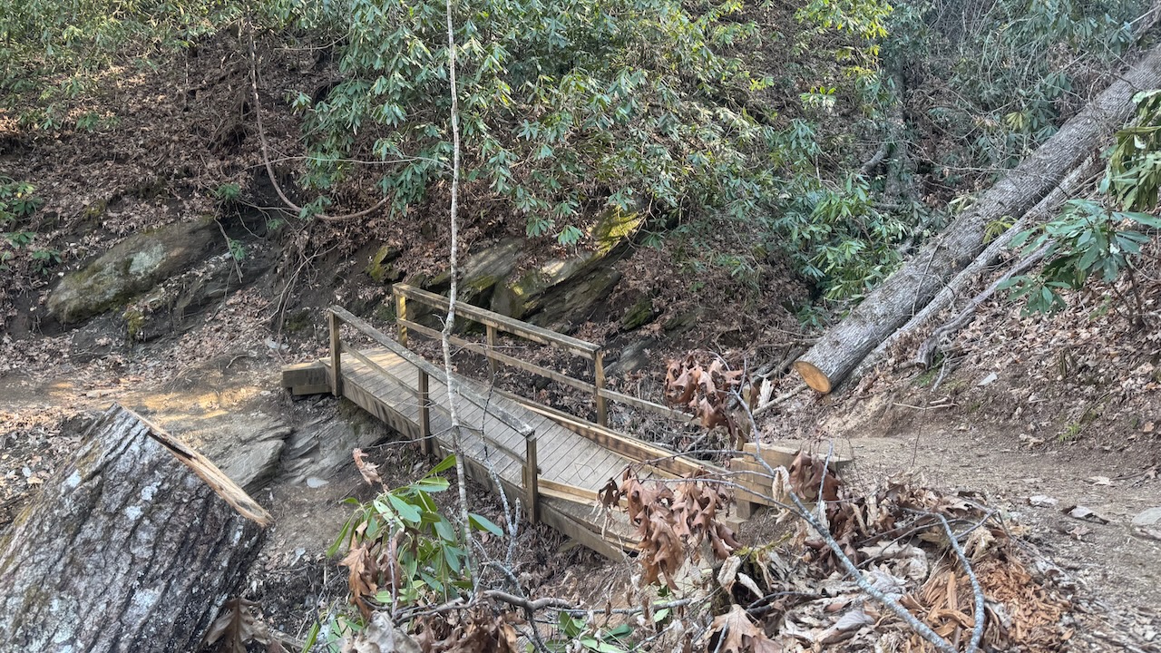

Quick and fun loop out of the campground. You'll want to ride the loop counterclockwise; otherwise there is a very steep climb at the beginning if you're starting at the campground Laurel Loop access. The backside is particularly scenic with laurel tunnels and the front side is pretty sweet too as it parallels the river. Watch for hikers. One of the footbridges is out as of April 2025.
| ThankWild, wooly and full of GNAR. Lots of climbing and tons of elevation gain. If you can ride here...you can ride anywhere.
| ThankWent left uphill from the campground. There was a ton of leaves so it was very slippery with a lot of roots. The climb pretty much sucks when its wet. The downhill at the end is definitely worth it. Fast with alot of unexpected log stairs that you can get alot of air on. Recommend riding with sycamore cove
| ThankNice trail! As others have previously stated the trail can be quite slick due to the roots & wet leaves, however I don't feel this detracts from the trail but adds to its character. My son who is 9 was able to ride the entire loop w/ no problems save for an ocassional tire slip/slid on a wet root or rock. We rode the trail in the CW direction & really enjoyed the ride along the ridge & the downhill section. This is a great trail to ride whenever one is limited for time or as a quick warm-up before crossing the street to tackle some of the longer Pisgah trails.
* Review edited 12/13/2011
| ThankWe just rode this the other day....it had rained the day prior and lots of leaves on the trail..it was slicker than SNOT!! Don't go if the conditions are the same as above..Tons of roots and smaller rocks, mostley those sideways roots across the trail, that if you not paying attention to your front tire, you'll be picking snails out of your teeth for the rest of the day. Could be a faster/more enjoyable trail when its dry..we still had a blast on the downhill, fun ledge jumps(at least the ones we could see that weren't camouflaged with fallen leaves)..The uphill is doable if your a pro-rider..
| ThankOne of my favorite short Pisgah rides! I always ride this, combined with Sycamore Cove across the street, when visiting in winter. Despite the original description, the climb is not impossible, though it is challenging with a number of log steps and plenty of leaves that stay moist and slick. Once up top, it's fast cruising with a few technical sections and a couple of challenging bridges. The descent off the trail is extremely fun if very short, with good flow. Keep an eye out for hikers!
| ThankReally fun trail - found inside of the Davidson River Campground. Uphill is 1.8 miles straight up, then downhill is around 3 miles and is tons of fun. Ridge riding, tree dodging, steep dropoffs, etc. The steps are dangerous though, my friend's jersey got caught on a branch and left him hanging from it! Lots of hikers - so keep an eye out for them and be audible to let them know your coming. Too bad it's seasonal. You can ride it off-season, but don't whine about getting a ticket if your caught.
| Thank