Makhtesh Ramon is the largest of the four makhteshim in Israel (The Small Makhtesh, the Great Makhtesh, and Mount Arif). These crater-like formations are a phenomenon unique to Israel, created as a result of water erosion undercutting the rock, not from the impact of a meteor or volcanic lava. Because of its physical configuration, riding through Makhtesh Ramon (or above it) will enable you to observe interesting geological phenomena and the wondrous colorful layers of the inner walls.
This segment of the Israel Bike Trail connects rich geology and a vanished ancient desert culture with breathtaking landscapes. The trail, about 40 km long, passes along the edge of the makhtesh, through wadi beds and along a section of the Nabatean Spice Route. The characteristics of the trail and its surroundings require skilled riders.
The segment begins in the city of Mitspe Ramon, which at 800 m above sea level is a tourist center and home to artists and nature enthusiasts. The city has a variety of restaurants and accommodation styles, ranging from lavish hotels to campgrounds. Mitspe Ramon and its surroundings offer many attractions, first and foremost being the visitors' center, the cliff-top promenade and an alpaca farm.
The weather in Mitspe Ramon is comfortable for most of the year, although in mid-summer it can get very hot and in the peak of winter, with luck, one can enjoy a snowfall.
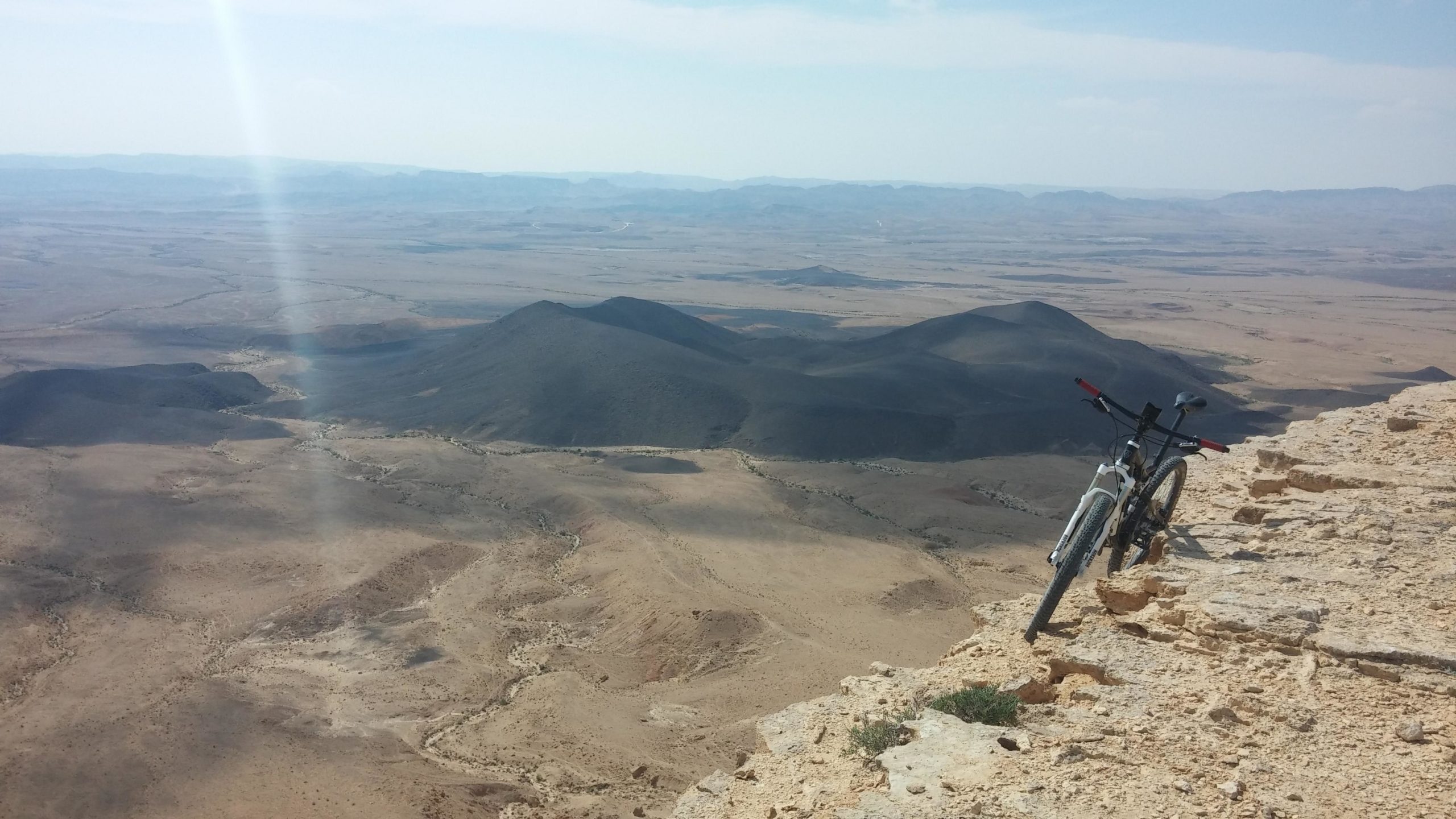
The trailhead is located on the eastern side of the parking lot adjacent to the pine grove at the entrance to the city. Just past the entrance sign, the trail turns northward, where you'll pedal through an interesting sculpture garden with a spectacular view into the makhtesh - it's worth a stop to have a good look. The path out of the sculpture garden takes you along a comfortable, volunteer-built single track.
After about 3 km, the trail moves away from the edge of the makhtesh cliff and enters the bed of Wadi Hava. The section is known as Single Track Nahal Hava (nahal is the Hebrew word for wadi), which twists back and forth across the wadi banks. In winter and spring, which is flower-blooming season in Israel, the ride is splendid, and even aromatic, with dozens of species of plants blossoming along the trail. The bed of Wadi Hava expands and deepens, at which point the trail leaves the wadi and climbs back up along a single track to the jeep path that follows the edge of the makhtesh.
Pedal along the jeep trail (marked in black next to the Israel Trail marking) for about 12 km until the Machmal Fort, which was part of the network of guard posts along the Incense Route built by the Nabateans in the early first century CE. The Israeli portion of the route, which begins in far-off Oman and ends on the shores of the Mediterranean Sea near the Gaza Strip, was recognized in 2005 as a UNESCO World Heritage Site. We recommend ascending to the lookout - the view is gorgeous.
The continuation of the trail from here is a combination of single tracks and dirt roads, until the start of the Noach Ascent, which you'll be taking downhill. Although noach means
comfortable in Hebrew, the route is actually not true to its name. We recommend that you walk your bike along the first part (which is a double track) and be very careful. About 300 m down the slope, that path separates from Single Track Machmal, which is a section of the Israel Bike Trail that leads to the floor of the makhtesh.
The trail turns south and continues its last section adjacent to the Incense Route, ending at Khan Be'erot. This campground is maintained and operated by the Israel Nature and Parks Authority and has an area for private tents, a large hospitality tent, a snack bar, showers and toilets. The parking lot is accessible to private motor vehicles from road 40, which crosses the makhtesh.
Website: http://www.ibt.org.il/en/segmentseng/mitzpe-ramon-be-erot
