×

|
Rate it:
Tags:
Level: Intermediate
Length: 10 mi (16.1 km)
Surface: Fire Road
Configuration: Other
Elevation: +1,116/ -690 ft
Total: 52 riders
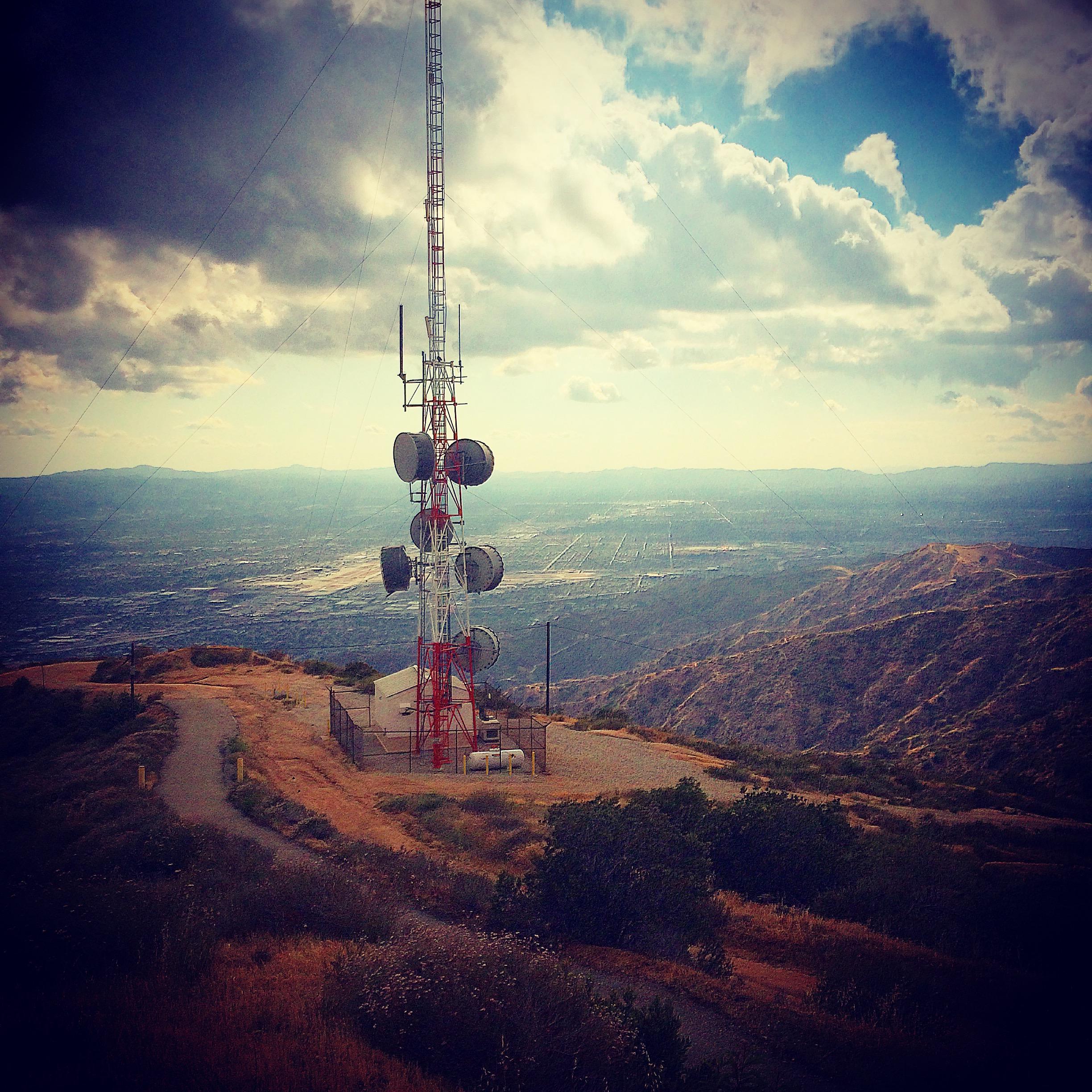
Mountain Biking La Tuna Canyon
#223 of 1,008 mountain bike trails in California
40min--1hr climb on fire road to the top. Over looks Burbank airport. you can returns back on the fire road or take various single track back down that lead out to La Tuna Canyon Rd.
I did once... good ride.
First added by OrkaRider on Feb 13, 2011. Last updated May 1, 2020. → add an update
Before you go
- Drinking water: unknown
- Lift service: unknown
- Night riding: unknown
- Pump track: unknown
- Restrooms: unknown
- Fat bike grooming: unknown
- E-bikes allowed: unknown
- Fee required: unknown
This trail information is user-generated. Help improve this information by suggesting a correction.
210Frwy exit La Tuna Cny Rd. Park on East bound side by freeway entrance. ride starts there. 40min--1hr climb on fire road


The fireroad up to La Tuna was just as I remember it - wide open. I went in the early evening so that helped with hiker traffic. The single track down has not been traveled in at least a year. The path is overgrown. I will not be going down the singletrack anytime soon.
| ThankWe did a 9.61 mi loop that ended on the street west of the trail head. Nice approx. 4 mi climb to the top all fire road then some really fun single track near the top. Single track all the way down had to walk down one section but i think we could have avoided it by going right instead if left at the last fork. Ride back to car is bad! Cars speeding by very close scary! I pretty much rode in the bushes if I could.
| ThankAs said previously, the fire road ascent is a great cardio workout. This time of year the sun is out early and if you show up with the sun it's not too crowded by hikers. Many of them take a steep shortcut and the fire road stays relatively clear. At the top I took a wrong turn and wound up going down the La Tuna Foot Trail off of the plantation lateral, and that was a BIG MISTAKE. Avoid the foot trail at all costs, it is very overgrown, extremely narrow, and dangerously loose in places. Hiked the bike about 33% of the way down, and the rest was white-knuckle death-face-staring insanity. I am definitely looking forward to a.... faster, safer, more engaging descent next time, via one of the bike-prepped singletrack trails.
| ThankFire road goes all the way up the make a right and go to la tuna trail. There is some really amazing single track at that point. It is very well maintained right now. A real gem.
| ThankThe view at the top is definitley worth the trip up. Going downhill is a bit more of a problem because of all the foot traffic. Im definitley going to the top to watch the sunrise this weekend!
| ThankThe view at the top is definitley worth the trip up. Going downhill is a bit more of a problem because of all the foot traffic. Im definitley going to the top to watch the sunrise this weekend!
| ThankWide fire road up, with a couple hacked out of the bush single track options down, and some crazy banzai downhill options that I'd never touch. Starts with 3 mile climb along fire road to an AMAZING view of the san fernando valley. Thats worth the trip, but the ride is not technical, more of a cardio builder. Downhill singletrack was really overgrown, to the point of being dangerous - I'd avoid it.
| ThankUpdate to my last review...do not turn off on plantation laterial (leads to La Tuna Foot Trail- hectic mtb terrain), rather enjoy some of the singletrack winding off and on as you proceed down Verdugo Mtwy to the La Tuna Canyon Trail. This was origional destination and is an extremely fun descent, not too technical, and in good riding shape as of December 2012. Beware poison oak and be wary of cars on your trek back up La Tuna Canyon to parking lot. It's about a 10 mile loop from lot to summit, down La Tuna Canyon Trail to La Tuna Canyon Road, back to lot, and can be done in 1.5-2 hours.
| ThankI enjoy Verdugo/La Tuna Cyn for the good cardio and terrific panoramic views, but only rate a "3" for the following: grind to top 100% fire road with plenty of foot traffic. Plus, the only singletrack I've ridden (verdugo mtwy-plantation laterial-la tuna foot trail) was fun and challenging enough for an intermediate rider, but it was extremely overgrown (lot's of poison oak) in Oct. 2011. With a little work this ride could easily rate a "4" due to the lengthy and fun sinletrack downhill. The fire road to summit makes for a good endurance test for riders used to shorter/flatter rides, or just wanting to work up to bigger rides. You can power down fire road, but must use extreme caution as many hikers use this trail and deserve not to be startled.
| Thank