×

|
Rate it:
Tags:
Level: Intermediate
Length: 8 mi (12.9 km)
Surface: Singletrack
Configuration: Network
Elevation: +1,986/ -1,495 ft
Total: 47 riders
Mountain Biking Kennerdell
#49 of 295 mountain bike trails in Pennsylvania
Smooth flowy single track, occasional double track Follow counterclockwise.
There is a massive trail system here, if you have 3 days you might cover it all.
First added by Jester1911 on Sep 7, 2008. Last updated Apr 28, 2020. → add an update
Before you go
- Drinking water: unknown
- Lift service: unknown
- Night riding: yes
- Pump track: unknown
- Restrooms: unknown
- Fat bike grooming: yes
- E-bikes allowed: unknown
- Fee required: unknown
This trail information is user-generated. Help improve this information by suggesting a correction.
Interstate 80 exit at route 8, Travel north on route 8 to old route 8. Travel north on
old route 8 to Dennison run road, turn right. Follow to Dewoody road, turn right,
follow to game land parking lot.


Great trails that don't seem to get much MTB use, though there are some horses out there on occasion. Also a good place to MTB in and backcountry camp for the night.
Some double track and forest service roads, some singletrack. Blunder Trail heading down can be pretty great. Windows Trail has some nice riding and great scenery.
Note that all the trails aren't open to mtb. Check the photo gallery here for a copy of the official map, which shows that anything south of Blunder Trail is hiking only. Some of the GPS tracks here on the topo map are trails that are not open to mtb.
| ThankTrails are well-marked, especially at intersections. Window trail is in the best condition and is very flowy with a nice view. Blunder trail is particularly rocky and has many roots to negotiate; this trail is especially technical when wet. Pipeline trail is fine, too, but don't follow the "road" downhill past the intersection of Pipeline and Ridge: it's impossible to climb back up, but may be there's a different way to return. I rode these trails on the last day of May and at least half of them were wet and/or muddy. Would be a nicer ride in August, I suspect.
| ThankMy second review.
Blunder trail down to the river has since washed out a bit, and unless it is repaired I don't see it making for a very fun descent. Many large holes to get stuck in.
Part of Fisherman's Cove trail has been taken over by an access road, destroying a diverse and gentle upland trail in the process. The road does provide another connection, though.
There are a couple noteworthy trails not listed. For one, you can follow the main pipeline between both crossings of Ridge Trail. Another is a doubletrack offshoot of Pipeline trail near the top, where Pipeline continues as singletrack. It is easy to confuse this for the main trail your first time. This trail ends in a clearing, and a subtle single track connects to Ridge Trail.
I now use the following loops frequently:
| Thank1. Ridge trail to the pipeline crossing, then take the pipeline left to the double track mentioned above. Turn right to follow it back to the ridge trail. This avoids the most difficult dip and climb, which I could never manage. Then continue on ridge past Blunder and on to Window Trail. Take Pipeline trail back to parking and take the roadback to the ridge trailhead.
2. Same as above, but take Pipe-Ridge (aka upper Blunder Trail) left to Pipeline trail, then take it down to Ridge and Window. Take Window up to Rock Oak, and then return to parking lot from there. I find that this route allows for better momentum and fewer uphill obstacles.
Great place to ride. We went after a full night of rain and were able to ride easily. Not much mud, just damp. Views on Window trail are unreal. Coming back up Blunder was a bit much from erosion. Overall a great place to ride and we'll be back many more times. Intermediate is accurate rating.
| ThankThis is the second time me and my friends have taken on this trail. We have no experience mountain biking on trails. Overall I would have to say I was pretty impressed with the quality of this trail. Although it is not well marked you can basically find your way around. I recommend getting a trail map before you head out as they are somewhat confusing. The first trip we took ridge trail to Blunder trail and pipeline back up. The second time we took window (Which I highly recommend as it is beautiful) then Ridge to the River and rode pipeline up once again.
| ThankKennerdell offers a nice network of trails for various levels of stamina and technical skill.
Ridge Trail offers the largest rocks and greatest technical challenge, with the hardest being the final descent to the river.
Blunder Trail offers a steep and somewhat rocky descent to the river.
Pipeline Trail offers a long and moderate trip from the trailhead to the river, and the Rock Oak Trail is a similar alternative route. Both are a mixture of singletrack, doubletrack, and gravel.
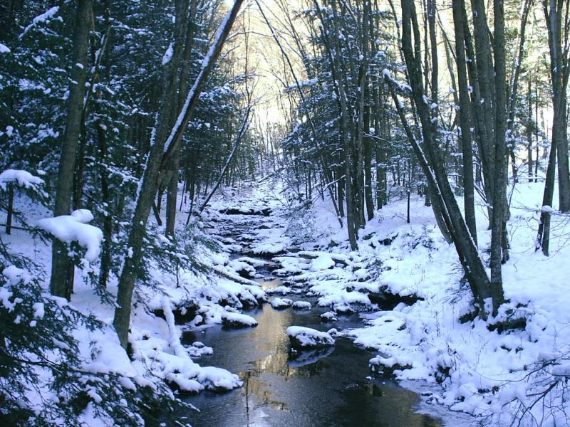
Window Trail is the real gem, providing a nice view of the valley.
Bear Wallow Trail is often wet, and makes an easier descent than ascent.
Stripmine Trail connects to a nice set of dirt tracks at the top of the mountain.
Fisherman's Cove Trail lets you add another loop if you use the pipeline access road, but takes another steep descent to the river if you don't turn back.
Ascending from the river is arduous no matter what. Pipeline Trail is the gentlest slope with the least technical challenge, but is so long that it's very demanding on the stamina.
The River Trail provides an easy and simple trip on river level, until it becomes rocky and closed to bicycles.
Other trails, such as the Hoh-Ya-Neh and Dennison Run systems are closed to bikes.
Recommended trips:
For young kids and low confidence beginners, ride the River Trail, and try ascending Pipeline Trail a bit at a time.
For beginners with good confidence, take Pipeline down to Window, return by Rock Oak to the top junction. Then ride Stripmine out to Fisherman's Cove Trail, and follow that until it crosses back over the access road. Take the road back to the main FC trail and return to Stripmine.
For moderately experienced riders, take Ridge Trail from the upper trailhead down to the junction with Window, then ride the length of Window to Pipeline, then use Pipeline to return to the trailhead.
If you want to add a climb and descent, more power to you, just know what you're getting into.
| ThankFirst an update! Only 13 miles of trail are now open to MTB and horses. Use the parking areas off Dennison Run Rd. If first Parking area is full of horse trailers!!!!!!!!!!!!!! there is another small parking area on the left just past the first.(too small for horse trailers) Map at TH and at http://www.neohbackpackingclub.com/mapLib/kennerdell_map.pdf Now for the good news, numerous and varying loops can be made, and riding everything available to MTB would take several hours and and at least 3 trips to the river. Large variety of trails from wide DT to technical ST.
| ThankNotes; Lower half of Bear Wallow should be renamed Pig Wallow (avoid); Blunder Trail is mostly a rock filled gully (rideable for the very skilled); Ridge trail down to the river is a blast; and finally the must ride trail is Window Trail (just a sweet XC cruise along the cliff.) Excellent views of the river when the leaves are down.
Even though the lot was full of horse trailers when I got back, I only meet 2 of them.