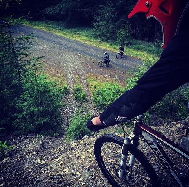
Some of the best downhill routes in the country. Innerleithen XC trail features red grade thrills in an ancient hunting forest. (via http://scotland.forestry.gov.uk/)
From Peebles, take the A72 heading east to Innerleithen. Turn off the A72 and take the B709 for Traquair. The 7stanes car park entrance is on the left hand side, approximately 50 metres over the bridge. The car park is at grid reference NT 335 357. (via http://scotland.forestry.gov.uk/)
Scotland's rugged Highlands offer epic mountain biking with world-class downhill tracks, extensive trail centers, and desolate landscapes perfect for adventurous riders of all levels.
As one of the famed 7 Stanes trail systems Interleithen did not disappoint. Nice parking, good trail board, awesome trail markings and beautiful trails, this place has it all. It's always nice when you can ride an enjoyable XC loop and still get in some fun DH runs. Can't wait to come back some day.


 1
1
As one of the famed 7 Stanes trail systems Interleithen did not disappoint. Nice parking, good trail board, awesome trail markings and beautiful trails, this place has it all. It's always nice when you can ride an enjoyable XC loop and still get in some fun DH runs. Can't wait to come back some day.
| Thank